THE ADVENTURE COLLECTIVE® · Independent discovery and booking for outdoor travel

Drive one of America’s most celebrated coastal roads at your own pace with a self-guided audio tour. Download the app, follow GPS-triggered stories for Bixby Bridge, McWay Falls, Pfeiffer Beach, and elephant seals, and pause wherever the coastline calls.
Drive one of America’s most celebrated coastal roads at your own pace with a self-guided audio tour. Download the app, follow GPS-triggered stories for Bixby Bridge, McWay Falls, Pfeiffer Beach, and elephant seals, and pause wherever the coastline calls.
You pull onto Highway 1 where the road narrows and the ocean leans in close—salt spray and wind pushing at the hood while the cliffs drop away into blue. The audio guide cues a story about the Spanish explorers and then a local naturalist explains why the Santa Lucia range falls so steeply to the sea.
Verified experiences and guided adventures in the surrounding area.
Operated by Adventures with Action · Big Sur, California
You pull onto Highway 1 where the road narrows and the ocean leans in close—salt spray and wind pushing at the hood while the cliffs drop away into blue. The audio guide cues a story about the Spanish explorers and then a local naturalist explains why the Santa Lucia range falls so steeply to the sea.
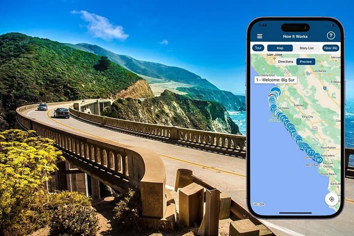
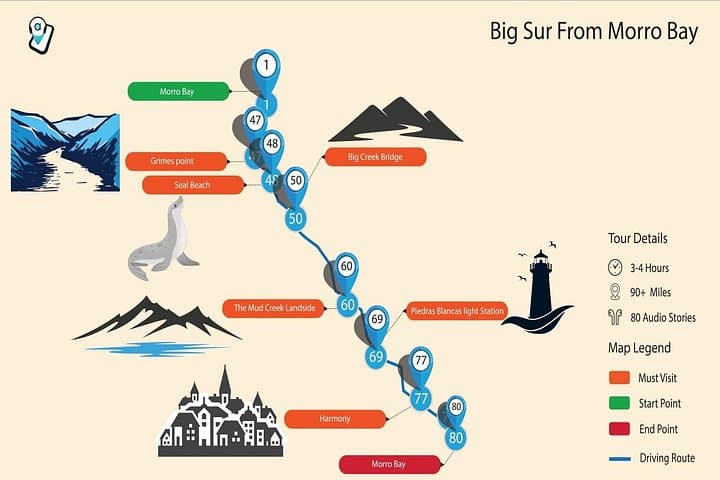
This self-guided audio tour threads roughly 120 miles of the Central Coast between Monterey and Morro Bay, with the most iconic section through Big Sur. Expect stops for Bixby Creek Bridge, McWay Falls, Pfeiffer Beach’s purple-hued sand, and elephant seal viewing at Piedras Blancas. Geology shows in the cliffs and landslides: the Santa Lucias are young, tectonically active, and constantly reshaping the shoreline, which is why Caltrans posts closures from time to time.
Culturally, the route touches small-scale fishing villages, Hearst-era opulence at San Simeon, and the literary legacy of Big Sur’s mid-20th-century writers. The audio mixes history, engineering notes (Bixby Bridge’s open-spandrel arch), and natural history so stops feel intentional rather than random.
Practical guidance: download the Action Tour Guide app on strong Wi‑Fi before you go, pair to your car’s audio, and obey speed limits—stories trigger by GPS. Plan for 2–3 hours of driving time without long hikes; add extra for beach walks and viewpoints. Pack water, layers against coastal wind, and patience for photo pullouts that can fill up fast. If a closure appears between Big Sur and Ragged Point, follow detour guidance—safety and road conditions change frequently.
No—buy one tour per car and everyone in the vehicle can listen together, which is more economical than per‑person tickets.
Closures occur from landslides and repairs (notably between Big Sur and Ragged Point); check Caltrans before departure and follow posted detours.
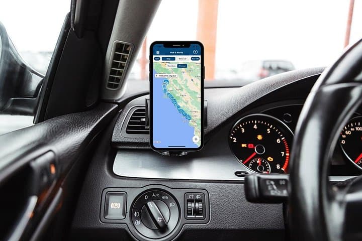
After downloading the Action Tour Guide app and the tour file, open the tour at the designated starting point—stories trigger automatically using GPS.
Yes; you must download the tour content while on Wi‑Fi or cellular first—after that, audio and offline maps work without signal.
Adventures with Action operates guided outdoor trips and adventures with an emphasis on safety, stewardship, and memorable experiences.

You pull onto Highway 1 where the road narrows and the ocean leans in close—salt spray and wind pushing at the hood while the cliffs drop away into blue. The audio guide cues a story about the Spanish explorers and then a local naturalist explains why the Santa Lucia range falls so steeply to the sea.
You pull onto Highway 1 where the road narrows and the ocean leans in close—salt spray and wind pushing at the hood while the cliffs drop away into blue. The audio guide cues a story about the Spanish explorers and then a local naturalist explains why the Santa Lucia range falls so steeply to the sea.
This self-guided audio tour threads roughly 120 miles of the Central Coast between Monterey and Morro Bay, with the most iconic section through Big Sur. Expect stops for Bixby Creek Bridge, McWay Falls, Pfeiffer Beach’s purple-hued sand, and elephant seal viewing at Piedras Blancas. Geology shows in the cliffs and landslides: the Santa Lucias are young, tectonically active, and constantly reshaping the shoreline, which is why Caltrans posts closures from time to time.
Culturally, the route touches small-scale fishing villages, Hearst-era opulence at San Simeon, and the literary legacy of Big Sur’s mid-20th-century writers. The audio mixes history, engineering notes (Bixby Bridge’s open-spandrel arch), and natural history so stops feel intentional rather than random.
Practical guidance: download the Action Tour Guide app on strong Wi‑Fi before you go, pair to your car’s audio, and obey speed limits—stories trigger by GPS. Plan for 2–3 hours of driving time without long hikes; add extra for beach walks and viewpoints. Pack water, layers against coastal wind, and patience for photo pullouts that can fill up fast. If a closure appears between Big Sur and Ragged Point, follow detour guidance—safety and road conditions change frequently.