THE ADVENTURE COLLECTIVE® · Independent discovery and booking for outdoor travel

Capture Cartagena from above on a private drone shoot that frames colonial walls, harbor waterways, and rooftop life. This short, guided experience combines technical flight operations with curated photo and video output—ideal for travelers seeking high-quality aerial footage of the Old City.
Capture Cartagena from above on a private drone shoot that frames colonial walls, harbor waterways, and rooftop life. This short, guided experience combines technical flight operations with curated photo and video output—ideal for travelers seeking high-quality aerial footage of the Old City.
The first frames open over Cartagena: a white-washed skyline rimmed by Caribbean blue, the drone tilting to catch the fortress shadow stretching across cobbled streets. The operator lifts altitude, and the city unfolds—colonial roofs, the stone bulk of San Felipe, and a harbor threaded with fishing boats—while the camera turns slowly to gather the vista.
Verified experiences and guided adventures in the surrounding area.
Operated by Tour a pie en donde realizamos fotos y videos desde el aire Drone Cartagena de Indias · Cartagena, Bolívar
The first frames open over Cartagena: a white-washed skyline rimmed by Caribbean blue, the drone tilting to catch the fortress shadow stretching across cobbled streets. The operator lifts altitude, and the city unfolds—colonial roofs, the stone bulk of San Felipe, and a harbor threaded with fishing boats—while the camera turns slowly to gather the vista.
Cartagena de Indias is a city shaped by military engineering and tropical geology. Built on low limestone and coastal plains, its colonial walls and the Castillo de San Felipe de Barajas reflect centuries of Spanish fortification against Caribbean winds and sea-borne threats. That history gives aerial footage dramatic geometry—ramparts, bastions, and a grid of narrow streets that read clearly from above.
Culturally, the Old City and nearby neighborhoods like Getsemaní offer color and texture: painted balconies, plazas, and rooftop life that translate well to motion and stills. Local insight: early morning and late afternoon light minimize glare on the water and deepen the stone tones, while avoiding crowds in plazas.
Practical guidance: this is a short, private service—expect 1–3 hours on-site. Operators handle flight logistics and most permits; guests should bring ID and follow staff guidance around heritage sites. Dress for heat and sun, and plan battery rotation for extended shooting. Be mindful of no-fly zones around the airport and prioritize gentle takeoff zones away from crowds. Photos and a short edited clip are standard inclusions—confirm delivery timeframe with the operator at booking.
A Cartagena drone shoot is part technical service, part urban observation: it gives you perspective that ground-level photos cannot, while demanding respect for local rules and the fragile coastal environment.
Drones are allowed in many areas but restricted near the airport and some heritage sites; licensed operators typically manage permissions and flight paths.
Delivery varies by operator, but edited stills and a short clip are commonly delivered within 24–72 hours; confirm timing when booking.
Yes—private tours are customizable within safety and permit limits; discuss must-have shots (e.g., Castillo de San Felipe, Clock Tower) when you book.
Operators will cancel or reschedule flights when weather compromises safety; the provider usually offers a refund or alternative time per their cancellation policy.
Tour a pie en donde realizamos fotos y videos desde el aire Drone Cartagena de Indias operates guided outdoor trips and adventures with an emphasis on safety, stewardship, and memorable experiences.
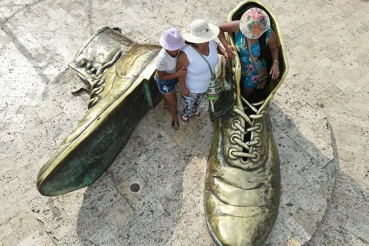
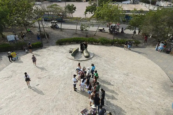
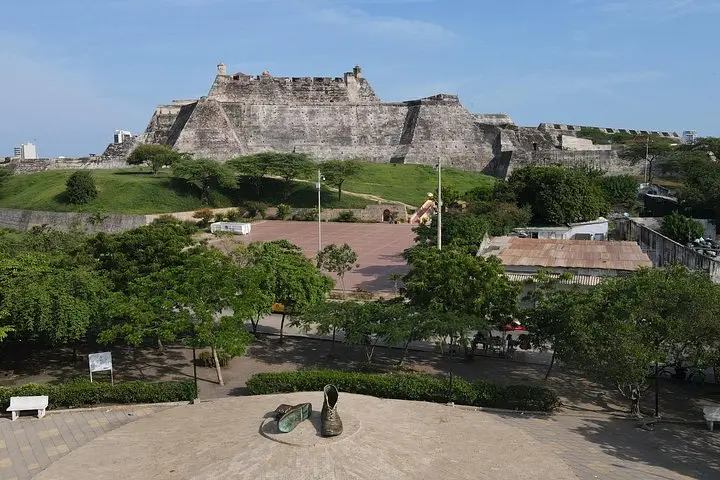
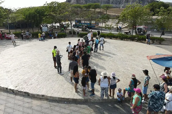
The first frames open over Cartagena: a white-washed skyline rimmed by Caribbean blue, the drone tilting to catch the fortress shadow stretching across cobbled streets. The operator lifts altitude, and the city unfolds—colonial roofs, the stone bulk of San Felipe, and a harbor threaded with fishing boats—while the camera turns slowly to gather the vista.
The first frames open over Cartagena: a white-washed skyline rimmed by Caribbean blue, the drone tilting to catch the fortress shadow stretching across cobbled streets. The operator lifts altitude, and the city unfolds—colonial roofs, the stone bulk of San Felipe, and a harbor threaded with fishing boats—while the camera turns slowly to gather the vista.
Cartagena de Indias is a city shaped by military engineering and tropical geology. Built on low limestone and coastal plains, its colonial walls and the Castillo de San Felipe de Barajas reflect centuries of Spanish fortification against Caribbean winds and sea-borne threats. That history gives aerial footage dramatic geometry—ramparts, bastions, and a grid of narrow streets that read clearly from above.
Culturally, the Old City and nearby neighborhoods like Getsemaní offer color and texture: painted balconies, plazas, and rooftop life that translate well to motion and stills. Local insight: early morning and late afternoon light minimize glare on the water and deepen the stone tones, while avoiding crowds in plazas.
Practical guidance: this is a short, private service—expect 1–3 hours on-site. Operators handle flight logistics and most permits; guests should bring ID and follow staff guidance around heritage sites. Dress for heat and sun, and plan battery rotation for extended shooting. Be mindful of no-fly zones around the airport and prioritize gentle takeoff zones away from crowds. Photos and a short edited clip are standard inclusions—confirm delivery timeframe with the operator at booking.
A Cartagena drone shoot is part technical service, part urban observation: it gives you perspective that ground-level photos cannot, while demanding respect for local rules and the fragile coastal environment.