THE ADVENTURE COLLECTIVE® · Independent discovery and booking for outdoor travel

A nine-day circuit from Quito through Cotopaxi, Quilotoa, Otavalo and Cuenca that pairs volcanic landscapes, indigenous markets and historic sites. Expect high-altitude walks, boat rides and cultural stops with daily transfers.
A nine-day circuit from Quito through Cotopaxi, Quilotoa, Otavalo and Cuenca that pairs volcanic landscapes, indigenous markets and historic sites. Expect high-altitude walks, boat rides and cultural stops with daily transfers.
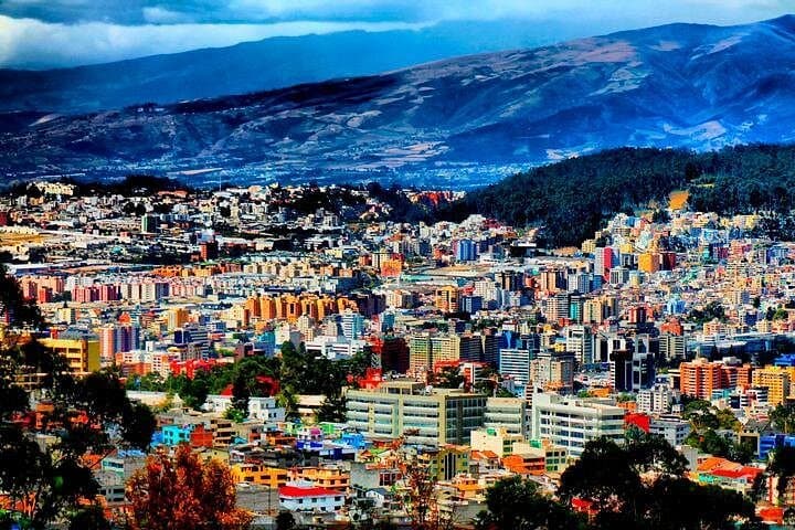
The first breath in Quito feels thin and electric: cool air at 2,850 m, church bells from the colonial center and a horizon of volcanic cones that seem to rewrite themselves as clouds drift.
Verified experiences and guided adventures in the surrounding area.
Operated by BM TOURS SA · Quito, Pichincha
The first breath in Quito feels thin and electric: cool air at 2,850 m, church bells from the colonial center and a horizon of volcanic cones that seem to rewrite themselves as clouds drift.
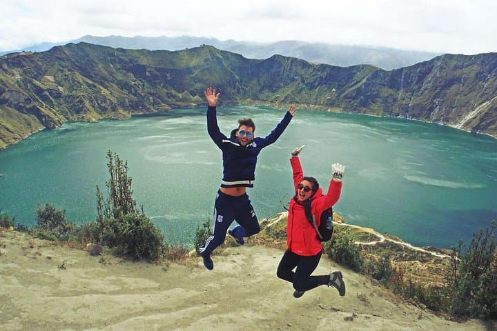
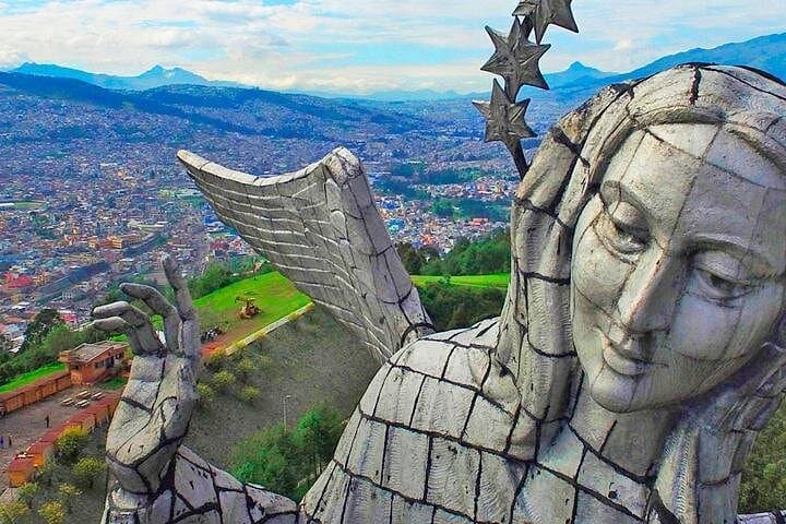
This nine-day loop moves from the capital’s Plaza Grande and the Middle of the World monument along the Avenue of the Volcanoes to Cotopaxi National Park, Quilotoa’s cobalt caldera, the artisan markets of Otavalo and Cotacachi, the thermal town of Baños, Inca stonework at Ingapirca and the highland lakes of Cajas before descending to Guayaquil.
Geology is the trip’s backbone — the Andean volcanic chain created dramatic peaks and crater lakes. Cotopaxi’s glacier-tipped cone and Quilotoa’s water-filled caldera are visible lessons in eruption and collapse. Culturally the route threads Spanish colonial cities and indigenous highland communities: Otavalo’s textile trade and Cuenca’s colonial architecture reflect centuries of exchange.
Expect a mix of easy walks, short high-altitude hikes (refuge at ~4,862 m at Cotopaxi), boat rides on Cuicocha and moving between destinations by private vehicle. Guides commonly explain local history, flora and fauna while you travel.
Practical guidance: pace your first 24–48 hours to acclimatize, keep hydrated and avoid heavy exertion the first day. Dress in layers and carry a waterproof shell — mountain weather flips fast. Bring small bills for market purchases and park fees. Plan early starts for clear views of volcanoes and Quilotoa’s rim trail; afternoons bring clouds. Footwear with good traction is useful for muddy trails around Quilotoa and Cajas. With modest fitness and attention to altitude, this itinerary packs diverse Andean landscapes and cultural stops into a compact, accessible journey.
Yes — several stops are above 3,000 m and Cotopaxi’s refuge sits near 4,860 m. Allow time to acclimatize, stay hydrated, avoid alcohol the first day and notify guides of symptoms.
The dry season (June–September) offers clearer mountain views and more stable weather, though the route is possible year-round; expect more rain from October–May.
The program lists breakfasts and some lunches; park or attraction fees are included per itinerary notes, but carry small cash for additional purchases and optional activities.
The tour is described as suitable for all fitness levels, but high-altitude days can be taxing; check health considerations with organizers for seniors and young children.
BM TOURS SA operates guided outdoor trips and adventures with an emphasis on safety, stewardship, and memorable experiences.

The first breath in Quito feels thin and electric: cool air at 2,850 m, church bells from the colonial center and a horizon of volcanic cones that seem to rewrite themselves as clouds drift.
The first breath in Quito feels thin and electric: cool air at 2,850 m, church bells from the colonial center and a horizon of volcanic cones that seem to rewrite themselves as clouds drift.
This nine-day loop moves from the capital’s Plaza Grande and the Middle of the World monument along the Avenue of the Volcanoes to Cotopaxi National Park, Quilotoa’s cobalt caldera, the artisan markets of Otavalo and Cotacachi, the thermal town of Baños, Inca stonework at Ingapirca and the highland lakes of Cajas before descending to Guayaquil.
Geology is the trip’s backbone — the Andean volcanic chain created dramatic peaks and crater lakes. Cotopaxi’s glacier-tipped cone and Quilotoa’s water-filled caldera are visible lessons in eruption and collapse. Culturally the route threads Spanish colonial cities and indigenous highland communities: Otavalo’s textile trade and Cuenca’s colonial architecture reflect centuries of exchange.
Expect a mix of easy walks, short high-altitude hikes (refuge at ~4,862 m at Cotopaxi), boat rides on Cuicocha and moving between destinations by private vehicle. Guides commonly explain local history, flora and fauna while you travel.
Practical guidance: pace your first 24–48 hours to acclimatize, keep hydrated and avoid heavy exertion the first day. Dress in layers and carry a waterproof shell — mountain weather flips fast. Bring small bills for market purchases and park fees. Plan early starts for clear views of volcanoes and Quilotoa’s rim trail; afternoons bring clouds. Footwear with good traction is useful for muddy trails around Quilotoa and Cajas. With modest fitness and attention to altitude, this itinerary packs diverse Andean landscapes and cultural stops into a compact, accessible journey.