THE ADVENTURE COLLECTIVE® · Independent discovery and booking for outdoor travel

A high-altitude trek through the Gokyo Valley that pairs glacier-fed lakes with panoramic views of Everest and neighboring giants. This practical guide covers culture, terrain, and what to pack for the multi-day tea-house route.
A high-altitude trek through the Gokyo Valley that pairs glacier-fed lakes with panoramic views of Everest and neighboring giants. This practical guide covers culture, terrain, and what to pack for the multi-day tea-house route.
You step out of a thin-air morning at 4,800 m and the world feels pared down to rock, ice and an impossible blue — the Gokyo Lakes spread below like a stair of glass, the high ridgelines of Everest, Lhotse, Makalu and Cho Oyu lining the horizon.
Verified experiences and guided adventures in the surrounding area.
Operated by Happyland Treks · Gokyo, Solukhumbu District
You step out of a thin-air morning at 4,800 m and the world feels pared down to rock, ice and an impossible blue — the Gokyo Lakes spread below like a stair of glass, the high ridgelines of Everest, Lhotse, Makalu and Cho Oyu lining the horizon.
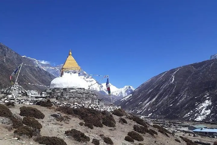
The Gokyo Lake Trek follows trade routes and yak tracks through the heart of Sagarmatha (Everest) National Park, established in 1976 to protect glaciers and Sherpa culture. Geologically the valley is carved by the Ngozumpa Glacier — Nepal’s largest — whose moraine forms the high basins that hold the multi-tiered glacial lakes. Villages along the trail are living museums of Sherpa life: mani walls, prayer flags, and teahouses offering thin soup and warm company.
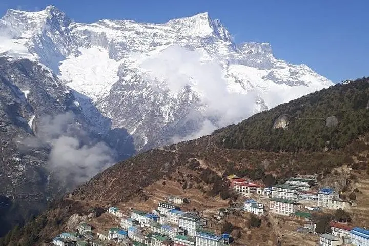
Expect steady uphill days between tea houses, with key gains: Lukla (2,840 m) to Namche (3,440 m), then gradual climbs to Machhermo and Gokyo (4,800 m), plus an acclimatization ascent to Gokyo Ri (~5,357 m) for sweeping panoramas. Terrain ranges from packed stone paths and suspension bridges to scree and icy trails near the lakes; weather swings fast — sun one hour, wind-driven snow the next.
Practical edge: hydrate often, manage pace on acclimatization days, carry layers for wind and afternoon storms, and use trekking poles for balance on rocky descents. Permit checks (TIMS, Sagarmatha NP) and a guide or porter are standard; tea-house nights are simple but welcoming. The reward is clear: blue alpine lakes, close-up faces of the highest giants, and the quiet cadence of high-altitude life.
Comparable overall—both are high-altitude treks requiring acclimatization; Gokyo adds steeper ascents like Gokyo Ri and longer stretches above 4,000 m.
Guides and porters are strongly recommended for navigation, logistics, and altitude support; permits and tea-house bookings are easier with an operator.
You need a TIMS card and Sagarmatha National Park permit; guides often handle these but carry copies with you.
Pre-monsoon (March–May) and post-monsoon (late Sept–Nov) offer the most stable weather and clear mountain views.
Happyland Treks operates guided outdoor trips and adventures with an emphasis on safety, stewardship, and memorable experiences.
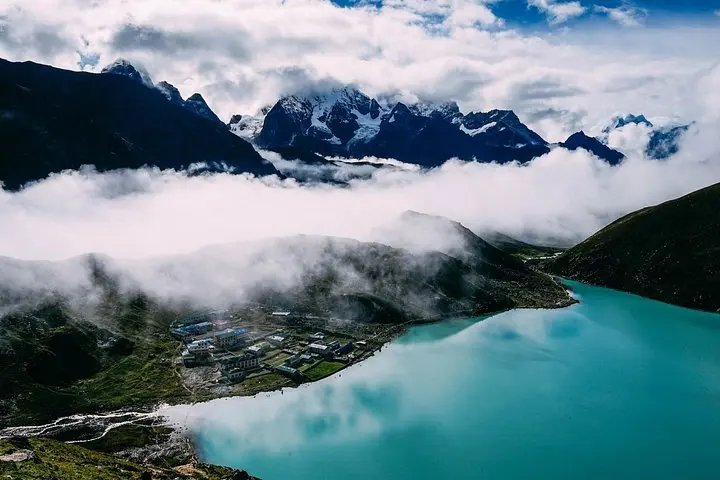
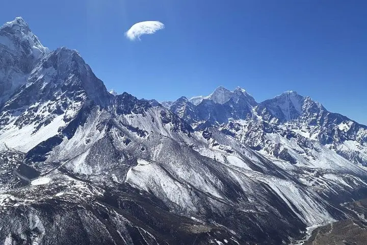
You step out of a thin-air morning at 4,800 m and the world feels pared down to rock, ice and an impossible blue — the Gokyo Lakes spread below like a stair of glass, the high ridgelines of Everest, Lhotse, Makalu and Cho Oyu lining the horizon.
You step out of a thin-air morning at 4,800 m and the world feels pared down to rock, ice and an impossible blue — the Gokyo Lakes spread below like a stair of glass, the high ridgelines of Everest, Lhotse, Makalu and Cho Oyu lining the horizon.
The Gokyo Lake Trek follows trade routes and yak tracks through the heart of Sagarmatha (Everest) National Park, established in 1976 to protect glaciers and Sherpa culture. Geologically the valley is carved by the Ngozumpa Glacier — Nepal’s largest — whose moraine forms the high basins that hold the multi-tiered glacial lakes. Villages along the trail are living museums of Sherpa life: mani walls, prayer flags, and teahouses offering thin soup and warm company.
Expect steady uphill days between tea houses, with key gains: Lukla (2,840 m) to Namche (3,440 m), then gradual climbs to Machhermo and Gokyo (4,800 m), plus an acclimatization ascent to Gokyo Ri (~5,357 m) for sweeping panoramas. Terrain ranges from packed stone paths and suspension bridges to scree and icy trails near the lakes; weather swings fast — sun one hour, wind-driven snow the next.
Practical edge: hydrate often, manage pace on acclimatization days, carry layers for wind and afternoon storms, and use trekking poles for balance on rocky descents. Permit checks (TIMS, Sagarmatha NP) and a guide or porter are standard; tea-house nights are simple but welcoming. The reward is clear: blue alpine lakes, close-up faces of the highest giants, and the quiet cadence of high-altitude life.