THE ADVENTURE COLLECTIVE® · Independent discovery and booking for outdoor travel

Take a 30–45 minute self-guided audio walk around Hengistbury Head to learn about its wartime history, coastal geology, and bird migration. Start near Hiker Cafe and use the VoiceMap app for offline maps and commentary while you explore at your own pace.
Take a 30–45 minute self-guided audio walk around Hengistbury Head to learn about its wartime history, coastal geology, and bird migration. Start near Hiker Cafe and use the VoiceMap app for offline maps and commentary while you explore at your own pace.
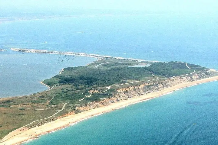
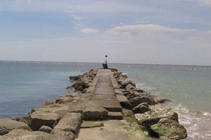
A cool sea breeze cuts across the path as you step away from the Hiker Cafe and onto the low, exposed ridge of Hengistbury Head. The headland widens before you — gravel spits, salt-scrub and grassy slopes meeting the channel that separates Bournemouth from Christchurch Harbour. The VoiceMap audio begins in your pocket, and a narrator pulls the place into focus: wartime defenses, timber and rock projections thrusting into the surf, and the ghostly rider story that locals still tell.
Verified experiences and guided adventures in the surrounding area.
Operated by VoiceMap Audio Tours · Bournemouth, Dorset
A cool sea breeze cuts across the path as you step away from the Hiker Cafe and onto the low, exposed ridge of Hengistbury Head. The headland widens before you — gravel spits, salt-scrub and grassy slopes meeting the channel that separates Bournemouth from Christchurch Harbour. The VoiceMap audio begins in your pocket, and a narrator pulls the place into focus: wartime defenses, timber and rock projections thrusting into the surf, and the ghostly rider story that locals still tell.
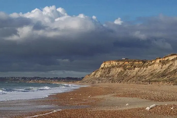
Hengistbury Head is an archaeological and natural patchwork. The hill above the reserve carries Iron Age earthworks and World War II remnants; the shoreline shows engineered groynes and timber defences installed to slow erosion. Geologically it’s largely sand and gravel with vegetated dunes and chalky soils inland, which combine to make a stopover for migrating birds and a laboratory of coastal processes.
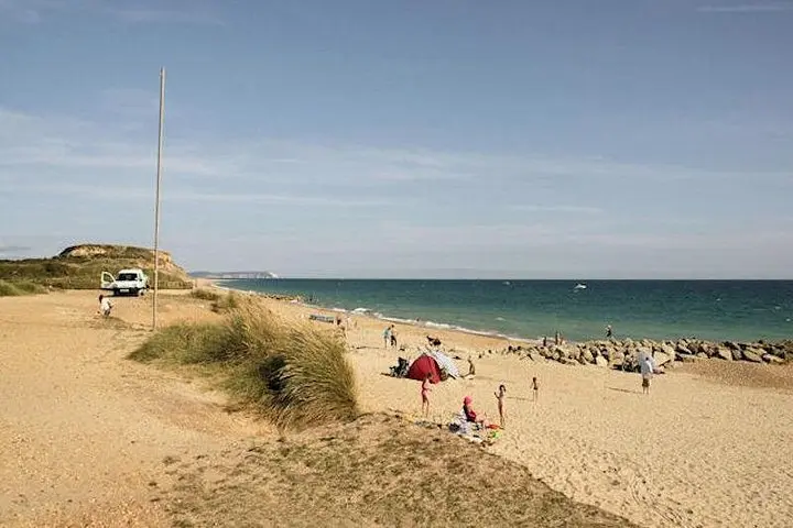
Culturally, it’s a community-managed reserve with active bird-ringing and conservation work; the audio tour explains both local lore and scientific monitoring. Expect short climbs up compacted trails and boardwalks, plus sweeping views across Christchurch Bay.
Practical notes: the tour runs 30–45 minutes and is fully self-guided via the VoiceMap app with offline maps and lifetime access. Paths are generally easy but can be muddy after rain; bring windproof layers and good footwear. Begin at the Hiker Cafe, follow the mapped route, and pause at viewpoints to hear the sections about migration, sea defences, and the headland’s history.
The self-guided audio tour runs about 30–45 minutes and is designed to be followed independently via the VoiceMap app; you control pace and pauses.
The tour begins near the Hiker Cafe at the Hengistbury Head reserve; directions are provided when you open the tour in the app.
Parts of the route are stroller-accessible and many paths are compacted, but some sections have slopes or uneven surfaces—check the route map and consider companion assistance for wheelchair users.
Yes—the VoiceMap inclusion provides offline access to audio, maps, and geodata so you won’t need continuous mobile signal.
VoiceMap Audio Tours operates guided outdoor trips and adventures with an emphasis on safety, stewardship, and memorable experiences.
A cool sea breeze cuts across the path as you step away from the Hiker Cafe and onto the low, exposed ridge of Hengistbury Head. The headland widens before you — gravel spits, salt-scrub and grassy slopes meeting the channel that separates Bournemouth from Christchurch Harbour. The VoiceMap audio begins in your pocket, and a narrator pulls the place into focus: wartime defenses, timber and rock projections thrusting into the surf, and the ghostly rider story that locals still tell.
A cool sea breeze cuts across the path as you step away from the Hiker Cafe and onto the low, exposed ridge of Hengistbury Head. The headland widens before you — gravel spits, salt-scrub and grassy slopes meeting the channel that separates Bournemouth from Christchurch Harbour. The VoiceMap audio begins in your pocket, and a narrator pulls the place into focus: wartime defenses, timber and rock projections thrusting into the surf, and the ghostly rider story that locals still tell.
Hengistbury Head is an archaeological and natural patchwork. The hill above the reserve carries Iron Age earthworks and World War II remnants; the shoreline shows engineered groynes and timber defences installed to slow erosion. Geologically it’s largely sand and gravel with vegetated dunes and chalky soils inland, which combine to make a stopover for migrating birds and a laboratory of coastal processes.
Culturally, it’s a community-managed reserve with active bird-ringing and conservation work; the audio tour explains both local lore and scientific monitoring. Expect short climbs up compacted trails and boardwalks, plus sweeping views across Christchurch Bay.
Practical notes: the tour runs 30–45 minutes and is fully self-guided via the VoiceMap app with offline maps and lifetime access. Paths are generally easy but can be muddy after rain; bring windproof layers and good footwear. Begin at the Hiker Cafe, follow the mapped route, and pause at viewpoints to hear the sections about migration, sea defences, and the headland’s history.