THE ADVENTURE COLLECTIVE® · Independent discovery and booking for outdoor travel

Three days across Vietnam’s northern karst plateau deliver cliffside passes, deep canyons and living ethnic culture. This practical guide explains what to expect on the road from Ha Giang to Ma Pi Leng and Dong Van’s markets.
Three days across Vietnam’s northern karst plateau deliver cliffside passes, deep canyons and living ethnic culture. This practical guide explains what to expect on the road from Ha Giang to Ma Pi Leng and Dong Van’s markets.
The bus slows into the highlands as dawn bleeds light over jagged limestone—spines of rock rising like the ribs of an old sea. You step out at Ma Pi Leng and the road plunges along the cliff edge; below, the Nho Que River threads between red-earth walls. Morning mist rolls through valleys where small fields and stone houses sit on steep terraces.
Verified experiences and guided adventures in the surrounding area.
Operated by Insight Vietnam · Dong Van, Ha Giang
The bus slows into the highlands as dawn bleeds light over jagged limestone—spines of rock rising like the ribs of an old sea. You step out at Ma Pi Leng and the road plunges along the cliff edge; below, the Nho Que River threads between red-earth walls. Morning mist rolls through valleys where small fields and stone houses sit on steep terraces.
This three-day, two-night route traces the Dong Van Karst Plateau, a geological uplift of Carboniferous–Permian limestone sculpted by erosion into towers, cliffs and deep canyons. The plateau has long been home to Hmong, Tay and Dao communities; markets in Dong Van and Lung Tam preserve textile, brocade and food traditions that date generations. Ma Pi Leng Pass (roughly 21 km of serpentine switchbacks) and the Tu San gorge—nearly 1,500 m in relief—are the region’s defining features.
Expect a mix of paved switchbacks and secondary roads, short village walks, a boat stretch on the Nho Que, and shared guesthouse lodging in Dong Van old quarter. Weather shifts quickly—sun to wind to drizzle—so plan layered clothing and waterproof layers. Altitude here is modest (1,200–1,500 m), but roads are steep and driving times are long; an overnight bus transfer is common.
Practical notes: carry cash for village purchases, bring a headlamp and sturdy walking shoes for uneven alleys, and allow time for market browsing at dawn or sunset when local life is most visible. Respect local customs when visiting family-run homestays and textile workshops: ask before photographing and accept invitations to try traditional dishes.
The tour is moderate: long vehicle transfers with short walks and boat time; you should be comfortable sitting for several hours and walking on uneven terrain.
Bring Vietnamese đồng in small denominations—remote markets and homestays rarely accept cards or foreign currency.
Elevations are generally 1,200–1,500 m; most travelers experience no altitude illness, but expect cooler temperatures and thinner air on exposed ridgelines.
Boat segments are generally calm but can be exposed; life jackets are provided—assess family comfort with water and check operator policies for infants.
Insight Vietnam operates guided outdoor trips and adventures with an emphasis on safety, stewardship, and memorable experiences.
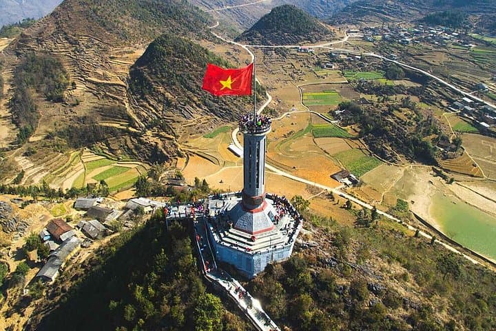
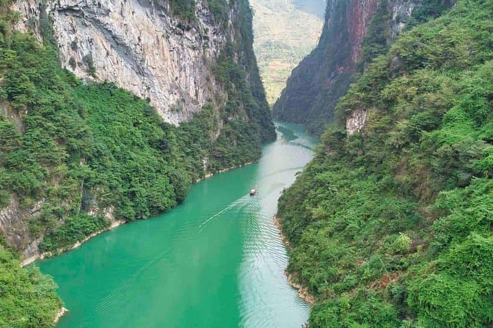
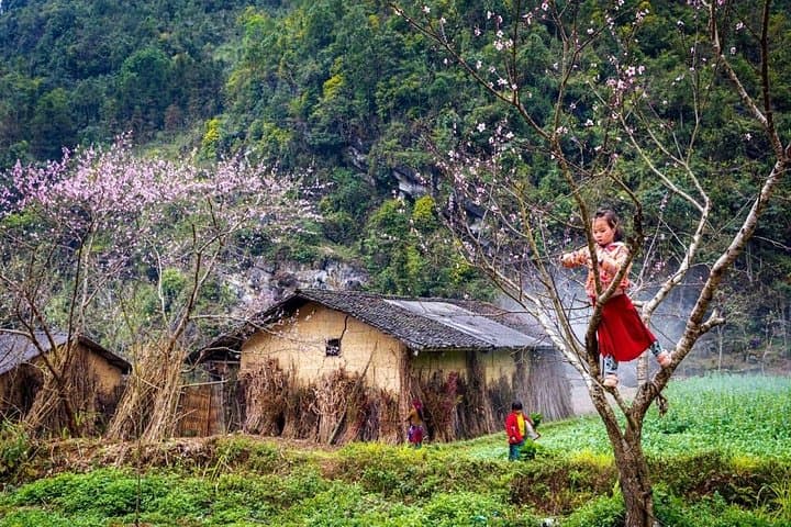
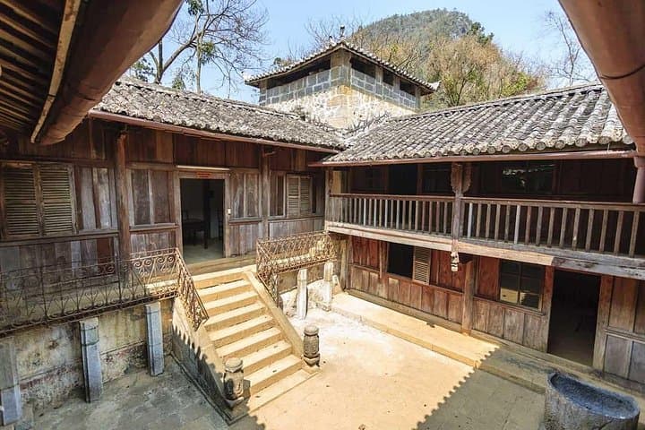
The bus slows into the highlands as dawn bleeds light over jagged limestone—spines of rock rising like the ribs of an old sea. You step out at Ma Pi Leng and the road plunges along the cliff edge; below, the Nho Que River threads between red-earth walls. Morning mist rolls through valleys where small fields and stone houses sit on steep terraces.
The bus slows into the highlands as dawn bleeds light over jagged limestone—spines of rock rising like the ribs of an old sea. You step out at Ma Pi Leng and the road plunges along the cliff edge; below, the Nho Que River threads between red-earth walls. Morning mist rolls through valleys where small fields and stone houses sit on steep terraces.
This three-day, two-night route traces the Dong Van Karst Plateau, a geological uplift of Carboniferous–Permian limestone sculpted by erosion into towers, cliffs and deep canyons. The plateau has long been home to Hmong, Tay and Dao communities; markets in Dong Van and Lung Tam preserve textile, brocade and food traditions that date generations. Ma Pi Leng Pass (roughly 21 km of serpentine switchbacks) and the Tu San gorge—nearly 1,500 m in relief—are the region’s defining features.
Expect a mix of paved switchbacks and secondary roads, short village walks, a boat stretch on the Nho Que, and shared guesthouse lodging in Dong Van old quarter. Weather shifts quickly—sun to wind to drizzle—so plan layered clothing and waterproof layers. Altitude here is modest (1,200–1,500 m), but roads are steep and driving times are long; an overnight bus transfer is common.
Practical notes: carry cash for village purchases, bring a headlamp and sturdy walking shoes for uneven alleys, and allow time for market browsing at dawn or sunset when local life is most visible. Respect local customs when visiting family-run homestays and textile workshops: ask before photographing and accept invitations to try traditional dishes.