THE ADVENTURE COLLECTIVE® · Independent discovery and booking for outdoor travel

A half-day small-group excursion from Flåm that pairs an easy walk along historic Stalheimskleiva with a scenic drive through Gudvangen and the Aurlandsfjellet, finishing at the glass-edged Stegastein viewpoint. Expect waterfalls, steep hairpins, and broad fjord panoramas.
A half-day small-group excursion from Flåm that pairs an easy walk along historic Stalheimskleiva with a scenic drive through Gudvangen and the Aurlandsfjellet, finishing at the glass-edged Stegastein viewpoint. Expect waterfalls, steep hairpins, and broad fjord panoramas.
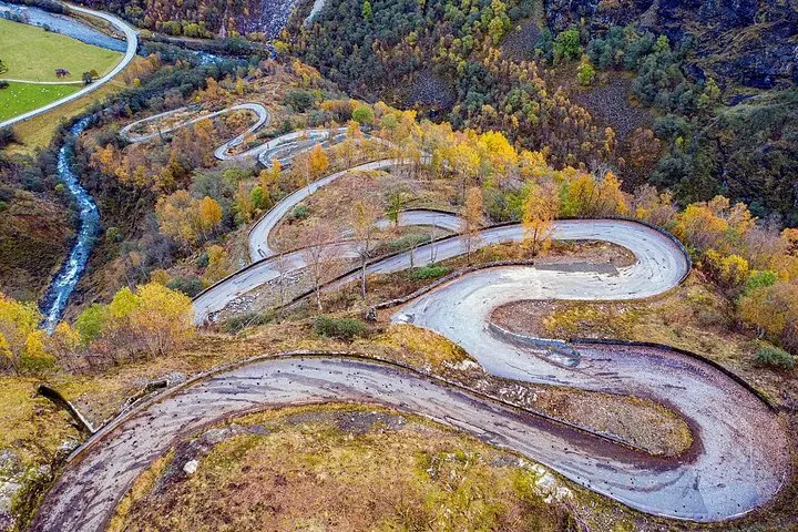
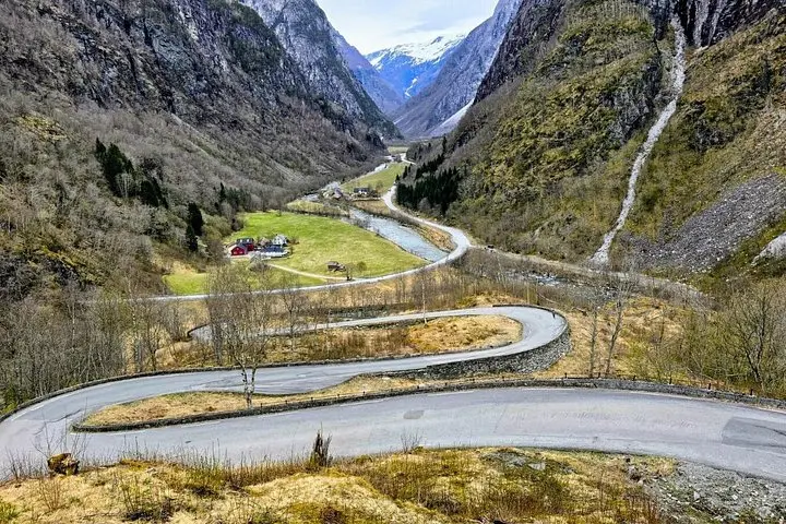
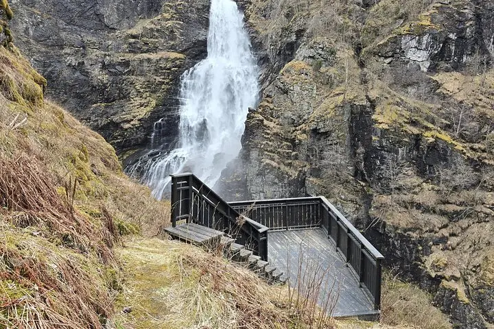
You step from an air-conditioned minibus into a breath of cold, mineral-rich air; the valley opens and water answers from every ridge. The walk down Stalheimskleiva begins with the staccato of waterfalls, glassy spray catching the light as you follow one of Norway’s steepest historic roads. The valley’s slopes press in, trees and rock framing the ribbon of road and the drop to the river below.
Verified experiences and guided adventures in the surrounding area.
Operated by Norwayfarers · Flåm, Vestland
You step from an air-conditioned minibus into a breath of cold, mineral-rich air; the valley opens and water answers from every ridge. The walk down Stalheimskleiva begins with the staccato of waterfalls, glassy spray catching the light as you follow one of Norway’s steepest historic roads. The valley’s slopes press in, trees and rock framing the ribbon of road and the drop to the river below.
This route threads through landscapes hewn by Ice Age glaciers: U-shaped valleys, sheer cliffs, and hanging waterfalls like Stalheimsfossen. Drive past Gudvangen, where the Nærøyfjord — a UNESCO site — narrows and holds centuries of coastal culture tied to Viking trade routes and mountain farms. The Aurlandsfjellet high plateaus present a change of tone: wind-swept moorland and exposed rock born of harder bedrock and glacial scouring.
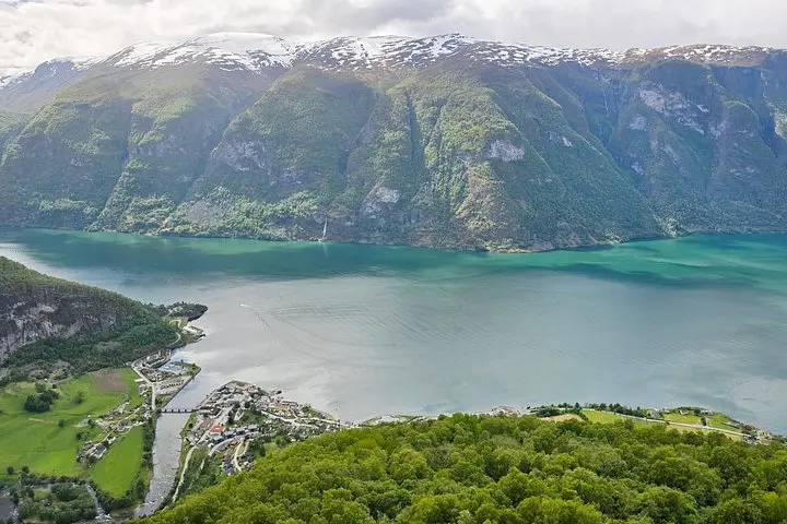
The grand stop is Stegastein, a 30-meter platform cantilevered 700 meters above Aurlandsfjord. The viewpoint’s low glass railing makes the fjord feel immediate — a dramatic endpoint after the slow descent along hairpin bends.
Practical guidance: the walking sections are easy but uneven; plan sturdy shoes and a waterproof layer. Expect rapidly changing weather and short photo stops; most tours run about five hours round-trip from Flåm. Bring a camera with spare battery, small daypack, and the patience to let light and mist compose the scene — this is a trip about shifting perspectives rather than a strenuous ascent.
No—the hike along Stalheimskleiva is an easy downhill walk on a historic road with some uneven sections; most participants find it accessible.
Yes—tour information notes stroller access and suitability for all fitness levels, but expect stairs and short uneven trails at viewpoints.
Tours may cancel or reschedule for safety in severe weather; bring waterproof layers because light rain and wind are common even on otherwise clear days.
Yes—stops include villages and viewpoints with restroom facilities, but bring hand sanitizer for short roadside stops.
Norwayfarers operates guided outdoor trips and adventures with an emphasis on safety, stewardship, and memorable experiences.
You step from an air-conditioned minibus into a breath of cold, mineral-rich air; the valley opens and water answers from every ridge. The walk down Stalheimskleiva begins with the staccato of waterfalls, glassy spray catching the light as you follow one of Norway’s steepest historic roads. The valley’s slopes press in, trees and rock framing the ribbon of road and the drop to the river below.
You step from an air-conditioned minibus into a breath of cold, mineral-rich air; the valley opens and water answers from every ridge. The walk down Stalheimskleiva begins with the staccato of waterfalls, glassy spray catching the light as you follow one of Norway’s steepest historic roads. The valley’s slopes press in, trees and rock framing the ribbon of road and the drop to the river below.
This route threads through landscapes hewn by Ice Age glaciers: U-shaped valleys, sheer cliffs, and hanging waterfalls like Stalheimsfossen. Drive past Gudvangen, where the Nærøyfjord — a UNESCO site — narrows and holds centuries of coastal culture tied to Viking trade routes and mountain farms. The Aurlandsfjellet high plateaus present a change of tone: wind-swept moorland and exposed rock born of harder bedrock and glacial scouring.
The grand stop is Stegastein, a 30-meter platform cantilevered 700 meters above Aurlandsfjord. The viewpoint’s low glass railing makes the fjord feel immediate — a dramatic endpoint after the slow descent along hairpin bends.
Practical guidance: the walking sections are easy but uneven; plan sturdy shoes and a waterproof layer. Expect rapidly changing weather and short photo stops; most tours run about five hours round-trip from Flåm. Bring a camera with spare battery, small daypack, and the patience to let light and mist compose the scene — this is a trip about shifting perspectives rather than a strenuous ascent.