THE ADVENTURE COLLECTIVE® · Independent discovery and booking for outdoor travel

Spend a day on alpine trails above Zermatt with a guide who knows the best viewpoints for Matterhorn reflections and alpine lakes. This full-day hike combines geology, local history and practical guidance for photographers and hikers alike.
Spend a day on alpine trails above Zermatt with a guide who knows the best viewpoints for Matterhorn reflections and alpine lakes. This full-day hike combines geology, local history and practical guidance for photographers and hikers alike.
A crisp alpine breeze meets your face as you leave the car-free streets of Zermatt and step onto a trail that climbs past larch stands and flower-specked meadows. The Matterhorn keeps pace to the west, its summit a silent challenge, while the trail alternates between firm dirt, rocky steps and short scree pitches that demand steady footing.
Verified experiences and guided adventures in the surrounding area.
Operated by PDS Snowsport · Zermatt, Valais
A crisp alpine breeze meets your face as you leave the car-free streets of Zermatt and step onto a trail that climbs past larch stands and flower-specked meadows. The Matterhorn keeps pace to the west, its summit a silent challenge, while the trail alternates between firm dirt, rocky steps and short scree pitches that demand steady footing.
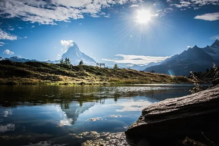
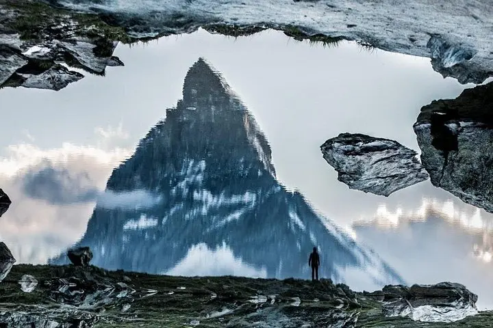
This region's story is written in ice and limestone: glaciers carved deep valleys and left moraines that now hold clear tarns such as Stellisee and Riffelsee, popular photo subjects because they can mirror the Matterhorn on still mornings. Zermatt’s shift from a farming village to a 19th-century mountaineering hub followed the first ascents of surrounding peaks; today guides blend local mountaineering knowledge with practical route-finding.
Expect a full-day loop or point-to-point of roughly 10–15 km with 500–900 m of cumulative elevation gain depending on the route, mostly on well-marked alpine paths. Trails run through mixed forest, open ridgelines and exposed viewpoints where weather changes fast and clouds can sculpt the peaks within minutes — the mountains push the pace as much as you will.
Practical edge: start early to catch calm reflections and avoid afternoon storms, bring layers and a waterproof, and carry at least 1–2 liters of water. A guide will manage pace and navigation, but shoes with ankle support, sun protection and a charged camera are essential. Public transport and mountain railways in Zermatt provide flexible access points, making it simple to tailor distance and difficulty to your group.
Routes are generally moderate: expect 10–15 km and 500–900 m cumulative elevation gain on well-marked trails; pace is adjusted by the guide to group ability.
No technical experience is needed, but participants should be comfortable with sustained walking on uneven ground and basic stamina for a 6-hour day.
Guiding, local knowledge and route planning are provided; check with the operator for specifics like lift tickets or meals, as these may not be included.
Cameras are encouraged; drones are restricted in many parts of the Alps and around Zermatt—check local regulations and operator policy before flying.
PDS Snowsport operates guided outdoor trips and adventures with an emphasis on safety, stewardship, and memorable experiences.
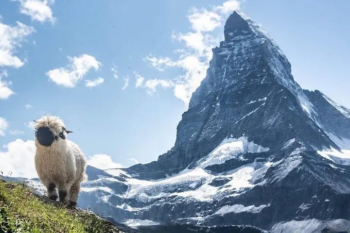
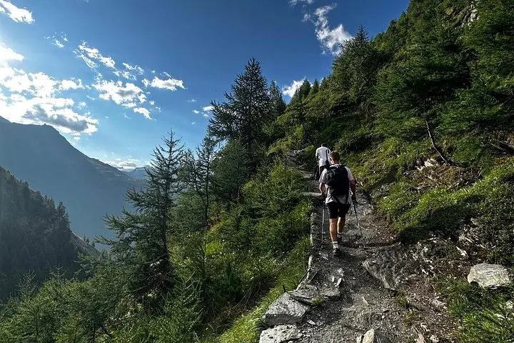
A crisp alpine breeze meets your face as you leave the car-free streets of Zermatt and step onto a trail that climbs past larch stands and flower-specked meadows. The Matterhorn keeps pace to the west, its summit a silent challenge, while the trail alternates between firm dirt, rocky steps and short scree pitches that demand steady footing.
A crisp alpine breeze meets your face as you leave the car-free streets of Zermatt and step onto a trail that climbs past larch stands and flower-specked meadows. The Matterhorn keeps pace to the west, its summit a silent challenge, while the trail alternates between firm dirt, rocky steps and short scree pitches that demand steady footing.
This region's story is written in ice and limestone: glaciers carved deep valleys and left moraines that now hold clear tarns such as Stellisee and Riffelsee, popular photo subjects because they can mirror the Matterhorn on still mornings. Zermatt’s shift from a farming village to a 19th-century mountaineering hub followed the first ascents of surrounding peaks; today guides blend local mountaineering knowledge with practical route-finding.
Expect a full-day loop or point-to-point of roughly 10–15 km with 500–900 m of cumulative elevation gain depending on the route, mostly on well-marked alpine paths. Trails run through mixed forest, open ridgelines and exposed viewpoints where weather changes fast and clouds can sculpt the peaks within minutes — the mountains push the pace as much as you will.
Practical edge: start early to catch calm reflections and avoid afternoon storms, bring layers and a waterproof, and carry at least 1–2 liters of water. A guide will manage pace and navigation, but shoes with ankle support, sun protection and a charged camera are essential. Public transport and mountain railways in Zermatt provide flexible access points, making it simple to tailor distance and difficulty to your group.