THE ADVENTURE COLLECTIVE® · Independent discovery and booking for outdoor travel

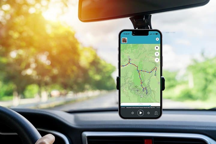
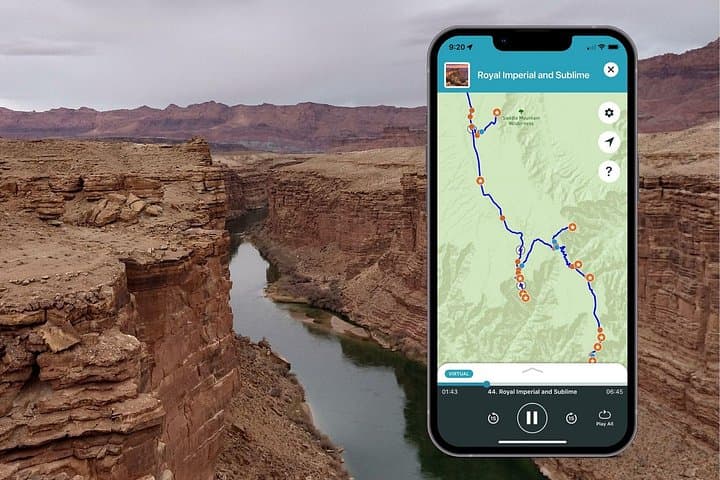
Drive your own itinerary along the Grand Canyon North Rim with a GPS-activated audio guide. Pause at overlooks, short hikes, and historical sites while the app narrates geology, history and local tips.
Drive your own itinerary along the Grand Canyon North Rim with a GPS-activated audio guide. Pause at overlooks, short hikes, and historical sites while the app narrates geology, history and local tips.
You round a bend and the road drops into a wide, raw horizon: red cliffs giving way to a knife-edged rim, ponderosa pines scenting the air. A GPS-guided voice cues the next pullout; you park, step onto wind-scrubbed pavement and the canyon opens — layered, ancient, waiting.
Verified experiences and guided adventures in the surrounding area.
Operated by Shaka Guide Apps · Jacob Lake, Arizona
You round a bend and the road drops into a wide, raw horizon: red cliffs giving way to a knife-edged rim, ponderosa pines scenting the air. A GPS-guided voice cues the next pullout; you park, step onto wind-scrubbed pavement and the canyon opens — layered, ancient, waiting.
This route traces routes of explorers and local peoples: Spanish expeditions in the 18th century, Kaibab Paiute heritage and later Mormon settlers who shaped the patchwork of ranches and trails. Geology here reads like a long ledger — uplifted plateaus, the Vermilion Cliffs, and the slow incision of the Colorado River that carved the gorge over millions of years. Small monuments and roadside ruins punctuate the drive: a 1927 Navajo Bridge, rustic innways, and interpretive stops that explain both natural forces and human stories.
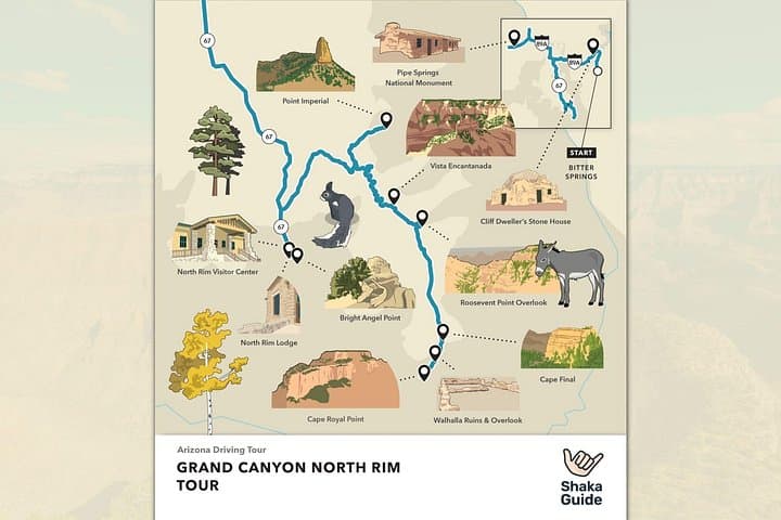
Practically, the audio driving tour hands you context and turn-by-turn guidance while you maintain control of your schedule. Expect multiple short hikes from pullouts (Bright Angel Point, Cape Final, Point Imperial), varied elevation — the North Rim sits around 8,000–8,800 ft — and dramatic microclimates as you move from desert through Kaibab National Forest. Download the Shaka Guide tour on Wi‑Fi before you go, carry water, layers, sunscreen, and plan fuel stops (Jacob Lake is a key last stop for services). Allow 4–8 hours for a full, unhurried loop; stretch shorter if you only want a few overlooks. Be mindful of seasonal closures: the North Rim road typically closes in winter. Drive responsibly, leave no trace, and use the audio guide to add depth to each lookout rather than distract from the views.
Yes—standard park entrance fees apply when you enter Grand Canyon National Park at the North Rim entrance station.
The app supports from 1 hour up to a full day; most visitors take 4–8 hours to follow key overlooks and short hikes.
No—the North Rim is seasonal and typically closes in winter due to snow; check NPS for current opening dates and road conditions.
No—the audio and map function offline after you download the tour, so you won’t need cell coverage while driving.
Shaka Guide Apps operates guided outdoor trips and adventures with an emphasis on safety, stewardship, and memorable experiences.

You round a bend and the road drops into a wide, raw horizon: red cliffs giving way to a knife-edged rim, ponderosa pines scenting the air. A GPS-guided voice cues the next pullout; you park, step onto wind-scrubbed pavement and the canyon opens — layered, ancient, waiting.
You round a bend and the road drops into a wide, raw horizon: red cliffs giving way to a knife-edged rim, ponderosa pines scenting the air. A GPS-guided voice cues the next pullout; you park, step onto wind-scrubbed pavement and the canyon opens — layered, ancient, waiting.
This route traces routes of explorers and local peoples: Spanish expeditions in the 18th century, Kaibab Paiute heritage and later Mormon settlers who shaped the patchwork of ranches and trails. Geology here reads like a long ledger — uplifted plateaus, the Vermilion Cliffs, and the slow incision of the Colorado River that carved the gorge over millions of years. Small monuments and roadside ruins punctuate the drive: a 1927 Navajo Bridge, rustic innways, and interpretive stops that explain both natural forces and human stories.
Practically, the audio driving tour hands you context and turn-by-turn guidance while you maintain control of your schedule. Expect multiple short hikes from pullouts (Bright Angel Point, Cape Final, Point Imperial), varied elevation — the North Rim sits around 8,000–8,800 ft — and dramatic microclimates as you move from desert through Kaibab National Forest. Download the Shaka Guide tour on Wi‑Fi before you go, carry water, layers, sunscreen, and plan fuel stops (Jacob Lake is a key last stop for services). Allow 4–8 hours for a full, unhurried loop; stretch shorter if you only want a few overlooks. Be mindful of seasonal closures: the North Rim road typically closes in winter. Drive responsibly, leave no trace, and use the audio guide to add depth to each lookout rather than distract from the views.