THE ADVENTURE COLLECTIVE® · Independent discovery and booking for outdoor travel

Lift off from St. George’s for a bird’s-eye view of Grenada’s volcanic peaks, secret waterfalls, and coastal villages. Choose 15–60 minute flights or charter to nearby islands for a flexible aerial adventure.
Lift off from St. George’s for a bird’s-eye view of Grenada’s volcanic peaks, secret waterfalls, and coastal villages. Choose 15–60 minute flights or charter to nearby islands for a flexible aerial adventure.
A low thrum builds beneath you as the Robinson R44 lifts off near St. George’s, and Grenada unfurls — beaches flash white, volcanic ridgelines roll green, and the sea pinpricks with fishing boats. From fifteen minutes to an hour in the air, the island’s contrasts read like a map you can feel: coral-fringed bays give way to cloud-tipped hills and hidden waterfalls that the island’s roads rarely reach.
Verified experiences and guided adventures in the surrounding area.
Operated by Dowden Aviation · St. George's, Saint George Parish
A low thrum builds beneath you as the Robinson R44 lifts off near St. George’s, and Grenada unfurls — beaches flash white, volcanic ridgelines roll green, and the sea pinpricks with fishing boats. From fifteen minutes to an hour in the air, the island’s contrasts read like a map you can feel: coral-fringed bays give way to cloud-tipped hills and hidden waterfalls that the island’s roads rarely reach.
Grenada’s landscape reflects its volcanic past: steep ridges and crater lakes such as Grand Etang tell of eruptions and long weathering. The island’s history—Arawak and Carib presence, centuries of colonial trade, and the nutmeg plantations that still define parts of its economy—appears in the patchwork of farmed slopes and colonial-era towns you pass overhead. Coastal villages pulse with market life, while offshore islands like Carriacou and St. Vincent punctuate the horizon.
Practically, expect clear visual access with headsets provided for pilot narration and music. Short flights (15–30 minutes) make an ideal orientation flight; a 60-minute charter lets you circle Grand Etang, waterfalls, and the capital’s harbor, or hop to neighboring islands when scheduled. Weather governs operations—operators will reschedule in heavy rain or low clouds. Bring a camera with a fast shutter, a light windbreaker for takeoff, and a sense of motion-sickness readiness if you’re sensitive. Weight and passenger limits apply; disclose them at booking.
This is aerial adventure that’s easy physically but rich in perspective — the kind of trip that turns familiar islands into a geography lesson you can feel in your chest.
Flights are offered in multiple durations—common options include 15, 30, and 60 minutes; confirm available durations when booking.
Yes—operators require passenger weights for safety and balance; disclose accurate weights at booking and during check-in.
Charters to nearby islands such as Carriacou and St. Vincent are available—confirm customs/arrival procedures and flight permissions ahead of time.
Flights are canceled for unsafe weather; operators typically offer a full refund or rescheduling if canceled due to weather conditions.
Dowden Aviation operates guided outdoor trips and adventures with an emphasis on safety, stewardship, and memorable experiences.
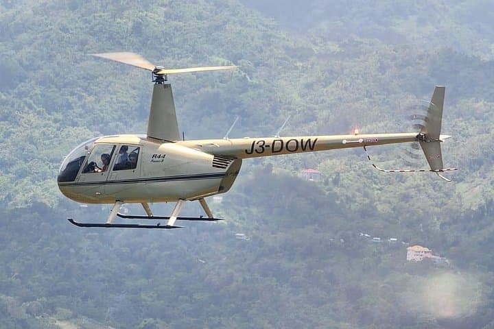
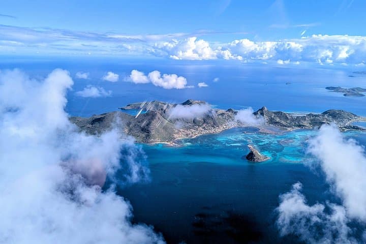
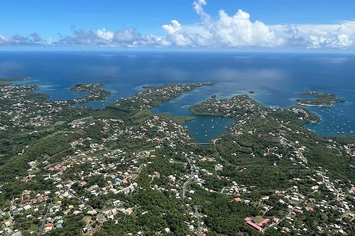
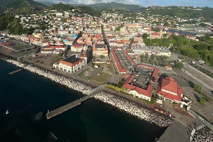
A low thrum builds beneath you as the Robinson R44 lifts off near St. George’s, and Grenada unfurls — beaches flash white, volcanic ridgelines roll green, and the sea pinpricks with fishing boats. From fifteen minutes to an hour in the air, the island’s contrasts read like a map you can feel: coral-fringed bays give way to cloud-tipped hills and hidden waterfalls that the island’s roads rarely reach.
A low thrum builds beneath you as the Robinson R44 lifts off near St. George’s, and Grenada unfurls — beaches flash white, volcanic ridgelines roll green, and the sea pinpricks with fishing boats. From fifteen minutes to an hour in the air, the island’s contrasts read like a map you can feel: coral-fringed bays give way to cloud-tipped hills and hidden waterfalls that the island’s roads rarely reach.
Grenada’s landscape reflects its volcanic past: steep ridges and crater lakes such as Grand Etang tell of eruptions and long weathering. The island’s history—Arawak and Carib presence, centuries of colonial trade, and the nutmeg plantations that still define parts of its economy—appears in the patchwork of farmed slopes and colonial-era towns you pass overhead. Coastal villages pulse with market life, while offshore islands like Carriacou and St. Vincent punctuate the horizon.
Practically, expect clear visual access with headsets provided for pilot narration and music. Short flights (15–30 minutes) make an ideal orientation flight; a 60-minute charter lets you circle Grand Etang, waterfalls, and the capital’s harbor, or hop to neighboring islands when scheduled. Weather governs operations—operators will reschedule in heavy rain or low clouds. Bring a camera with a fast shutter, a light windbreaker for takeoff, and a sense of motion-sickness readiness if you’re sensitive. Weight and passenger limits apply; disclose them at booking.
This is aerial adventure that’s easy physically but rich in perspective — the kind of trip that turns familiar islands into a geography lesson you can feel in your chest.