THE ADVENTURE COLLECTIVE® · Independent discovery and booking for outdoor travel

Explore the quieter side of Snowdonia on a guided day-hike from Croesor to Moelwyn Mawr and Moelwyn Bach. Rugged ridgelines, slate-industry ruins and wide mountain views make for a rewarding 6–7 hour adventure.
Explore the quieter side of Snowdonia on a guided day-hike from Croesor to Moelwyn Mawr and Moelwyn Bach. Rugged ridgelines, slate-industry ruins and wide mountain views make for a rewarding 6–7 hour adventure.
You step out of Croesor with peat underfoot and a slate-grey sky pressing close, the valley folding inward like a paused breath. The path climbs through scattered spoil heaps and craggy outcrops, then opens to a ridgeline where wind pushes you along—Snowdon and Cadair Idris sit as distant, familiar shapes on the horizon.
Verified experiences and guided adventures in the surrounding area.
Operated by Wild Wales · Croesor, Gwynedd
You step out of Croesor with peat underfoot and a slate-grey sky pressing close, the valley folding inward like a paused breath. The path climbs through scattered spoil heaps and craggy outcrops, then opens to a ridgeline where wind pushes you along—Snowdon and Cadair Idris sit as distant, familiar shapes on the horizon.
This guided day walk follows historic routes through Cwm Croesor, an area shaped by Ordovician geology and the slate industry of the 18th–20th centuries. Ruined adits, tipping terraces and stone workers’ cottages punctuate the slopes; the landscape reads as both natural monument and industrial archive. Moelwyn Mawr (770 m) and Moelwyn Bach (720 m) reward the ascent with broad views over Llyn Stwlan reservoir and the surrounding peaks.
Expect varied terrain: rocky scrambles, grassy ramps, occasional peat bogs and narrow ridges. A local, qualified Mountain Leader manages route-finding and pace for small groups (max 10), offering context on geology, mining history and local ecology as you go.
Practically, the day is about 6–7 hours on foot with moderate fitness needed and a few steep sections requiring sure-footedness. Weather changes fast—waterproof layers, solid boots and navigation basics matter even with a guide. Hydrate before exposed ridgelines and plan for muddy patches after rain. Those who come prepared will find quiet routes and expansive mountain views without the crowds of Snowdon itself, and a chance to trace the human story etched into these slopes.
The guided route is about 6–7 hours on mixed terrain with roughly 700–800 m of ascent; it’s moderate but includes steep, rocky sections requiring sure-footedness.
Group size is limited to a maximum of 10 to keep the experience personal and manageable on narrow paths.
The walk starts in the village of Croesor; the booking confirmation will give the exact meeting point and time—plan on arriving early.
The tour operator may cancel in unsafe conditions (they state they cancel for bad weather); check confirmation policies—sales are final so monitoring forecasts before travel is advised.
Wild Wales operates guided outdoor trips and adventures with an emphasis on safety, stewardship, and memorable experiences.
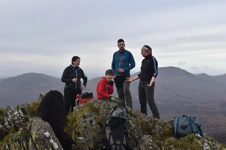
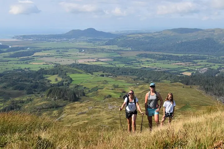

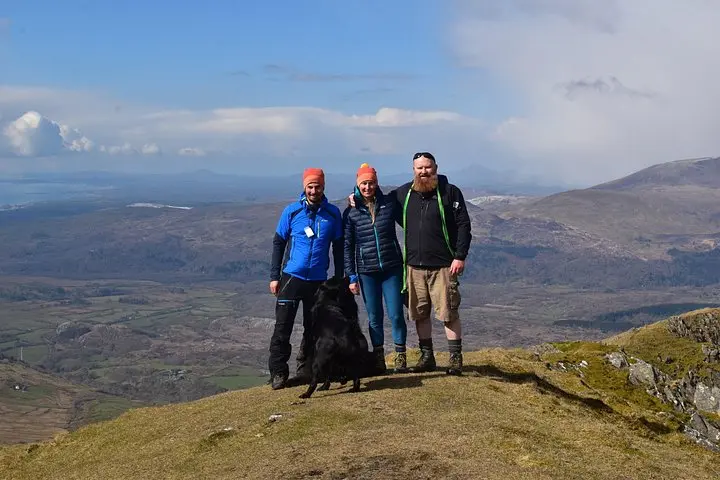
You step out of Croesor with peat underfoot and a slate-grey sky pressing close, the valley folding inward like a paused breath. The path climbs through scattered spoil heaps and craggy outcrops, then opens to a ridgeline where wind pushes you along—Snowdon and Cadair Idris sit as distant, familiar shapes on the horizon.
You step out of Croesor with peat underfoot and a slate-grey sky pressing close, the valley folding inward like a paused breath. The path climbs through scattered spoil heaps and craggy outcrops, then opens to a ridgeline where wind pushes you along—Snowdon and Cadair Idris sit as distant, familiar shapes on the horizon.
This guided day walk follows historic routes through Cwm Croesor, an area shaped by Ordovician geology and the slate industry of the 18th–20th centuries. Ruined adits, tipping terraces and stone workers’ cottages punctuate the slopes; the landscape reads as both natural monument and industrial archive. Moelwyn Mawr (770 m) and Moelwyn Bach (720 m) reward the ascent with broad views over Llyn Stwlan reservoir and the surrounding peaks.
Expect varied terrain: rocky scrambles, grassy ramps, occasional peat bogs and narrow ridges. A local, qualified Mountain Leader manages route-finding and pace for small groups (max 10), offering context on geology, mining history and local ecology as you go.
Practically, the day is about 6–7 hours on foot with moderate fitness needed and a few steep sections requiring sure-footedness. Weather changes fast—waterproof layers, solid boots and navigation basics matter even with a guide. Hydrate before exposed ridgelines and plan for muddy patches after rain. Those who come prepared will find quiet routes and expansive mountain views without the crowds of Snowdon itself, and a chance to trace the human story etched into these slopes.