THE ADVENTURE COLLECTIVE® · Independent discovery and booking for outdoor travel

Ride the Ha Giang loop over three days, passing Ma Pi Leng Pass, Quan Ba Heaven Gate and remote Tay homestays. Expect steep passes, paved but narrow roads, and close cultural encounters in mountain markets and villages.
Ride the Ha Giang loop over three days, passing Ma Pi Leng Pass, Quan Ba Heaven Gate and remote Tay homestays. Expect steep passes, paved but narrow roads, and close cultural encounters in mountain markets and villages.
A low sun slices across limestone ridges as a convoy of motorbikes peels out of Ha Giang city, engines humming against a backdrop of sheer canyons. Over three days you thread through Bac Son and Tham Ma passes, cross the Quan Ba ‘Heaven Gate’ viewpoint and stand at the edge of Ma Pi Leng, where the Nho Que River dares you to look down.
Verified experiences and guided adventures in the surrounding area.
Operated by LemonThai Tour Ha Giang · Ha Giang, Ha Giang Province
A low sun slices across limestone ridges as a convoy of motorbikes peels out of Ha Giang city, engines humming against a backdrop of sheer canyons. Over three days you thread through Bac Son and Tham Ma passes, cross the Quan Ba ‘Heaven Gate’ viewpoint and stand at the edge of Ma Pi Leng, where the Nho Que River dares you to look down.
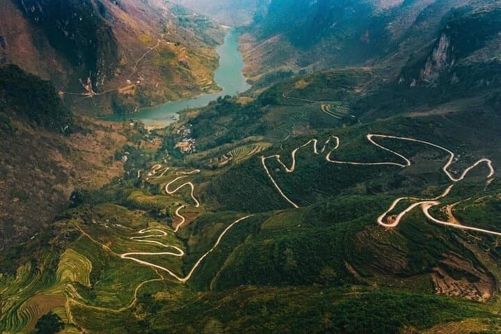
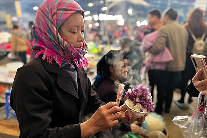
The region sits on the Dong Van Karst Plateau, a fractured limestone landscape shaped by millions of years of uplift and erosion. Centuries of ethnically diverse mountain life — H’mong, Tay, Dao and Lo Lo communities — shaped the patchwork of terraced fields, hemp-weaving villages and bustling weekend markets that punctuate the route. Historic sites such as the Hmong King’s palace speak to local authority structures before modern roads opened the plateau.
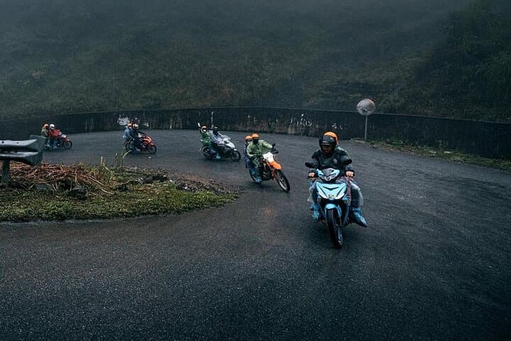
Expect paved but narrow roads with steep hairpins and occasional gravel shoulders; daily distances average 110–135 km, totaling roughly 360–370 km. Accommodation alternates between simple homestays and local guesthouses with family meals included; breakfasts and most lunches/dinners are provided. Plan early starts for cooler riding and clearer views; mid- to late-afternoon clouds and sudden showers are common in summer.
Practical points: pack a sturdy helmet and layered waterproofs, carry Vietnamese dong for markets and remote villages, and be ready for limited cell coverage. Guides are local riders familiar with road conditions and culture, and homestays reward respectful interaction with strong, home-cooked regional dishes. This loop balances dramatic alpine vistas with close cultural encounters — an active, attainable way to experience Ha Giang’s highlands.
Legally, riding a motorcycle in Vietnam requires an appropriate license; operators commonly provide drivers for guests without licenses or allow passengers to ride as pillions — confirm with the operator before booking.
Accommodation is basic to comfortable: family-run homestays and local guesthouses with shared facilities. Expect local meals and simple bedding in remote villages.
Autumn (September–November) and spring (March–May) offer more stable weather and clearer skies; summer brings heavier rains and possible road-side slips, while winter can be cold at higher elevations.
With an experienced local guide and conservative pacing it can work for less-experienced riders, but novices should consider riding as a passenger or ensuring they have some mountain-road experience.
LemonThai Tour Ha Giang operates guided outdoor trips and adventures with an emphasis on safety, stewardship, and memorable experiences.

A low sun slices across limestone ridges as a convoy of motorbikes peels out of Ha Giang city, engines humming against a backdrop of sheer canyons. Over three days you thread through Bac Son and Tham Ma passes, cross the Quan Ba ‘Heaven Gate’ viewpoint and stand at the edge of Ma Pi Leng, where the Nho Que River dares you to look down.
A low sun slices across limestone ridges as a convoy of motorbikes peels out of Ha Giang city, engines humming against a backdrop of sheer canyons. Over three days you thread through Bac Son and Tham Ma passes, cross the Quan Ba ‘Heaven Gate’ viewpoint and stand at the edge of Ma Pi Leng, where the Nho Que River dares you to look down.
The region sits on the Dong Van Karst Plateau, a fractured limestone landscape shaped by millions of years of uplift and erosion. Centuries of ethnically diverse mountain life — H’mong, Tay, Dao and Lo Lo communities — shaped the patchwork of terraced fields, hemp-weaving villages and bustling weekend markets that punctuate the route. Historic sites such as the Hmong King’s palace speak to local authority structures before modern roads opened the plateau.
Expect paved but narrow roads with steep hairpins and occasional gravel shoulders; daily distances average 110–135 km, totaling roughly 360–370 km. Accommodation alternates between simple homestays and local guesthouses with family meals included; breakfasts and most lunches/dinners are provided. Plan early starts for cooler riding and clearer views; mid- to late-afternoon clouds and sudden showers are common in summer.
Practical points: pack a sturdy helmet and layered waterproofs, carry Vietnamese dong for markets and remote villages, and be ready for limited cell coverage. Guides are local riders familiar with road conditions and culture, and homestays reward respectful interaction with strong, home-cooked regional dishes. This loop balances dramatic alpine vistas with close cultural encounters — an active, attainable way to experience Ha Giang’s highlands.