THE ADVENTURE COLLECTIVE® · Independent discovery and booking for outdoor travel

Four days on the Ha Giang loop take you from sleeper-bus dusk into limestone highlands where deep canyons and ethnic villages define the landscape. Short treks, a river boat ride and homestay nights pair big views with cultural connection.
Four days on the Ha Giang loop take you from sleeper-bus dusk into limestone highlands where deep canyons and ethnic villages define the landscape. Short treks, a river boat ride and homestay nights pair big views with cultural connection.
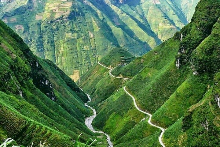
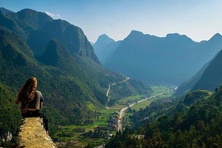
Dust from the overnight sleeper bus still clings to your jacket as dawn opens over Ha Giang. The road peels away into switchbacks and the air cools; karst towers and stepped rice paddies push the horizon into a serrated line. Rivers cut deep canyons that seem to dare you to look down, and the Nho Que flows like a bright vein through the cliffs.
Verified experiences and guided adventures in the surrounding area.
Operated by Tiger Tourist · Ha Giang, Ha Giang
Dust from the overnight sleeper bus still clings to your jacket as dawn opens over Ha Giang. The road peels away into switchbacks and the air cools; karst towers and stepped rice paddies push the horizon into a serrated line. Rivers cut deep canyons that seem to dare you to look down, and the Nho Que flows like a bright vein through the cliffs.
This four-day loop moves through landscapes shaped over 400 million years—limestone plateaus, sinkholes and razorback ridges that define the Dong Van Karst Plateau Geopark. Along the way you'll pass Quan Ba’s Twin Mountains, test your stomach on the hairpin Tham Ma slopes and stand on Ma Pi Leng, where the Sky Path frames the Nho Que canyon far below. Cultural layers are as visible as the rock: the Vuong family’s palace in Sa Phin speaks to early 20th-century wealth and power, while Dao, Hmong, Tay and Lo Lo communities continue traditional farming, textile and homestay practices.
Expect short treks (2–4 km), village visits, an hour-long boat ride on the Nho Que and homestay nights with basic comforts. Practical planning matters: pack layers for big temperature swings, bring cash for remote villages, and give space to daily life—ask before photographing people. Footwear with good grip is essential for limestone trails and waterfall approaches; hydrate on long road transfers and be ready for early starts. The route balances scenic highlights with meaningful cultural encounters, offering a grounded, active way to experience Vietnam’s northern highlands.
The tour is paced for a broad range of fitness levels with short treks (typically 2–4 km) and vehicle transfers; participants should be comfortable walking uneven ground and managing stairs.
Accommodations alternate between simple homestays and basic hotels—expect communal bathrooms in villages and warm hospitality rather than boutique amenities.
Altitudes are generally moderate (850–1,100 m); most travelers do not experience altitude sickness, but those sensitive to elevation should monitor symptoms and hydrate.
Local languages include Vietnamese and various ethnic languages; an experienced English-speaking guide is included to interpret cultural context and logistics.
Tiger Tourist operates guided outdoor trips and adventures with an emphasis on safety, stewardship, and memorable experiences.


Dust from the overnight sleeper bus still clings to your jacket as dawn opens over Ha Giang. The road peels away into switchbacks and the air cools; karst towers and stepped rice paddies push the horizon into a serrated line. Rivers cut deep canyons that seem to dare you to look down, and the Nho Que flows like a bright vein through the cliffs.
Dust from the overnight sleeper bus still clings to your jacket as dawn opens over Ha Giang. The road peels away into switchbacks and the air cools; karst towers and stepped rice paddies push the horizon into a serrated line. Rivers cut deep canyons that seem to dare you to look down, and the Nho Que flows like a bright vein through the cliffs.
This four-day loop moves through landscapes shaped over 400 million years—limestone plateaus, sinkholes and razorback ridges that define the Dong Van Karst Plateau Geopark. Along the way you'll pass Quan Ba’s Twin Mountains, test your stomach on the hairpin Tham Ma slopes and stand on Ma Pi Leng, where the Sky Path frames the Nho Que canyon far below. Cultural layers are as visible as the rock: the Vuong family’s palace in Sa Phin speaks to early 20th-century wealth and power, while Dao, Hmong, Tay and Lo Lo communities continue traditional farming, textile and homestay practices.
Expect short treks (2–4 km), village visits, an hour-long boat ride on the Nho Que and homestay nights with basic comforts. Practical planning matters: pack layers for big temperature swings, bring cash for remote villages, and give space to daily life—ask before photographing people. Footwear with good grip is essential for limestone trails and waterfall approaches; hydrate on long road transfers and be ready for early starts. The route balances scenic highlights with meaningful cultural encounters, offering a grounded, active way to experience Vietnam’s northern highlands.