THE ADVENTURE COLLECTIVE® · Independent discovery and booking for outdoor travel

Four days of mountain switchbacks, limestone ridgelines and homestay nights on Vietnam’s Ha Giang Loop. This guided motorbike tour covers Ma Pi Leng, Lung Cu and the Dong Van Karst Plateau with local culture and dramatic river canyons.
Four days of mountain switchbacks, limestone ridgelines and homestay nights on Vietnam’s Ha Giang Loop. This guided motorbike tour covers Ma Pi Leng, Lung Cu and the Dong Van Karst Plateau with local culture and dramatic river canyons.
You kick away from Hanoi before dawn and the road narrows into a mountain ribbon; by afternoon rice terraces thread the valley walls and you’re threading switchbacks that crawl toward cloud. Wind cuts through open-face helmets, and the limestone ridges of the Dong Van Karst Plateau rise like cut stone against a cobalt sky.
Verified experiences and guided adventures in the surrounding area.
Operated by Authentic Hanoi Homestay & Travel · Ha Giang, Ha Giang Province
You kick away from Hanoi before dawn and the road narrows into a mountain ribbon; by afternoon rice terraces thread the valley walls and you’re threading switchbacks that crawl toward cloud. Wind cuts through open-face helmets, and the limestone ridges of the Dong Van Karst Plateau rise like cut stone against a cobalt sky.
The Ha Giang Loop is as much geology as it is culture: part of the Dong Van Karst Plateau Geopark, this region is carved from Ordovician limestone folded into sharp ridgelines and deep canyons. Centuries of Hmong, Tay, Lo Lo and other ethnic groups have shaped villages here — your nights in family-run homestays put you at the heart of local foodways, house music and, sometimes, a strong corn wine toast.
Expect roughly 300–350 km of riding over four days, with daily legs of 80–150 km and passes that climb to about 1,400–1,700 m. Roads are mostly paved but include narrow, rough sections and tight switchbacks (Ma Pi Leng is the steep, scenic highlight). On day three you crest Lung Cu and peer toward the Chinese border; on day four a short boat on the Nho Que River takes you below Tu San Canyon.
Practical edge: fuel and cash are sparse outside Ha Giang city, weather changes quickly above 1,200 m, and mobile signal is intermittent. Ride conservatively on wet roads, carry layered clothing and a reliable helmet, and plan daylight riding—sunset on the passes drops temperatures fast. Respect homestay customs, keep noise low in villages, and pack out what you pack in; the landscape is fragile and still very much lived in.
Yes — you should be confident handling a 110–125cc bike on hills and switchbacks; the tour may provide an experienced driver or easy rider if arranged.
Most are paved but narrow, with occasional gravel or potholes; expect steep switchbacks (Ma Pi Leng) and variable conditions after rain.
Vietnamese dong is preferred; many small restaurants and homestays accept cash only — ATMs are available in Ha Giang city and larger towns.
Altitudes are moderate (peaks around 1,500–1,700 m); most travelers do fine, but take it easy if you’re sensitive to elevation and stay hydrated.
Authentic Hanoi Homestay & Travel operates guided outdoor trips and adventures with an emphasis on safety, stewardship, and memorable experiences.
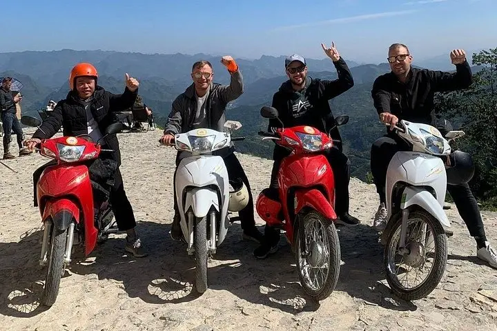

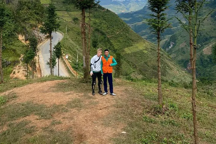
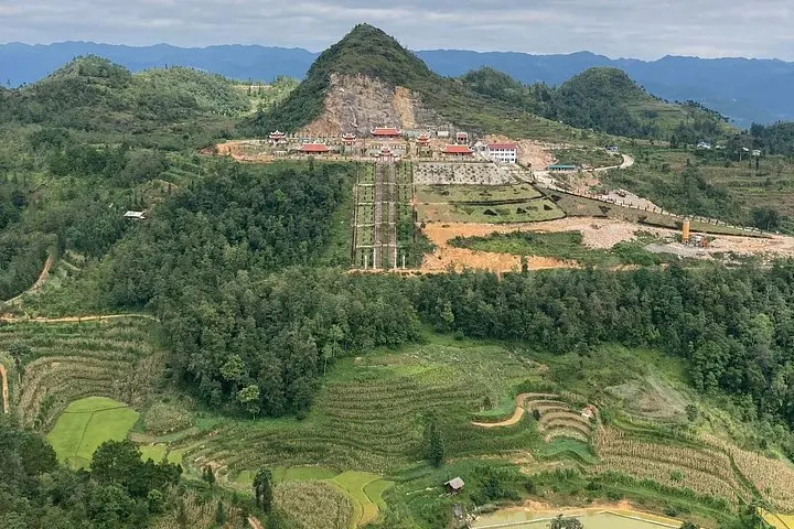
You kick away from Hanoi before dawn and the road narrows into a mountain ribbon; by afternoon rice terraces thread the valley walls and you’re threading switchbacks that crawl toward cloud. Wind cuts through open-face helmets, and the limestone ridges of the Dong Van Karst Plateau rise like cut stone against a cobalt sky.
You kick away from Hanoi before dawn and the road narrows into a mountain ribbon; by afternoon rice terraces thread the valley walls and you’re threading switchbacks that crawl toward cloud. Wind cuts through open-face helmets, and the limestone ridges of the Dong Van Karst Plateau rise like cut stone against a cobalt sky.
The Ha Giang Loop is as much geology as it is culture: part of the Dong Van Karst Plateau Geopark, this region is carved from Ordovician limestone folded into sharp ridgelines and deep canyons. Centuries of Hmong, Tay, Lo Lo and other ethnic groups have shaped villages here — your nights in family-run homestays put you at the heart of local foodways, house music and, sometimes, a strong corn wine toast.
Expect roughly 300–350 km of riding over four days, with daily legs of 80–150 km and passes that climb to about 1,400–1,700 m. Roads are mostly paved but include narrow, rough sections and tight switchbacks (Ma Pi Leng is the steep, scenic highlight). On day three you crest Lung Cu and peer toward the Chinese border; on day four a short boat on the Nho Que River takes you below Tu San Canyon.
Practical edge: fuel and cash are sparse outside Ha Giang city, weather changes quickly above 1,200 m, and mobile signal is intermittent. Ride conservatively on wet roads, carry layered clothing and a reliable helmet, and plan daylight riding—sunset on the passes drops temperatures fast. Respect homestay customs, keep noise low in villages, and pack out what you pack in; the landscape is fragile and still very much lived in.