THE ADVENTURE COLLECTIVE® · Independent discovery and booking for outdoor travel

Ride the Ha Giang Loop over four days to trace Northern Vietnam’s karst plateaus, marble passes and remote ethnic villages. Choose Easy Rider guides for local insight or self-ride if you have mountain experience.
Ride the Ha Giang Loop over four days to trace Northern Vietnam’s karst plateaus, marble passes and remote ethnic villages. Choose Easy Rider guides for local insight or self-ride if you have mountain experience.
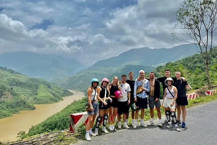
You wake before dawn in Ha Giang, engine hum a steady heartbeat as mist peels off limestone ridges. The road unspools: sharp hairpins, sheer drops and small villages that cling to terraces like stubborn ink on paper. Over four days you ride roughly 350–400 km of remote highway and gravel tracks, moving through Quan Ba’s twin peaks, the lunar moonscape of Dong Van, the dizzying Ma Pi Leng Pass and the northern flagpole at Lung Cu.
Verified experiences and guided adventures in the surrounding area.
Operated by Local Tours HALONG · Ha Giang, Ha Giang Province
You wake before dawn in Ha Giang, engine hum a steady heartbeat as mist peels off limestone ridges. The road unspools: sharp hairpins, sheer drops and small villages that cling to terraces like stubborn ink on paper. Over four days you ride roughly 350–400 km of remote highway and gravel tracks, moving through Quan Ba’s twin peaks, the lunar moonscape of Dong Van, the dizzying Ma Pi Leng Pass and the northern flagpole at Lung Cu.
This corner of Vietnam sits on the Dong Van Karst Plateau — an ancient limestone landscape carved into steep canyons and needle-like peaks. H'Mong and Tay communities shaped these highlands for centuries; you'll pass traditional stilt houses, weaving villages and the Vuong family mansion that hints at French and Chinese influences in stone and timber.
Expect mixed surfaces: sealed provincial roads, cracked asphalt, and patches of loose gravel. Ma Pi Leng’s cliffs dare you to look down at the Nho Que River cutting a deep green gorge. Cultural moments are frequent: market stalls selling woven cloth, homestays serving tay-style dinners and small altars on roadside shrines.
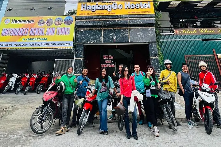
Practical edge: choose an Easy Rider guide if you want local knowledge and fewer logistics; self-riders should have solid mountain riding experience, a well-serviced 150–250cc bike, and spare inner tubes. Plan for early starts to avoid afternoon rain and limited daylight in winter. Hydrate, pack a breathable rain shell and respect local customs — slow down for livestock and village children. The loop is as much about patience and attention as it is about speed.
Vietnam requires a valid motorcycle license; many travelers rent locally and use an Easy Rider option to avoid licensing complications—check rental terms before booking.
Surfaces vary from good asphalt to cracked road and short gravel sections; Ma Pi Leng and some secondary routes are narrow with steep drops—experience recommended.
Rain increases slippery gravel and risk of landslides; if you ride in the wet season plan extra time, avoid steep unpaved descents and consider a guide.
Mostly family-run homestays and simple guesthouses; facilities are basic but welcoming—book ahead in peak season for Dong Van and Meo Vac.
Local Tours HALONG operates guided outdoor trips and adventures with an emphasis on safety, stewardship, and memorable experiences.


You wake before dawn in Ha Giang, engine hum a steady heartbeat as mist peels off limestone ridges. The road unspools: sharp hairpins, sheer drops and small villages that cling to terraces like stubborn ink on paper. Over four days you ride roughly 350–400 km of remote highway and gravel tracks, moving through Quan Ba’s twin peaks, the lunar moonscape of Dong Van, the dizzying Ma Pi Leng Pass and the northern flagpole at Lung Cu.
You wake before dawn in Ha Giang, engine hum a steady heartbeat as mist peels off limestone ridges. The road unspools: sharp hairpins, sheer drops and small villages that cling to terraces like stubborn ink on paper. Over four days you ride roughly 350–400 km of remote highway and gravel tracks, moving through Quan Ba’s twin peaks, the lunar moonscape of Dong Van, the dizzying Ma Pi Leng Pass and the northern flagpole at Lung Cu.
This corner of Vietnam sits on the Dong Van Karst Plateau — an ancient limestone landscape carved into steep canyons and needle-like peaks. H'Mong and Tay communities shaped these highlands for centuries; you'll pass traditional stilt houses, weaving villages and the Vuong family mansion that hints at French and Chinese influences in stone and timber.
Expect mixed surfaces: sealed provincial roads, cracked asphalt, and patches of loose gravel. Ma Pi Leng’s cliffs dare you to look down at the Nho Que River cutting a deep green gorge. Cultural moments are frequent: market stalls selling woven cloth, homestays serving tay-style dinners and small altars on roadside shrines.
Practical edge: choose an Easy Rider guide if you want local knowledge and fewer logistics; self-riders should have solid mountain riding experience, a well-serviced 150–250cc bike, and spare inner tubes. Plan for early starts to avoid afternoon rain and limited daylight in winter. Hydrate, pack a breathable rain shell and respect local customs — slow down for livestock and village children. The loop is as much about patience and attention as it is about speed.