THE ADVENTURE COLLECTIVE® · Independent discovery and booking for outdoor travel

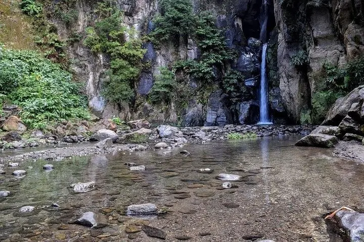
Drive narrow secondary roads to Pico da Barrosa and stand above Lagoa do Fogo’s crater lake. This half-day tour pairs dramatic rim views with a stop at Salto do Cabrito waterfall—ideal for visitors who want a compact, scenic introduction to São Miguel’s volcanic heart.
Drive narrow secondary roads to Pico da Barrosa and stand above Lagoa do Fogo’s crater lake. This half-day tour pairs dramatic rim views with a stop at Salto do Cabrito waterfall—ideal for visitors who want a compact, scenic introduction to São Miguel’s volcanic heart.
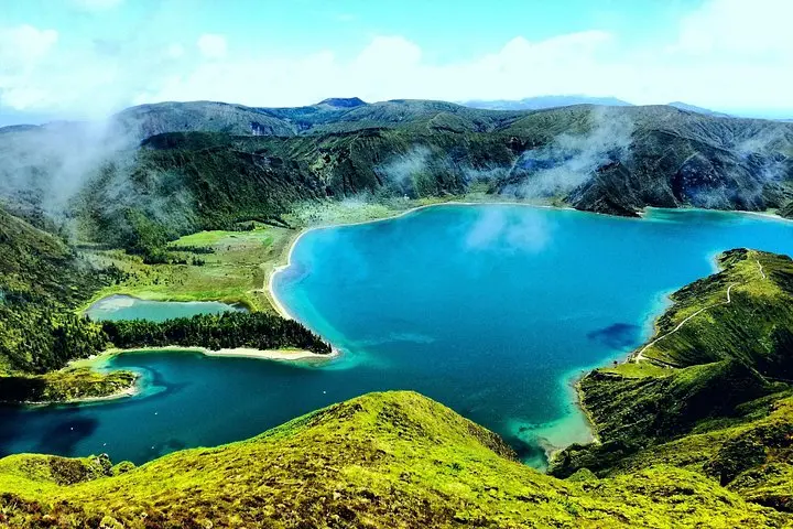
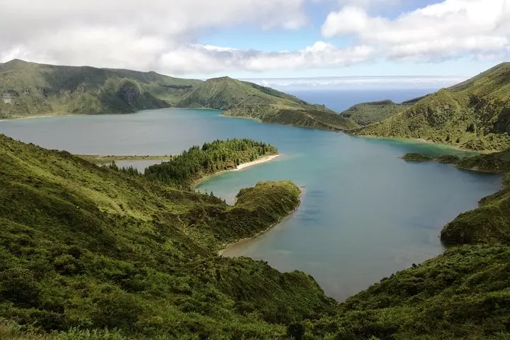
A wind-scoured ridge opens into the crater and the lake sits like a quiet eye below — this is Lagoa do Fogo from the top of Pico da Barrosa. The road climbs through patchworks of pasture and laurel forest, then narrows to secondary lanes where each bend reveals another coastal seam of São Miguel. From the 947-meter summit the island’s two coastlines can be seen at once: ocean on one side, the Fire Lake crater on the other.
Verified experiences and guided adventures in the surrounding area.
Operated by Greenzone, Animation Turistica Lda. · Ponta Delgada, Azores
A wind-scoured ridge opens into the crater and the lake sits like a quiet eye below — this is Lagoa do Fogo from the top of Pico da Barrosa. The road climbs through patchworks of pasture and laurel forest, then narrows to secondary lanes where each bend reveals another coastal seam of São Miguel. From the 947-meter summit the island’s two coastlines can be seen at once: ocean on one side, the Fire Lake crater on the other.
Geology here is recent and readable. Lagoa do Fogo is a volcanic caldera carved by explosive eruptions and later filled by rain and groundwater; cliffs expose layered ash and lava flows. Culturally the area reflects rural Azorean life — small farms, stone walls, and a history tied to volcanic soils and fishing down the coast. The site is part of the Reserva Natural da Lagoa do Fogo, protected for its endemic plants and breeding birds.
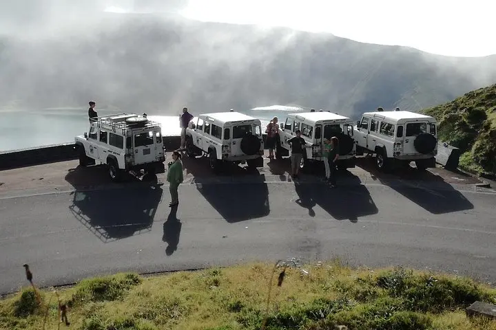
Practical guidance: the tour uses secondary roads to reach viewpoints and includes a short stop at Salto do Cabrito waterfall; expect brief walks from parking to overlooks rather than long hikes. Weather changes quickly at elevation: bring a windproof layer and waterproof shoes if you plan to explore the crater rim. Morning light is best for visibility and fewer clouds; afternoons often bring coastal mist. The guide provides context on access and local ecology, and the route is suitable for most fitness levels, though some paths are uneven. Stay on marked tracks, carry water, and keep camera gear ready — the crater rewards patience with wide, elemental views.
The tour runs about 3.5 hours (210 minutes) and includes driving between viewpoints with short stops for walks and photos.
No — walks from parking to viewpoints are brief but may be on uneven ground; suitable for most ages and fitness levels.
On clear days you can see both major coastlines of São Miguel from the 947m summit, though coastal mist can limit visibility.
No special permits are needed, but the area is protected; follow reserve rules and any guidance from the licensed tour guide.
Greenzone, Animation Turistica Lda. operates guided outdoor trips and adventures with an emphasis on safety, stewardship, and memorable experiences.
A wind-scoured ridge opens into the crater and the lake sits like a quiet eye below — this is Lagoa do Fogo from the top of Pico da Barrosa. The road climbs through patchworks of pasture and laurel forest, then narrows to secondary lanes where each bend reveals another coastal seam of São Miguel. From the 947-meter summit the island’s two coastlines can be seen at once: ocean on one side, the Fire Lake crater on the other.
A wind-scoured ridge opens into the crater and the lake sits like a quiet eye below — this is Lagoa do Fogo from the top of Pico da Barrosa. The road climbs through patchworks of pasture and laurel forest, then narrows to secondary lanes where each bend reveals another coastal seam of São Miguel. From the 947-meter summit the island’s two coastlines can be seen at once: ocean on one side, the Fire Lake crater on the other.
Geology here is recent and readable. Lagoa do Fogo is a volcanic caldera carved by explosive eruptions and later filled by rain and groundwater; cliffs expose layered ash and lava flows. Culturally the area reflects rural Azorean life — small farms, stone walls, and a history tied to volcanic soils and fishing down the coast. The site is part of the Reserva Natural da Lagoa do Fogo, protected for its endemic plants and breeding birds.
Practical guidance: the tour uses secondary roads to reach viewpoints and includes a short stop at Salto do Cabrito waterfall; expect brief walks from parking to overlooks rather than long hikes. Weather changes quickly at elevation: bring a windproof layer and waterproof shoes if you plan to explore the crater rim. Morning light is best for visibility and fewer clouds; afternoons often bring coastal mist. The guide provides context on access and local ecology, and the route is suitable for most fitness levels, though some paths are uneven. Stay on marked tracks, carry water, and keep camera gear ready — the crater rewards patience with wide, elemental views.