THE ADVENTURE COLLECTIVE® · Independent discovery and booking for outdoor travel

A 60-minute helicopter flight from Bentota puts Adam's Peak and Sri Lanka's central highlands within arm's reach—ideal for travelers who want dramatic aerial photos and a compact taste of the island's geology and culture. Read on for what to expect, when to go, and how to prepare.
A 60-minute helicopter flight from Bentota puts Adam's Peak and Sri Lanka's central highlands within arm's reach—ideal for travelers who want dramatic aerial photos and a compact taste of the island's geology and culture. Read on for what to expect, when to go, and how to prepare.
You lift off from Bentota beach and the coastline immediately shrinks beneath you: palms become perfect blades, the Bentota River snakes like a dark ribbon daring you to follow, and the Indian Ocean slides away in a sheet of blue.
Verified experiences and guided adventures in the surrounding area.
Operated by Lakpura LLC · Bentota, Southern Province
You lift off from Bentota beach and the coastline immediately shrinks beneath you: palms become perfect blades, the Bentota River snakes like a dark ribbon daring you to follow, and the Indian Ocean slides away in a sheet of blue.
Within minutes the island's lowlands give way to rising green—patchwork tea terraces, rainforest crowns and the pyramidal silhouette of Adam's Peak (Sri Pada) asserting itself above the clouds. From the air the peak’s steep flanks and the small plateau at the summit read clearly: a sacred landmark that draws pilgrims on foot but commands silence from the sky.
Geology here is rugged; Adam's Peak is a remnant of folded highlands rising to about 2,243 meters, carved by rainfall into steep ravines and waterfalls. Culturally the mountain is shared—Buddhists, Hindus, Muslims and Christians revere the summit footprint, giving the peak a layered history you can sense even from the air.
Practical guidance: the flight runs roughly 60 minutes and typically departs and lands near Bentota beach or a local school ground. Expect open-cabin noise, brief hover time for photography, and quick transfers to ground transport included in many packages. Visibility is best in the dry season (December–April); monsoon winds and low cloud can close flights.
Bring a good camera with a polarizer, a windproof jacket for landings, and plan for a short, flat walk to and from landing zones. If you want a longer shoreline view or a photo of the peak rising from mist, request a route that tracks inland over the central highlands—pilots can often adapt the flight path to weather and visibility.
The advertised flight time is about 60 minutes from takeoff to landing, with short hover or circling time near Adam's Peak for photos.
Most flights are scenic and may not land on the peak; this tour lands at Bentota beach or a designated ground site and provides ground transport to nearby historical spots.
Flights are often canceled for low cloud, strong winds or heavy rain; many operators allow a full refund if canceled at least 24 hours in advance—confirm the provider's policy when booking.
Infants can usually fly if secured in appropriate seats and accompanied by an adult; check with the operator about age or weight restrictions and availability of infant seating.
Lakpura LLC operates guided outdoor trips and adventures with an emphasis on safety, stewardship, and memorable experiences.
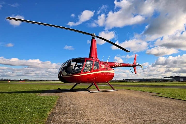


You lift off from Bentota beach and the coastline immediately shrinks beneath you: palms become perfect blades, the Bentota River snakes like a dark ribbon daring you to follow, and the Indian Ocean slides away in a sheet of blue.
You lift off from Bentota beach and the coastline immediately shrinks beneath you: palms become perfect blades, the Bentota River snakes like a dark ribbon daring you to follow, and the Indian Ocean slides away in a sheet of blue.
Within minutes the island's lowlands give way to rising green—patchwork tea terraces, rainforest crowns and the pyramidal silhouette of Adam's Peak (Sri Pada) asserting itself above the clouds. From the air the peak’s steep flanks and the small plateau at the summit read clearly: a sacred landmark that draws pilgrims on foot but commands silence from the sky.
Geology here is rugged; Adam's Peak is a remnant of folded highlands rising to about 2,243 meters, carved by rainfall into steep ravines and waterfalls. Culturally the mountain is shared—Buddhists, Hindus, Muslims and Christians revere the summit footprint, giving the peak a layered history you can sense even from the air.
Practical guidance: the flight runs roughly 60 minutes and typically departs and lands near Bentota beach or a local school ground. Expect open-cabin noise, brief hover time for photography, and quick transfers to ground transport included in many packages. Visibility is best in the dry season (December–April); monsoon winds and low cloud can close flights.
Bring a good camera with a polarizer, a windproof jacket for landings, and plan for a short, flat walk to and from landing zones. If you want a longer shoreline view or a photo of the peak rising from mist, request a route that tracks inland over the central highlands—pilots can often adapt the flight path to weather and visibility.