THE ADVENTURE COLLECTIVE® · Independent discovery and booking for outdoor travel

Drive Highway 49 with a GPS-guided audio companion that narrates Gold Rush stories, geology, and roadside stops between Angels Camp and Jamestown. Perfect for a half-day outing or a slow, discovery-filled day with planned stops.
Drive Highway 49 with a GPS-guided audio companion that narrates Gold Rush stories, geology, and roadside stops between Angels Camp and Jamestown. Perfect for a half-day outing or a slow, discovery-filled day with planned stops.
You pull onto Highway 49 as morning light slants through oak branches and the engine hum becomes a steady companion. The VoiceMap narrator begins, and the landscape unfurls: dry foothills give way to riparian green near the Stanislaus River, and small town storefronts — weathered wood and painted brick — appear like pages in a living history book.
Verified experiences and guided adventures in the surrounding area.
Operated by VoiceMap Audio Tours · Angels Camp, California
You pull onto Highway 49 as morning light slants through oak branches and the engine hum becomes a steady companion. The VoiceMap narrator begins, and the landscape unfurls: dry foothills give way to riparian green near the Stanislaus River, and small town storefronts — weathered wood and painted brick — appear like pages in a living history book.
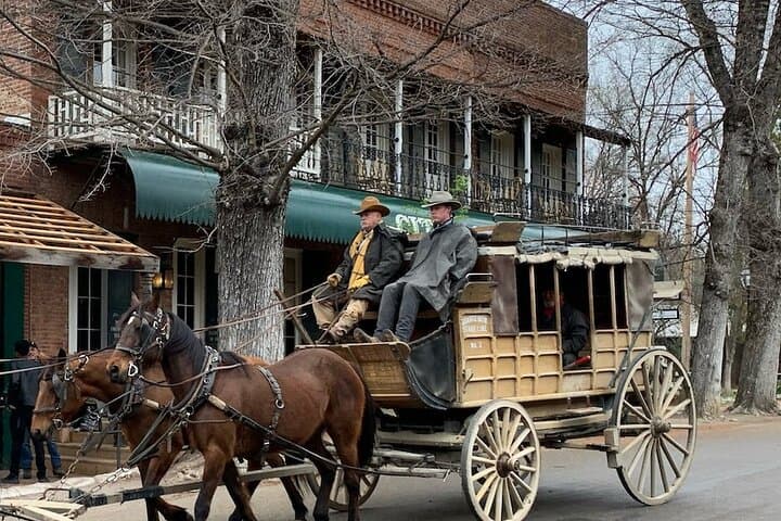
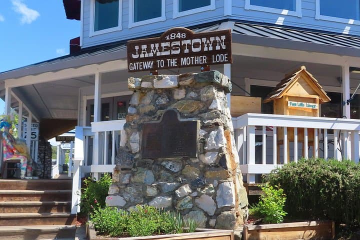
This stretch of California’s Gold Country is where 1849 prospectors chased quick fortunes and towns sprang up overnight. Geology here is honest: limestone caverns, serpentine outcrops, and the towering trunks of Sierra redwoods at Calaveras Big Trees State Park mark the region’s ancient processes. Cultural touchstones — Columbia State Historic Park’s preserved 19th-century main street, Sonora’s Gold Rush-era businesses, Jamestown’s Railtown 1897 — keep history tactile: stagecoaches, train roundhouses, and prospector stories narrated in the app.
Practically, this tour is a self-paced driving itinerary with GPS-triggered chapters; you can linger at Mercer and Moaning Caverns, walk the Natural Bridges Trail, or stop for coffee in Murphys. Download the VoiceMap file before you go, bring a charged phone and headphones, and allow 2.5–3 hours for the route—or a full day if you plan stops. Expect narrow county roads, occasional steep grades, and seasonal crowds on summer weekends. Fuel, parking, and cell coverage vary between towns; plan accordingly. The audio format turns the windshield into a guidebook, pairing on-road convenience with local storytelling so the landscape feels both immediate and storied as you move through it.
No—download the tour and its offline maps in the VoiceMap app before you leave; GPS playback works without a data connection.
You control the pace: the tour suggests stops but you can pause, rewind, or leave the route to explore sites and resume later.
No—entrance fees, guided-cavern tours, and parking costs at places like Mercer Caverns, Moaning Caverns, or Calaveras Big Trees are separate and paid on-site.
Driving and listening are fully accessible, but individual sites vary—check each attraction (e.g., Columbia State Historic Park vs. caverns) for accessibility details before you stop.
VoiceMap Audio Tours operates guided outdoor trips and adventures with an emphasis on safety, stewardship, and memorable experiences.
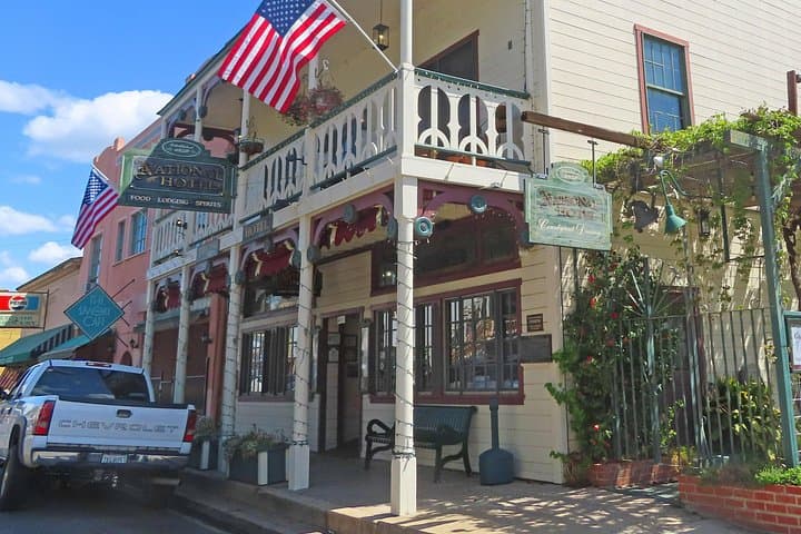
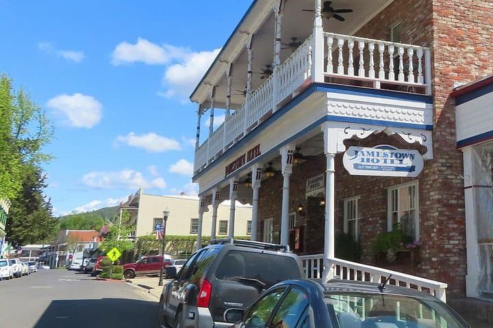
You pull onto Highway 49 as morning light slants through oak branches and the engine hum becomes a steady companion. The VoiceMap narrator begins, and the landscape unfurls: dry foothills give way to riparian green near the Stanislaus River, and small town storefronts — weathered wood and painted brick — appear like pages in a living history book.
You pull onto Highway 49 as morning light slants through oak branches and the engine hum becomes a steady companion. The VoiceMap narrator begins, and the landscape unfurls: dry foothills give way to riparian green near the Stanislaus River, and small town storefronts — weathered wood and painted brick — appear like pages in a living history book.
This stretch of California’s Gold Country is where 1849 prospectors chased quick fortunes and towns sprang up overnight. Geology here is honest: limestone caverns, serpentine outcrops, and the towering trunks of Sierra redwoods at Calaveras Big Trees State Park mark the region’s ancient processes. Cultural touchstones — Columbia State Historic Park’s preserved 19th-century main street, Sonora’s Gold Rush-era businesses, Jamestown’s Railtown 1897 — keep history tactile: stagecoaches, train roundhouses, and prospector stories narrated in the app.
Practically, this tour is a self-paced driving itinerary with GPS-triggered chapters; you can linger at Mercer and Moaning Caverns, walk the Natural Bridges Trail, or stop for coffee in Murphys. Download the VoiceMap file before you go, bring a charged phone and headphones, and allow 2.5–3 hours for the route—or a full day if you plan stops. Expect narrow county roads, occasional steep grades, and seasonal crowds on summer weekends. Fuel, parking, and cell coverage vary between towns; plan accordingly. The audio format turns the windshield into a guidebook, pairing on-road convenience with local storytelling so the landscape feels both immediate and storied as you move through it.