THE ADVENTURE COLLECTIVE® · Independent discovery and booking for outdoor travel

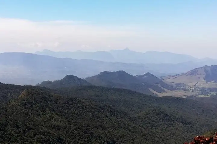
A demanding 7 km ascent from Horton Plains to Kirigalpoththa offers sweeping highland views, cloud forest, bogs and exposed scrambling. This guide covers what to expect on the trail and how to prepare for rapidly changing mountain conditions.
A demanding 7 km ascent from Horton Plains to Kirigalpoththa offers sweeping highland views, cloud forest, bogs and exposed scrambling. This guide covers what to expect on the trail and how to prepare for rapidly changing mountain conditions.
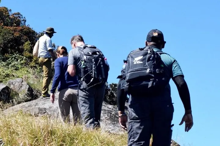
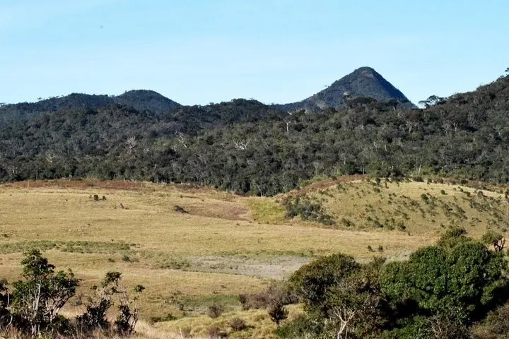
A cool wind sweeps across the grass plains as hikers gather at the park gate; cloud wisps roll low and the path to Kirigalpoththa narrows into an overgrown ribbon that climbs out of Horton Plains. The trail moves from wide, sun-exposed moorland into damp cloud forest, then across raised bog and finally onto steep, exposed rock where each step feels deliberate and earned.
Verified experiences and guided adventures in the surrounding area.
Operated by Travceylon Leisure · Nuwara Eliya, Central Province
A cool wind sweeps across the grass plains as hikers gather at the park gate; cloud wisps roll low and the path to Kirigalpoththa narrows into an overgrown ribbon that climbs out of Horton Plains. The trail moves from wide, sun-exposed moorland into damp cloud forest, then across raised bog and finally onto steep, exposed rock where each step feels deliberate and earned.
Horton Plains is an uplifted plateau carved by ancient rivers and later glaciation-like processes; its soils and heath-like vegetation support endemic plants and a pocket of montane cloud forest unique to Sri Lanka’s Central Highlands. The region has long been culturally important to local communities and now lies within a national park created to protect fragile highland ecosystems.
Expect changing geology underfoot: boggy boardwalks, grassy tussocks that hide ruts, and slabs of metamorphic rock on the upper slopes. Wildlife here is shy but present — sambar and the occasional leopard are part of the park’s story, while endemic birds add flashes of color to the canopy.
Practically, the route is a tough 7 km (one way) with significant scrambling and route-finding in places; weather shifts rapidly so layer for wind and rain. Guided groups typically plan for 5–7 hours round trip including time at the summit. Carry water, high-traction boots, navigation backup, and treat this as a mountaineering-style day — not a casual walk. Park permits and an experienced guide are strongly recommended; a backup vehicle is often on call for emergencies.
Yes — guides are recommended for safety, route-finding and park permit compliance; terrain can be treacherous and conditions change fast.
January–March is commonly recommended for clearer weather, though June–August can also be suitable; always check local forecasts.
Encounters with sambar or leopard are rare; keep noise, follow guide instructions and avoid hiking alone to minimize risk.
The 7 km one-way route involves steep sections, scrambling and exposed rock—it's suitable for experienced hikers in good fitness.
Travceylon Leisure operates guided outdoor trips and adventures with an emphasis on safety, stewardship, and memorable experiences.
A cool wind sweeps across the grass plains as hikers gather at the park gate; cloud wisps roll low and the path to Kirigalpoththa narrows into an overgrown ribbon that climbs out of Horton Plains. The trail moves from wide, sun-exposed moorland into damp cloud forest, then across raised bog and finally onto steep, exposed rock where each step feels deliberate and earned.
A cool wind sweeps across the grass plains as hikers gather at the park gate; cloud wisps roll low and the path to Kirigalpoththa narrows into an overgrown ribbon that climbs out of Horton Plains. The trail moves from wide, sun-exposed moorland into damp cloud forest, then across raised bog and finally onto steep, exposed rock where each step feels deliberate and earned.
Horton Plains is an uplifted plateau carved by ancient rivers and later glaciation-like processes; its soils and heath-like vegetation support endemic plants and a pocket of montane cloud forest unique to Sri Lanka’s Central Highlands. The region has long been culturally important to local communities and now lies within a national park created to protect fragile highland ecosystems.
Expect changing geology underfoot: boggy boardwalks, grassy tussocks that hide ruts, and slabs of metamorphic rock on the upper slopes. Wildlife here is shy but present — sambar and the occasional leopard are part of the park’s story, while endemic birds add flashes of color to the canopy.
Practically, the route is a tough 7 km (one way) with significant scrambling and route-finding in places; weather shifts rapidly so layer for wind and rain. Guided groups typically plan for 5–7 hours round trip including time at the summit. Carry water, high-traction boots, navigation backup, and treat this as a mountaineering-style day — not a casual walk. Park permits and an experienced guide are strongly recommended; a backup vehicle is often on call for emergencies.