THE ADVENTURE COLLECTIVE® · Independent discovery and booking for outdoor travel

Trek across solidified lava and stand near one of Guatemala’s most active volcanoes on a full-day tour from Puerto Quetzal. Expect rough basalt fields, wide Pacific views, and a guide-led introduction to the volcano’s geology and local significance.
Trek across solidified lava and stand near one of Guatemala’s most active volcanoes on a full-day tour from Puerto Quetzal. Expect rough basalt fields, wide Pacific views, and a guide-led introduction to the volcano’s geology and local significance.
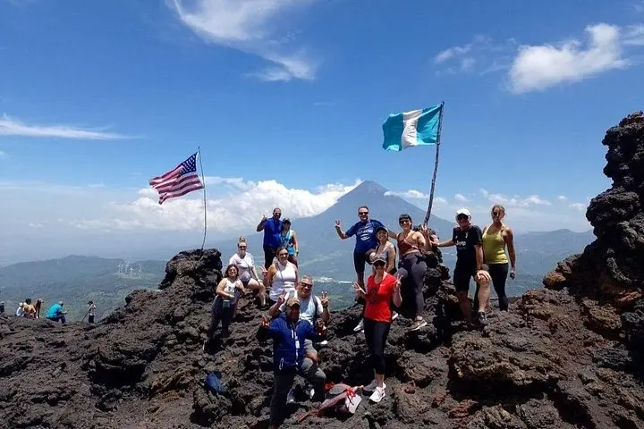
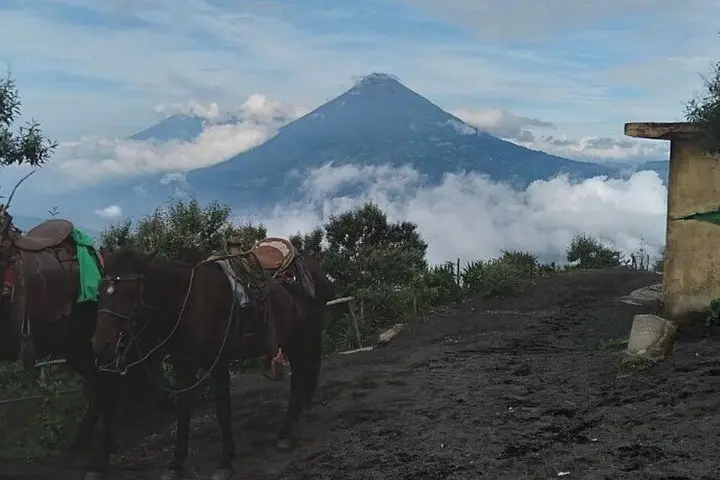
You step from the air-conditioned vehicle into a wind that smells faintly of sulfur and dust. Underfoot the ground is a mosaic of black, glassy lava and dusty soil; the volcano ahead breathes, a slow, persistent exhale that hints at fresh molten rock somewhere below. On a clear day the Pacific drops away to the southwest while Guatemala City and a string of volcanoes puncture the horizon.
Verified experiences and guided adventures in the surrounding area.
Operated by MB Guatemaya Travel · Puerto Quetzal, Escuintla
You step from the air-conditioned vehicle into a wind that smells faintly of sulfur and dust. Underfoot the ground is a mosaic of black, glassy lava and dusty soil; the volcano ahead breathes, a slow, persistent exhale that hints at fresh molten rock somewhere below. On a clear day the Pacific drops away to the southwest while Guatemala City and a string of volcanoes puncture the horizon.
Pacaya is one of Guatemala’s most active cones, its current shape carved by frequent flows since the 1960s, though the mountain has been part of local life for centuries. The trail crosses hardened lava fields, younger basaltic flows, and scrubby highland pasture—terrain that tells a geological story in every cracked seam. Guides from nearby coastal towns combine natural history with cultural context: how volcanic soils deepen local agriculture, and how eruption cycles shaped settlement patterns in the valley.
Expect a steady climb over uneven, rocky ground for roughly three hours of hiking (total tour time is longer with transit). Footing is firm but loose in places; the landscape is exposed, so sun and wind matter. You’ll pass steam vents and fields of clinker rock, and, if conditions permit, see fresh pahoehoe textures left from recent activity.
Practical edge: bring sturdy boots, layered clothes for wind and sun, and at least 2 liters of water. Morning departures avoid afternoon showers and give the clearest coastal views. Respect closed areas—volcanic terrain is dynamic and park rules prioritize safety and conservation.
The hiking section is about three hours round-trip over uneven volcanic terrain; the full tour including drives typically runs 4–7 hours.
The route is suitable for moderately fit beginners but not recommended for small children, people with serious heart or spinal conditions, or pregnant travelers.
Active lava visibility depends on current activity and park restrictions; you will likely walk over recent flows and see vents, but eruptions are unpredictable and access is controlled for safety.
Pacaya’s summit area sits around 2,500–2,700 meters elevation; temperatures are cooler than the coast, with strong sun and potential for wind or afternoon showers in the wet season.
MB Guatemaya Travel operates guided outdoor trips and adventures with an emphasis on safety, stewardship, and memorable experiences.
You step from the air-conditioned vehicle into a wind that smells faintly of sulfur and dust. Underfoot the ground is a mosaic of black, glassy lava and dusty soil; the volcano ahead breathes, a slow, persistent exhale that hints at fresh molten rock somewhere below. On a clear day the Pacific drops away to the southwest while Guatemala City and a string of volcanoes puncture the horizon.
You step from the air-conditioned vehicle into a wind that smells faintly of sulfur and dust. Underfoot the ground is a mosaic of black, glassy lava and dusty soil; the volcano ahead breathes, a slow, persistent exhale that hints at fresh molten rock somewhere below. On a clear day the Pacific drops away to the southwest while Guatemala City and a string of volcanoes puncture the horizon.
Pacaya is one of Guatemala’s most active cones, its current shape carved by frequent flows since the 1960s, though the mountain has been part of local life for centuries. The trail crosses hardened lava fields, younger basaltic flows, and scrubby highland pasture—terrain that tells a geological story in every cracked seam. Guides from nearby coastal towns combine natural history with cultural context: how volcanic soils deepen local agriculture, and how eruption cycles shaped settlement patterns in the valley.
Expect a steady climb over uneven, rocky ground for roughly three hours of hiking (total tour time is longer with transit). Footing is firm but loose in places; the landscape is exposed, so sun and wind matter. You’ll pass steam vents and fields of clinker rock, and, if conditions permit, see fresh pahoehoe textures left from recent activity.
Practical edge: bring sturdy boots, layered clothes for wind and sun, and at least 2 liters of water. Morning departures avoid afternoon showers and give the clearest coastal views. Respect closed areas—volcanic terrain is dynamic and park rules prioritize safety and conservation.