THE ADVENTURE COLLECTIVE® · Independent discovery and booking for outdoor travel

Walk from the Omalos plateau down through the narrow Iron Gates to Agia Roumeli on the Libyan Sea. This full-day adventure blends dramatic geology, rare wildlife sightings of kri-kri goats, and practical logistics—ferry timing is everything.
Walk from the Omalos plateau down through the narrow Iron Gates to Agia Roumeli on the Libyan Sea. This full-day adventure blends dramatic geology, rare wildlife sightings of kri-kri goats, and practical logistics—ferry timing is everything.
The morning air on the Omalos plateau is sharp; stone cottages blink awake and the road narrows toward Xyloskalo, the northern gate of Samaria Gorge. From the vehicle you step out at 1,250 m and the gorge immediately pulls you down—rock, fir groves, and the steady insistence of a dry riverbed daring you onward.
Verified experiences and guided adventures in the surrounding area.
Operated by NIKOS TOURS · Chania, Crete
The morning air on the Omalos plateau is sharp; stone cottages blink awake and the road narrows toward Xyloskalo, the northern gate of Samaria Gorge. From the vehicle you step out at 1,250 m and the gorge immediately pulls you down—rock, fir groves, and the steady insistence of a dry riverbed daring you onward.
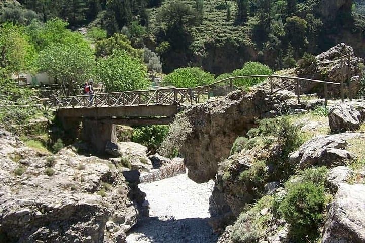
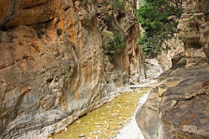
Samaria is one of Europe’s longest and most famous gorges, carved through limestone and schist over millennia. The trail drops roughly 1,250 m over 16–17 km to meet the Libyan Sea at Agia Roumeli. Along the way are human traces—Byzantine and Minoan-era routes, shepherd paths, and the narrow “Sideroportes” or Iron Gates where cliffs squeeze to just a few meters apart.
Culturally, the hike threads through Cretan village life: you’ll pass old chapels and stone shepherd shelters and might glimpse kri-kri goats on the cliff ledges, or griffon vultures circling overhead. Geology is on full display—steep, folded strata, talus slopes, and river-polished boulders that mark seasonal flow.
Practical planning is straightforward but firm: expect 5–7 hours of walking on uneven, rocky terrain. Start early—ferries from Agia Roumeli to Chora Sfakion run on a schedule and missing the last boat leaves you stranded. Wear stiff-soled hiking shoes, carry 2–3 liters of water, sun protection, and a light layer for wind on the plateau. There are tavernas and simple facilities at Agia Roumeli for a post-hike swim and meal.
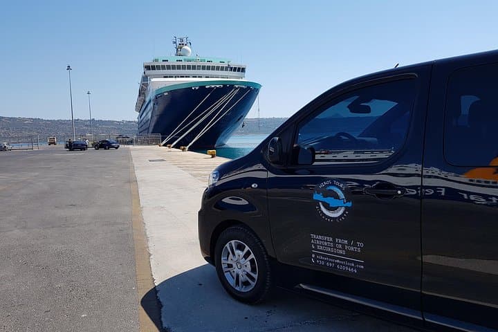
A private roundtrip transfer from Chania simplifies logistics—hotel pickup, an air-conditioned vehicle to Xyloskalo, and a return from Chora Sfakion after the ferry—letting you focus on the walk and the views that push and pull like tide and rock.
The trail runs about 16–17 km from Xyloskalo (Omalos) to Agia Roumeli; most hikers take 5–7 hours depending on pace and stops.
Ferries from Agia Roumeli to Chora Sfakion operate on a timetable; a private transfer itinerary typically times pickups to the ferry schedule, but check local timetables during planning.
Not ideal—uneven terrain and long downhill sections make it strenuous; travelers with spinal, heart, or pregnancy concerns should avoid the full gorge.
Basic snacks and water are available at the start and at Agia Roumeli. Carry sufficient water for the hike itself, especially in warm months.
NIKOS TOURS operates guided outdoor trips and adventures with an emphasis on safety, stewardship, and memorable experiences.

The morning air on the Omalos plateau is sharp; stone cottages blink awake and the road narrows toward Xyloskalo, the northern gate of Samaria Gorge. From the vehicle you step out at 1,250 m and the gorge immediately pulls you down—rock, fir groves, and the steady insistence of a dry riverbed daring you onward.
The morning air on the Omalos plateau is sharp; stone cottages blink awake and the road narrows toward Xyloskalo, the northern gate of Samaria Gorge. From the vehicle you step out at 1,250 m and the gorge immediately pulls you down—rock, fir groves, and the steady insistence of a dry riverbed daring you onward.
Samaria is one of Europe’s longest and most famous gorges, carved through limestone and schist over millennia. The trail drops roughly 1,250 m over 16–17 km to meet the Libyan Sea at Agia Roumeli. Along the way are human traces—Byzantine and Minoan-era routes, shepherd paths, and the narrow “Sideroportes” or Iron Gates where cliffs squeeze to just a few meters apart.
Culturally, the hike threads through Cretan village life: you’ll pass old chapels and stone shepherd shelters and might glimpse kri-kri goats on the cliff ledges, or griffon vultures circling overhead. Geology is on full display—steep, folded strata, talus slopes, and river-polished boulders that mark seasonal flow.
Practical planning is straightforward but firm: expect 5–7 hours of walking on uneven, rocky terrain. Start early—ferries from Agia Roumeli to Chora Sfakion run on a schedule and missing the last boat leaves you stranded. Wear stiff-soled hiking shoes, carry 2–3 liters of water, sun protection, and a light layer for wind on the plateau. There are tavernas and simple facilities at Agia Roumeli for a post-hike swim and meal.
A private roundtrip transfer from Chania simplifies logistics—hotel pickup, an air-conditioned vehicle to Xyloskalo, and a return from Chora Sfakion after the ferry—letting you focus on the walk and the views that push and pull like tide and rock.