THE ADVENTURE COLLECTIVE® · Independent discovery and booking for outdoor travel

Trace the bones of the Spoleto–Norcia railway along tunnels and river-cut gorge walls, finishing with panoramic views over Valnerina. This six-hour guided hike combines industrial history, limestone geology and clear, practical trail guidance.
Trace the bones of the Spoleto–Norcia railway along tunnels and river-cut gorge walls, finishing with panoramic views over Valnerina. This six-hour guided hike combines industrial history, limestone geology and clear, practical trail guidance.
You step off the trail where the old Spoleto–Norcia railway once threaded through stone, and the world narrows to rock, river and tunnel.
Verified experiences and guided adventures in the surrounding area.
Operated by crusoe.travel · Spoleto, Umbria
You step off the trail where the old Spoleto–Norcia railway once threaded through stone, and the world narrows to rock, river and tunnel.
For six hours the hike moves through shaded woodland, along an abandoned railbed and into the cool black of hand-cut tunnels where a flashlight becomes a small, human sun. Below, the Nera River has gnawed a deep gorge over millennia; its currents dare you to listen for the slow work of water and time. Higher up the path opens, offering broad views down the Valnerina and, on clear evenings, a straightforward line to a long Italian sunset.
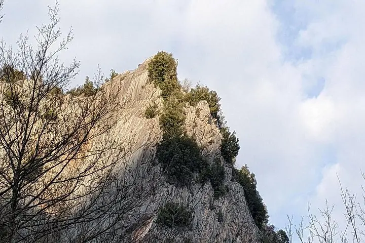
This corridor of Umbria carries layers of history: pre-Roman routes, nineteenth- and twentieth-century railway engineering, and the dismantling of the line in the 1970s that left a raw, industrial archaeology to explore. Geologically the gorge exposes river-cut limestone and schist; culturally, the route connects small towns shaped by river trade and mountain agriculture.
Practicals are simple and specific: expect roughly 10 km of walking with about 350–450 m of cumulative ascent over mixed packed-earth trail, gravel and occasional rocky steps. Several tunnels require light and steady footing; a guided pace keeps the group cohesive. Hydrate frequently, pack an energy-rich lunch and a spare layer for gusty ridge sections. If you aim for late-afternoon departures, allow extra time for low-light sections and watch the weather—heavy rain floods tunnels and forces cancellations. The route is a tactile lesson in how landscape, water and human ambition carve a region into routes worth walking.
Guided trips run about six hours covering roughly 10 km with 350–450 m of ascent—rated moderate and suited to walkers in reasonable shape.
Tunnels are safe with the guide but are unlit; bring a headlamp and wear sturdy footwear for uneven surfaces.
Children used to hikes and older adults in good health can participate, but those with spinal, heart or pregnancy restrictions should avoid it per operator guidance.
The operator cancels in heavy rain or unsafe tunnel conditions; check the 24‑hour cancellation policy for refunds.
crusoe.travel operates guided outdoor trips and adventures with an emphasis on safety, stewardship, and memorable experiences.
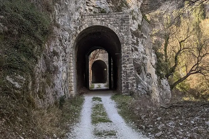
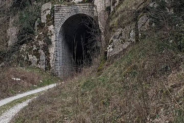
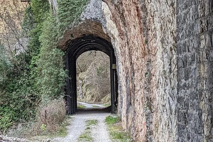
You step off the trail where the old Spoleto–Norcia railway once threaded through stone, and the world narrows to rock, river and tunnel.
You step off the trail where the old Spoleto–Norcia railway once threaded through stone, and the world narrows to rock, river and tunnel.
For six hours the hike moves through shaded woodland, along an abandoned railbed and into the cool black of hand-cut tunnels where a flashlight becomes a small, human sun. Below, the Nera River has gnawed a deep gorge over millennia; its currents dare you to listen for the slow work of water and time. Higher up the path opens, offering broad views down the Valnerina and, on clear evenings, a straightforward line to a long Italian sunset.
This corridor of Umbria carries layers of history: pre-Roman routes, nineteenth- and twentieth-century railway engineering, and the dismantling of the line in the 1970s that left a raw, industrial archaeology to explore. Geologically the gorge exposes river-cut limestone and schist; culturally, the route connects small towns shaped by river trade and mountain agriculture.
Practicals are simple and specific: expect roughly 10 km of walking with about 350–450 m of cumulative ascent over mixed packed-earth trail, gravel and occasional rocky steps. Several tunnels require light and steady footing; a guided pace keeps the group cohesive. Hydrate frequently, pack an energy-rich lunch and a spare layer for gusty ridge sections. If you aim for late-afternoon departures, allow extra time for low-light sections and watch the weather—heavy rain floods tunnels and forces cancellations. The route is a tactile lesson in how landscape, water and human ambition carve a region into routes worth walking.