THE ADVENTURE COLLECTIVE® · Independent discovery and booking for outdoor travel

Walk between Butrint Lake and the Ionian on a 3‑hour small‑group tour that pairs a 12th‑century monastery visit with a look at communist‑era bunkers. Expect coastal views, mixed terrain and stops for local history and photography.
Walk between Butrint Lake and the Ionian on a 3‑hour small‑group tour that pairs a 12th‑century monastery visit with a look at communist‑era bunkers. Expect coastal views, mixed terrain and stops for local history and photography.
You step off the minivan onto a narrow track that runs between a brackish lagoon and the open Ionian, wind tugging at the reeds and the silhouette of Corfu sitting like a distant promise on the horizon.
Verified experiences and guided adventures in the surrounding area.
Operated by South Albania Escurs · Sarandë, Vlorë
You step off the minivan onto a narrow track that runs between a brackish lagoon and the open Ionian, wind tugging at the reeds and the silhouette of Corfu sitting like a distant promise on the horizon.
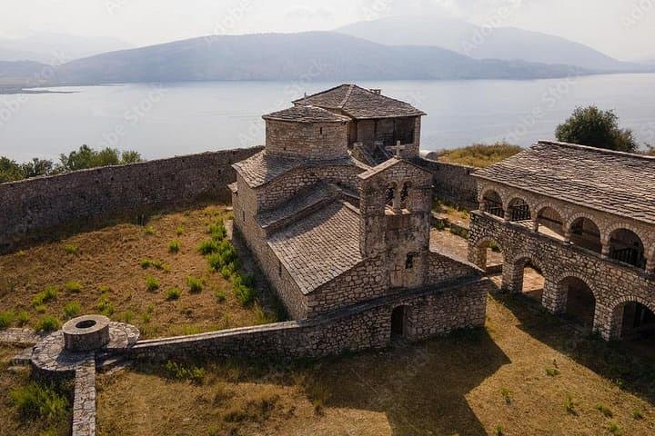
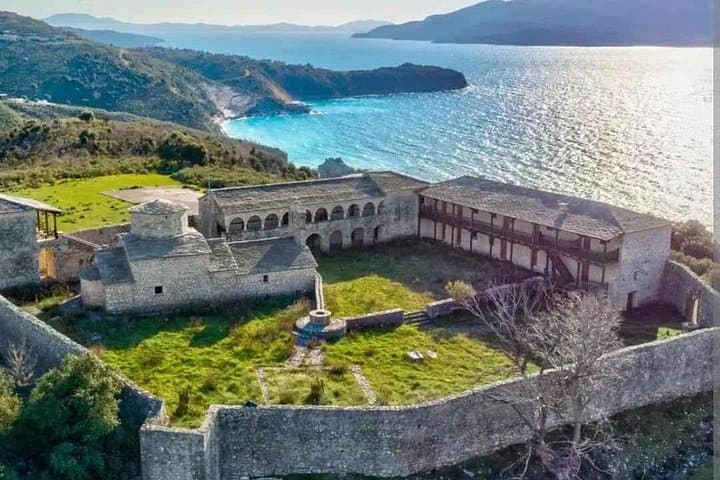
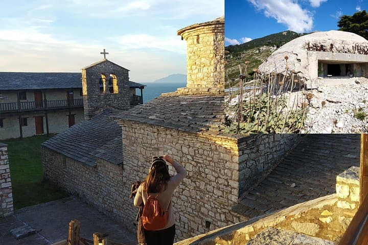
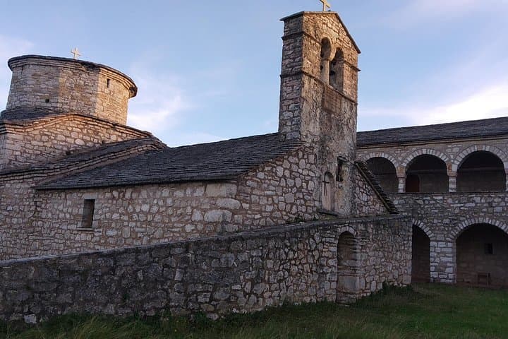
The path winds past low limestone outcrops toward St. George Monastery, a site with medieval stonework and carved inscriptions that speak to the 12th century church’s long watch over Butrint’s southern shore. Geologically, the route follows coastal terrace and coastal marsh—soft dirt, limestone pavers and the occasional stone stair—offering sweeping views of Butrint Lake one way and the Ionic blue the other. Later sections lead to concrete relics from the Hoxha era: anti-aircraft emplacements and bunkers baked pale in the sun, their instruction stenciling still readable inside.
Culturally the day layers eras: ancient Butrint’s classical past, Byzantine monastic life, Venetian trade routes, and 20th‑century isolationism. Locals now repurpose bunkers for storage or shelter; guides point out graffiti, hand-lettered operational notes, and the marks of reuse.
Expect around 3 hours on this small-group walk with frequent stops for photos and interpretation—roughly 4–6 km of mostly easy walking on uneven surfaces, short inclines and simple stairs. Bring sturdy shoes, sun protection, and 1–1.5 L of water; a light rain layer helps in shoulder seasons. Photography is excellent from the ridgeline overlooking the lake at sunset. Respect park signage, stay to the paths around archaeological zones, and allow the guide to explain fragile features—this route rewards quiet attention as much as curiosity.
Yes—private transportation is listed in the inclusions; confirm your pickup point when booking.
Entrance to the monastery is included as part of the activity, and the guide handles group logistics.
Tours run in small groups—minimum 4 travelers, maximum 10—so booking early helps secure your spot.
The route is rated easy but has uneven surfaces and short stair sections; it’s suitable for most children but not recommended for travelers with serious cardiovascular issues or pregnancy.
South Albania Escurs operates guided outdoor trips and adventures with an emphasis on safety, stewardship, and memorable experiences.
You step off the minivan onto a narrow track that runs between a brackish lagoon and the open Ionian, wind tugging at the reeds and the silhouette of Corfu sitting like a distant promise on the horizon.
You step off the minivan onto a narrow track that runs between a brackish lagoon and the open Ionian, wind tugging at the reeds and the silhouette of Corfu sitting like a distant promise on the horizon.
The path winds past low limestone outcrops toward St. George Monastery, a site with medieval stonework and carved inscriptions that speak to the 12th century church’s long watch over Butrint’s southern shore. Geologically, the route follows coastal terrace and coastal marsh—soft dirt, limestone pavers and the occasional stone stair—offering sweeping views of Butrint Lake one way and the Ionic blue the other. Later sections lead to concrete relics from the Hoxha era: anti-aircraft emplacements and bunkers baked pale in the sun, their instruction stenciling still readable inside.
Culturally the day layers eras: ancient Butrint’s classical past, Byzantine monastic life, Venetian trade routes, and 20th‑century isolationism. Locals now repurpose bunkers for storage or shelter; guides point out graffiti, hand-lettered operational notes, and the marks of reuse.
Expect around 3 hours on this small-group walk with frequent stops for photos and interpretation—roughly 4–6 km of mostly easy walking on uneven surfaces, short inclines and simple stairs. Bring sturdy shoes, sun protection, and 1–1.5 L of water; a light rain layer helps in shoulder seasons. Photography is excellent from the ridgeline overlooking the lake at sunset. Respect park signage, stay to the paths around archaeological zones, and allow the guide to explain fragile features—this route rewards quiet attention as much as curiosity.