THE ADVENTURE COLLECTIVE® · Independent discovery and booking for outdoor travel

Walk a 13 km route through limestone walls, clear blue-green water and small waterfalls to reach Danilo’s Bridge and the Gate of Wish. This 5–6 hour guided hike from Međuriječje mixes geology, local history and accessible scrambling.
Walk a 13 km route through limestone walls, clear blue-green water and small waterfalls to reach Danilo’s Bridge and the Gate of Wish. This 5–6 hour guided hike from Međuriječje mixes geology, local history and accessible scrambling.
A narrow ribbon of river carves between high limestone walls as you step into Mrtvica Canyon—light slants through knife-edged cliffs, water gurgles and draws you deeper. The trail follows the river, sometimes tight against rock, sometimes opening to pebbled “stone beaches” where the current slows and the colors turn sharp blue-green.
Verified experiences and guided adventures in the surrounding area.
Operated by Monte Mare Travel · Međuriječje, Kolašin Municipality
A narrow ribbon of river carves between high limestone walls as you step into Mrtvica Canyon—light slants through knife-edged cliffs, water gurgles and draws you deeper. The trail follows the river, sometimes tight against rock, sometimes opening to pebbled “stone beaches” where the current slows and the colors turn sharp blue-green.
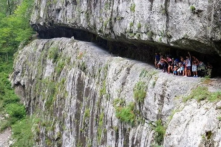
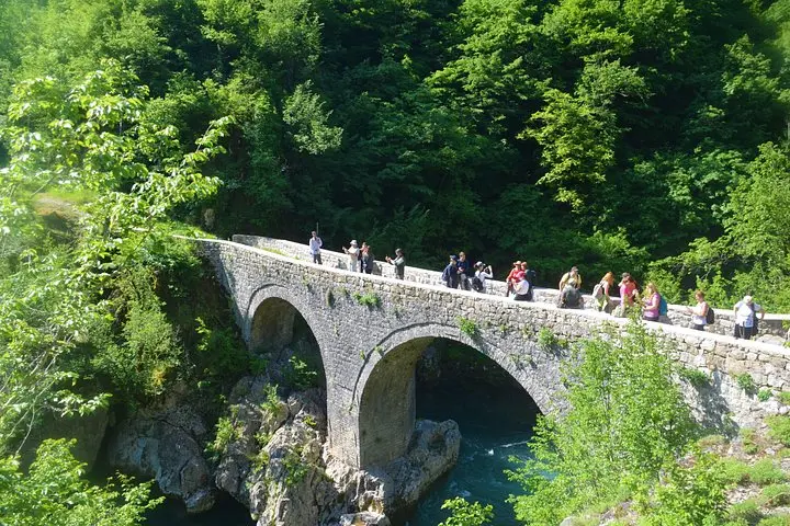
This canyon sits beneath the Maganik range and has been shaped over millennia by springs and rapids flowing into the Morača. Human history threads the route: Prince Danilo’s 1858 stone bridge marks the entrance, while a 20th-century army-cut passage called Danilo’s Road links long-separated villages. Local lore gathers at the Gate of Wish, a rock arch where villagers once exchanged promises.
Geologically, expect steep karst walls, narrow gorges and pockets of dense riparian vegetation—maple, hornbeam and shrubs that anchor soil above sheer drops. The canyon’s waterfalls, notably the White Nerini, punctuate the hike with spray and echo.
Practical guidance: the full track is about 13 km with a maximum altitude near 586 m; plan 5–6 hours including transfers. Terrain ranges from firm path to rocky, uneven sections—good traction is essential. Water and snacks are a must; mobile signal is intermittent. Spring–autumn is the normal season; high water after heavy rain makes some squeezes hazardous. Guides usually provide pickup from nearby towns and manage route choices based on flow.
Expect moderate exertion, rewarding close-up river scenery and cultural markers that give the canyon its personality—both wild and human-shaped.
The route is about 13 km round-trip with a maximum altitude around 586 m; guide companies estimate 5–6 hours including transfers.
Families with older children in good walking shape can manage parts of the trail, but some narrow, rocky sections make it unsuitable for very young children or those with limited mobility.
Independent hiking is possible, but guides are recommended for navigation, local knowledge and safety when river flow or weather are variable.
April–November is typical; late spring and early autumn balance lower flows and pleasant temperatures—avoid peak flood periods and heavy winter snowmelt.
Monte Mare Travel operates guided outdoor trips and adventures with an emphasis on safety, stewardship, and memorable experiences.
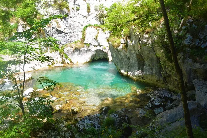
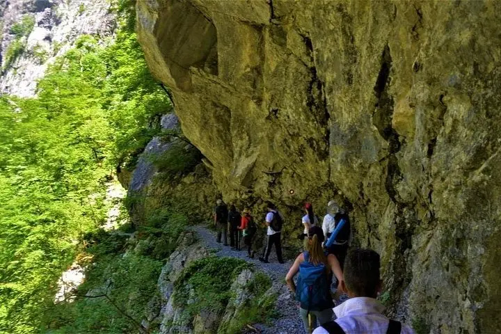
A narrow ribbon of river carves between high limestone walls as you step into Mrtvica Canyon—light slants through knife-edged cliffs, water gurgles and draws you deeper. The trail follows the river, sometimes tight against rock, sometimes opening to pebbled “stone beaches” where the current slows and the colors turn sharp blue-green.
A narrow ribbon of river carves between high limestone walls as you step into Mrtvica Canyon—light slants through knife-edged cliffs, water gurgles and draws you deeper. The trail follows the river, sometimes tight against rock, sometimes opening to pebbled “stone beaches” where the current slows and the colors turn sharp blue-green.
This canyon sits beneath the Maganik range and has been shaped over millennia by springs and rapids flowing into the Morača. Human history threads the route: Prince Danilo’s 1858 stone bridge marks the entrance, while a 20th-century army-cut passage called Danilo’s Road links long-separated villages. Local lore gathers at the Gate of Wish, a rock arch where villagers once exchanged promises.
Geologically, expect steep karst walls, narrow gorges and pockets of dense riparian vegetation—maple, hornbeam and shrubs that anchor soil above sheer drops. The canyon’s waterfalls, notably the White Nerini, punctuate the hike with spray and echo.
Practical guidance: the full track is about 13 km with a maximum altitude near 586 m; plan 5–6 hours including transfers. Terrain ranges from firm path to rocky, uneven sections—good traction is essential. Water and snacks are a must; mobile signal is intermittent. Spring–autumn is the normal season; high water after heavy rain makes some squeezes hazardous. Guides usually provide pickup from nearby towns and manage route choices based on flow.
Expect moderate exertion, rewarding close-up river scenery and cultural markers that give the canyon its personality—both wild and human-shaped.