THE ADVENTURE COLLECTIVE® · Independent discovery and booking for outdoor travel

A six-hour join-in tour from Stavanger takes you through the Ryfast tunnel to the trailhead, then up a 3.8 km climb to Preikestolen’s 604-meter cliff edge. Expect rocky terrain, sweeping fjord views, and practical, weather-ready hiking.
A six-hour join-in tour from Stavanger takes you through the Ryfast tunnel to the trailhead, then up a 3.8 km climb to Preikestolen’s 604-meter cliff edge. Expect rocky terrain, sweeping fjord views, and practical, weather-ready hiking.
The minivan eases out of Stavanger before dawn, the driver steering a quiet procession through the Ryfast undersea tunnel while the fjord outside still sleeps. By the time the road gives way to rock and scrub, the air tastes like seawater and alpine moss; the trailhead squats common and uncompromising, a promise and a challenge. Hikers step off the bus with layered jackets, cameras, and the same small, taut eagerness—the sort that comes before a good climb.
Verified experiences and guided adventures in the surrounding area.
Operated by Uopera tours · Stavanger, Rogaland
The minivan eases out of Stavanger before dawn, the driver steering a quiet procession through the Ryfast undersea tunnel while the fjord outside still sleeps. By the time the road gives way to rock and scrub, the air tastes like seawater and alpine moss; the trailhead squats common and uncompromising, a promise and a challenge. Hikers step off the bus with layered jackets, cameras, and the same small, taut eagerness—the sort that comes before a good climb.
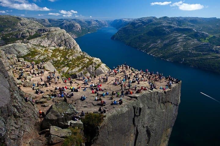
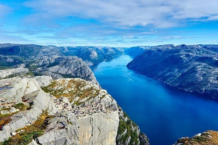
Preikestolen (Pulpit Rock) perches 604 meters above Lysefjorden, a raw slab of cliff carved by glaciers and ocean over millennia. The fjord below, narrow and deep, dares you to measure its depth by the light that bounces off it. The route itself is straightforward but honest: roughly 3.8 km each way (about 7.6 km roundtrip) with ~350 meters of elevation gain, a mix of root-and-rock steps, mossy slabs, and exposed viewpoints that keep the senses keyed.
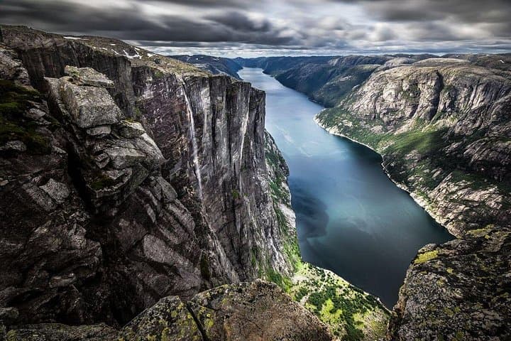
History and geology are stitched into each ledge. Lysefjord is the result of ice-age carving; the plateau that becomes the pulpit was scoured free, leaving a clean, almost architectural cliff face. Local farms once clung to higher terraces; today, their stacked stone walls and sparse summer cabins are reminders of a human rhythm in a place that otherwise feels dominated by the elements.
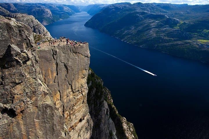
Wildlife is discrete: sea eagles wheel over the fjord and seals sometimes bob in the water, but the trail is primarily the domain of hikers and the weather. In summer, boats thread the fjord like slow pens, offering water-level perspectives of the same walls you’re climbing to observe from above.
Practical guidance: expect 2 hours uphill and around 1.5–2 hours back down if you keep a steady pace; guides factor breaks for photos and views into a typical six-hour tour (including transfer time from Stavanger). Terrain is uneven—firm-ankled hikers in good cardio shape will manage comfortably. Bring a waterproof layer, stout hiking shoes with grip, 1.5–2 liters of water, and snacks. Start early on clear days to avoid crowds at the pulpit edge; wind can be strong on the plateau, so keep a close eye on children and packs near the drop.
Logistics are simple on a join-in tour: hotel or port pickup in Stavanger, a short drive through Ryfast Tunnel, guided ascent, time on the cliff, and return. The route is well-marked but can be slick after rain; treat the hike with respect and give yourself extra time for photos and quiet moments. Standing on the Pulpit Rock, the fjord stretches thin and relentless below—an elemental place that rewards straightforward preparation with an unforgettable angle on Norway’s geology and light.
The trail is about 3.8 km each way (7.6 km roundtrip) with roughly 350 m elevation gain; most groups take 4 hours for the hiking portion.
Children in good hiking condition can do it, but watch younger kids near the cliff edge and account for extra stops and slower pace.
You can hike independently—the trail is well-marked—but the join-in tour includes transfers and a guide which simplifies logistics from Stavanger.
Trails become slippery in heavy rain; tours may still run but bring waterproof gear and consider postponing if winds are extreme or visibility is near zero.
Basic facilities are available at the main trailhead; there are no maintained restrooms along the ascent.
Swimming is possible from sheltered spots but the water is cold year-round—assess currents and use caution if you plan to enter the fjord.
Uopera tours operates guided outdoor trips and adventures with an emphasis on safety, stewardship, and memorable experiences.
The minivan eases out of Stavanger before dawn, the driver steering a quiet procession through the Ryfast undersea tunnel while the fjord outside still sleeps. By the time the road gives way to rock and scrub, the air tastes like seawater and alpine moss; the trailhead squats common and uncompromising, a promise and a challenge. Hikers step off the bus with layered jackets, cameras, and the same small, taut eagerness—the sort that comes before a good climb.
The minivan eases out of Stavanger before dawn, the driver steering a quiet procession through the Ryfast undersea tunnel while the fjord outside still sleeps. By the time the road gives way to rock and scrub, the air tastes like seawater and alpine moss; the trailhead squats common and uncompromising, a promise and a challenge. Hikers step off the bus with layered jackets, cameras, and the same small, taut eagerness—the sort that comes before a good climb.
Preikestolen (Pulpit Rock) perches 604 meters above Lysefjorden, a raw slab of cliff carved by glaciers and ocean over millennia. The fjord below, narrow and deep, dares you to measure its depth by the light that bounces off it. The route itself is straightforward but honest: roughly 3.8 km each way (about 7.6 km roundtrip) with ~350 meters of elevation gain, a mix of root-and-rock steps, mossy slabs, and exposed viewpoints that keep the senses keyed.
History and geology are stitched into each ledge. Lysefjord is the result of ice-age carving; the plateau that becomes the pulpit was scoured free, leaving a clean, almost architectural cliff face. Local farms once clung to higher terraces; today, their stacked stone walls and sparse summer cabins are reminders of a human rhythm in a place that otherwise feels dominated by the elements.
Wildlife is discrete: sea eagles wheel over the fjord and seals sometimes bob in the water, but the trail is primarily the domain of hikers and the weather. In summer, boats thread the fjord like slow pens, offering water-level perspectives of the same walls you’re climbing to observe from above.
Practical guidance: expect 2 hours uphill and around 1.5–2 hours back down if you keep a steady pace; guides factor breaks for photos and views into a typical six-hour tour (including transfer time from Stavanger). Terrain is uneven—firm-ankled hikers in good cardio shape will manage comfortably. Bring a waterproof layer, stout hiking shoes with grip, 1.5–2 liters of water, and snacks. Start early on clear days to avoid crowds at the pulpit edge; wind can be strong on the plateau, so keep a close eye on children and packs near the drop.
Logistics are simple on a join-in tour: hotel or port pickup in Stavanger, a short drive through Ryfast Tunnel, guided ascent, time on the cliff, and return. The route is well-marked but can be slick after rain; treat the hike with respect and give yourself extra time for photos and quiet moments. Standing on the Pulpit Rock, the fjord stretches thin and relentless below—an elemental place that rewards straightforward preparation with an unforgettable angle on Norway’s geology and light.