THE ADVENTURE COLLECTIVE® · Independent discovery and booking for outdoor travel

A brisk, scenic hike across volcanic ridges and cultivated slopes, Serra Malagueta offers compact panoramas of Santiago Island and an accessible taste of Cape Verde’s upland ecology. This guided 2–3 hour walk is best for hikers with moderate fitness who want dramatic views without technical climbing.
A brisk, scenic hike across volcanic ridges and cultivated slopes, Serra Malagueta offers compact panoramas of Santiago Island and an accessible taste of Cape Verde’s upland ecology. This guided 2–3 hour walk is best for hikers with moderate fitness who want dramatic views without technical climbing.
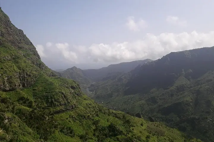
You step onto a narrow path at roughly 800 meters above sea level and the island exhales around you — wind pushing through scrub and tall grasses, a ridge line daring you toward a high, layered horizon. The trail climbs through patches of cultivated terraces and stands of endemic plants; every turn opens to new panoramas of Santiago’s north coast and the pale villages dotting the slopes.
Verified experiences and guided adventures in the surrounding area.
Operated by DIAS TOUR Lda · Assomada, Santiago
You step onto a narrow path at roughly 800 meters above sea level and the island exhales around you — wind pushing through scrub and tall grasses, a ridge line daring you toward a high, layered horizon. The trail climbs through patches of cultivated terraces and stands of endemic plants; every turn opens to new panoramas of Santiago’s north coast and the pale villages dotting the slopes.
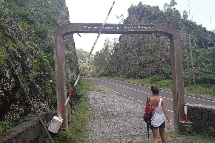
Serra Malagueta is a government-protected natural park on Santiago Island formed by ancient volcanics and sculpted by erosion into ridges and gullies. The soils are volcanic, supporting plantations and pockets of native flora that thrive during the wetter months (roughly August–December). Local communities historically used these slopes for subsistence agriculture; today the park balances conservation with low-impact recreation.
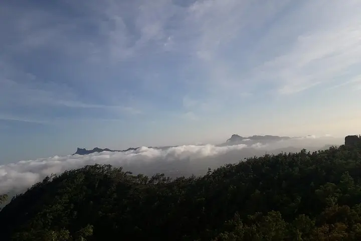
Expect a compact, exposed ridge hike of moderate intensity: roughly 4–6 km round-trip with an elevation change in the order of 200–400 m depending on route, rocky single-track, and occasional steep pitches. The route passes viewpoints where the island’s second-highest rises in the distance and where the ocean frames lowland settlements.
Practical notes: start early for cooler temperatures and clearer views, carry at least 1–2 liters of water, wear sturdy hiking shoes for loose volcanic scree, and bring sun protection — shade is limited. Snacks are often provided on guided walks. The trail suits hikers with moderate fitness; those with back or heart problems should avoid strenuous sections. Leave no trace and respect grazing areas and marked paths for the park’s ongoing protection.
Guided walks typically last 2–3 hours, covering approximately 4–6 km round-trip with modest elevation gain; it’s rated moderate and requires steady walking on uneven terrain.
Snacks are commonly provided on guided tours, but potable water is not guaranteed — bring your own supply.
Beginners with a reasonable level of fitness can join, but people with back or heart conditions are advised not to attempt steeper sections.
Service animals are permitted according to the tour information, but pets beyond service animals should be confirmed with the operator.
DIAS TOUR Lda operates guided outdoor trips and adventures with an emphasis on safety, stewardship, and memorable experiences.
You step onto a narrow path at roughly 800 meters above sea level and the island exhales around you — wind pushing through scrub and tall grasses, a ridge line daring you toward a high, layered horizon. The trail climbs through patches of cultivated terraces and stands of endemic plants; every turn opens to new panoramas of Santiago’s north coast and the pale villages dotting the slopes.
You step onto a narrow path at roughly 800 meters above sea level and the island exhales around you — wind pushing through scrub and tall grasses, a ridge line daring you toward a high, layered horizon. The trail climbs through patches of cultivated terraces and stands of endemic plants; every turn opens to new panoramas of Santiago’s north coast and the pale villages dotting the slopes.
Serra Malagueta is a government-protected natural park on Santiago Island formed by ancient volcanics and sculpted by erosion into ridges and gullies. The soils are volcanic, supporting plantations and pockets of native flora that thrive during the wetter months (roughly August–December). Local communities historically used these slopes for subsistence agriculture; today the park balances conservation with low-impact recreation.
Expect a compact, exposed ridge hike of moderate intensity: roughly 4–6 km round-trip with an elevation change in the order of 200–400 m depending on route, rocky single-track, and occasional steep pitches. The route passes viewpoints where the island’s second-highest rises in the distance and where the ocean frames lowland settlements.
Practical notes: start early for cooler temperatures and clearer views, carry at least 1–2 liters of water, wear sturdy hiking shoes for loose volcanic scree, and bring sun protection — shade is limited. Snacks are often provided on guided walks. The trail suits hikers with moderate fitness; those with back or heart problems should avoid strenuous sections. Leave no trace and respect grazing areas and marked paths for the park’s ongoing protection.