THE ADVENTURE COLLECTIVE® · Independent discovery and booking for outdoor travel

Set out from Ísafjörður by boat to Hesteyri and follow a 12 km, 300 m-elevation hike across Hornstrandir’s raw fjord coastline. This full-day guided route combines abandoned settlements, seabird colonies and stark volcanic cliffs with a reliable boat pickup at Aðalvík.
Set out from Ísafjörður by boat to Hesteyri and follow a 12 km, 300 m-elevation hike across Hornstrandir’s raw fjord coastline. This full-day guided route combines abandoned settlements, seabird colonies and stark volcanic cliffs with a reliable boat pickup at Aðalvík.
A low, steady hum of the outboard and a pale Arctic light set the tone as you leave Ísafjörður behind. The boat cuts between fjord walls, and by mid-morning you step ashore at Hesteyri — wind on your face, seabirds daring you to follow the shoreline. Abandoned turf houses and rusting fishhooks mark the traces of a once-inhabited coast; beyond them the route climbs and dips over tussock and scree toward Sæból in Aðalvík.
Verified experiences and guided adventures in the surrounding area.
Operated by Sjóferðir · Ísafjörður, Westfjords
A low, steady hum of the outboard and a pale Arctic light set the tone as you leave Ísafjörður behind. The boat cuts between fjord walls, and by mid-morning you step ashore at Hesteyri — wind on your face, seabirds daring you to follow the shoreline. Abandoned turf houses and rusting fishhooks mark the traces of a once-inhabited coast; beyond them the route climbs and dips over tussock and scree toward Sæból in Aðalvík.
Hornstrandir’s landscape is shaped by glacial sculpting and basalt cliffs that drop into fjords. Human presence here retreated in the mid-20th century; farms and fishing outposts were abandoned and the area was protected in 1974, allowing arctic foxes, nesting seabirds and hardy Arctic flora to recover.
Culturally the ruins tell a plain story: small-scale subsistence living carved out of wind, sea and stone. Geologically you’ll notice layers of volcanic rock weathered by wind and ice; small creeks run cold and clear, fed by melt and mountain springs.
Practically: expect roughly 12 km of rough, uneven terrain and about 300 m of cumulative elevation gain on a full-day itinerary. The route demands steady footing, good stamina and waterproof, grippy boots. There are no services on trail — pack lunch, extra layers and a reliable rain shell. Guides run the boat to Hesteyri in the morning and collect you at Aðalvík in the afternoon, so timing is fixed.
Leave no trace: carry out all waste and respect nesting birds. With proper planning this is a singular day hike — raw, exposed and unforgettable in a way only high-latitude wilderness can be.
The guided route covers about 12 km of rough terrain with roughly 300 meters of cumulative elevation gain; the full outing is a full-day (8–10 hours) including boat transfers.
No — there are no services, snack stands or running water sources you should rely on; bring all food, water and any personal supplies you need for the day.
The hike is best for those in moderate to good physical condition; beginners with no trail experience may find the uneven terrain and distance challenging.
You may observe arctic foxes, seals and nesting seabirds at a distance; do not feed or approach wildlife and follow guide instructions to minimize disturbance.
Sjóferðir operates guided outdoor trips and adventures with an emphasis on safety, stewardship, and memorable experiences.

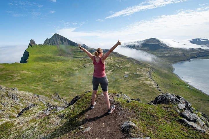

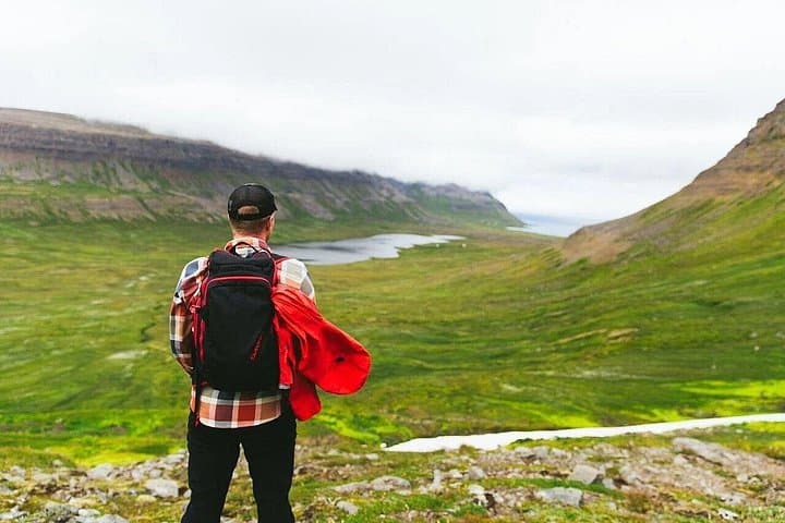
A low, steady hum of the outboard and a pale Arctic light set the tone as you leave Ísafjörður behind. The boat cuts between fjord walls, and by mid-morning you step ashore at Hesteyri — wind on your face, seabirds daring you to follow the shoreline. Abandoned turf houses and rusting fishhooks mark the traces of a once-inhabited coast; beyond them the route climbs and dips over tussock and scree toward Sæból in Aðalvík.
A low, steady hum of the outboard and a pale Arctic light set the tone as you leave Ísafjörður behind. The boat cuts between fjord walls, and by mid-morning you step ashore at Hesteyri — wind on your face, seabirds daring you to follow the shoreline. Abandoned turf houses and rusting fishhooks mark the traces of a once-inhabited coast; beyond them the route climbs and dips over tussock and scree toward Sæból in Aðalvík.
Hornstrandir’s landscape is shaped by glacial sculpting and basalt cliffs that drop into fjords. Human presence here retreated in the mid-20th century; farms and fishing outposts were abandoned and the area was protected in 1974, allowing arctic foxes, nesting seabirds and hardy Arctic flora to recover.
Culturally the ruins tell a plain story: small-scale subsistence living carved out of wind, sea and stone. Geologically you’ll notice layers of volcanic rock weathered by wind and ice; small creeks run cold and clear, fed by melt and mountain springs.
Practically: expect roughly 12 km of rough, uneven terrain and about 300 m of cumulative elevation gain on a full-day itinerary. The route demands steady footing, good stamina and waterproof, grippy boots. There are no services on trail — pack lunch, extra layers and a reliable rain shell. Guides run the boat to Hesteyri in the morning and collect you at Aðalvík in the afternoon, so timing is fixed.
Leave no trace: carry out all waste and respect nesting birds. With proper planning this is a singular day hike — raw, exposed and unforgettable in a way only high-latitude wilderness can be.