THE ADVENTURE COLLECTIVE® · Independent discovery and booking for outdoor travel

A full-day, 14 km hike from Ella across Horton Plains’ wind-swept plateau to the dramatic drop at World’s End. Early starts, layered clothing, and steady fitness reward hikers with sweeping views before the mists roll in.
A full-day, 14 km hike from Ella across Horton Plains’ wind-swept plateau to the dramatic drop at World’s End. Early starts, layered clothing, and steady fitness reward hikers with sweeping views before the mists roll in.
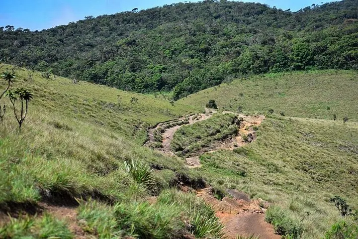
Mist sits low across the plateau as your minibus rumbles up from Ella and the air sharpens—cooler, thinner, wind-proud. Stepping onto the trail, grass blades push back like an audience; the path follows Non Pareil Road past a tea estate, through pockets of cloud-touched forest, and out onto open moorland where the wind seems to be testing every jacket.
Verified experiences and guided adventures in the surrounding area.
Operated by Lakpura LLC · Ella, Uva Province
Mist sits low across the plateau as your minibus rumbles up from Ella and the air sharpens—cooler, thinner, wind-proud. Stepping onto the trail, grass blades push back like an audience; the path follows Non Pareil Road past a tea estate, through pockets of cloud-touched forest, and out onto open moorland where the wind seems to be testing every jacket.
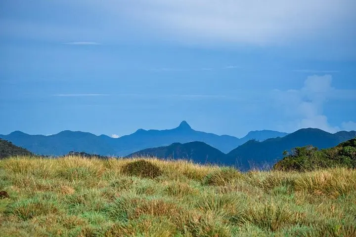
Horton Plains is a high-altitude plateau shaped by ancient uplift and erosion at roughly 2,100–2,300 m. The landscape alternates between grassland, stunted cloud forest, and exposed rock. Cultural threads run through the area: the park sits near colonial-era tea estates and routes long used by local communities. The most famous viewpoint is World’s End, a sheer escarpment with a drop of about 1,200 m (4,000 ft) that rewards early walkers with broad vistas before clouds arrive.
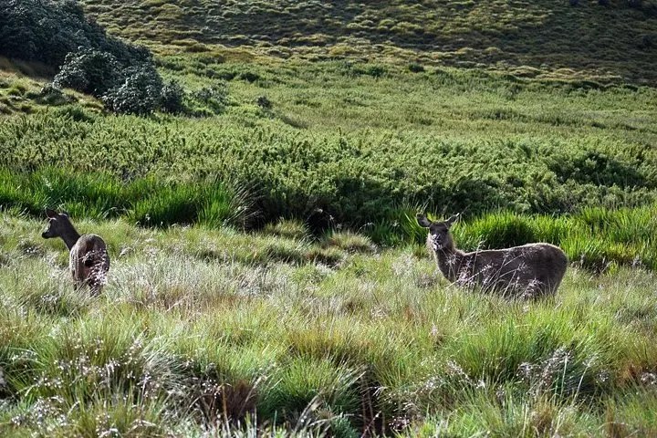
Expect a 14 km loop that takes most groups a full day (the organized tour runs about nine hours from Ella). Terrain is mixed—well-worn dirt track, boardwalks in boggier sections, and rocky outsides near the cliffs. Wildlife is subtle: sambar deer and purple-faced langurs prefer dawn and dusk, and bird calls punctuate the high grass.
Practical guidance: start very early to beat the mist at World’s End, carry 2–3 liters of water, pack windproof layers and a light rain shell, and use sturdy, grippy footwear for wet rock. The park is exposed and chilly; sunscreen and a hat still matter. Trails are clear but uneven—moderate fitness and steady footing will make the day more enjoyable.
The guided route is about 14 km and typically takes 8–9 hours round trip; it’s rated moderate—expect steady walking with some uneven and exposed sections.
Park entry and conservation fees are managed at the park entrance; if you’re on an organized tour the operator usually handles entry arrangements.
Clearer mornings are most common in the dry months (roughly December to April), but weather is changeable—early starts improve visibility year-round.
Large mammals are uncommon; sambar deer, elk-like mammals, and endemic birds such as the Sri Lanka whistling thrush or purple-faced langur are most likely sightings.
Lakpura LLC operates guided outdoor trips and adventures with an emphasis on safety, stewardship, and memorable experiences.

Mist sits low across the plateau as your minibus rumbles up from Ella and the air sharpens—cooler, thinner, wind-proud. Stepping onto the trail, grass blades push back like an audience; the path follows Non Pareil Road past a tea estate, through pockets of cloud-touched forest, and out onto open moorland where the wind seems to be testing every jacket.
Mist sits low across the plateau as your minibus rumbles up from Ella and the air sharpens—cooler, thinner, wind-proud. Stepping onto the trail, grass blades push back like an audience; the path follows Non Pareil Road past a tea estate, through pockets of cloud-touched forest, and out onto open moorland where the wind seems to be testing every jacket.
Horton Plains is a high-altitude plateau shaped by ancient uplift and erosion at roughly 2,100–2,300 m. The landscape alternates between grassland, stunted cloud forest, and exposed rock. Cultural threads run through the area: the park sits near colonial-era tea estates and routes long used by local communities. The most famous viewpoint is World’s End, a sheer escarpment with a drop of about 1,200 m (4,000 ft) that rewards early walkers with broad vistas before clouds arrive.
Expect a 14 km loop that takes most groups a full day (the organized tour runs about nine hours from Ella). Terrain is mixed—well-worn dirt track, boardwalks in boggier sections, and rocky outsides near the cliffs. Wildlife is subtle: sambar deer and purple-faced langurs prefer dawn and dusk, and bird calls punctuate the high grass.
Practical guidance: start very early to beat the mist at World’s End, carry 2–3 liters of water, pack windproof layers and a light rain shell, and use sturdy, grippy footwear for wet rock. The park is exposed and chilly; sunscreen and a hat still matter. Trails are clear but uneven—moderate fitness and steady footing will make the day more enjoyable.