THE ADVENTURE COLLECTIVE® · Independent discovery and booking for outdoor travel

Rise before the mist for an exposed plateau hike to World's End, where a sheer 1,200m cliff drops into the lowlands. This guided day hike from Nuwara Eliya covers montane grasslands, waterfalls, and endemic wildlife in about five hours.
Rise before the mist for an exposed plateau hike to World's End, where a sheer 1,200m cliff drops into the lowlands. This guided day hike from Nuwara Eliya covers montane grasslands, waterfalls, and endemic wildlife in about five hours.
Dawn arrives on the plateau as a cool wind sweeps the grass into low, silver waves and mist slithers through the stunted forest. You round a rocky outcrop and the trail drops toward World's End — a sheer cliff that stares straight down roughly 1,200 meters — while curious sambar pick their way through the grass below.
Verified experiences and guided adventures in the surrounding area.
Operated by Lakpura LLC · Nuwara Eliya, Central Province
Dawn arrives on the plateau as a cool wind sweeps the grass into low, silver waves and mist slithers through the stunted forest. You round a rocky outcrop and the trail drops toward World's End — a sheer cliff that stares straight down roughly 1,200 meters — while curious sambar pick their way through the grass below.
Horton Plains sits on Sri Lanka’s Central Highlands, a high-elevation moorland cut into rolling plateaus by ancient uplift and persistent erosion. The British recognized the area's unique climate during the colonial tea boom, but protection came later: Horton Plains was designated a national park to preserve its rare montane grasslands and endemic species. Local communities still read the land by weather and water; streams here feed the island’s major rivers.
On the trail you’ll pass filigree waterfalls, boggy boardwalks and rocky heath, with a surprising variety of birds and endemic plants that thrive at 2,000+ meters. The route is exposed at times — wind will push at you and clouds can arrive quickly — so timing matters.
Plan for an early start to catch clear views and wildlife activity. Wear waterproof layers and sturdy boots for muddy sections and boardwalks. Bring at least 1–2 liters of water, a light pack, and binoculars for birding. Stay on marked paths to protect fragile peat soils, and expect a steady 5-hour outing that’s more about altitude and steady footing than technical climbing.
The guided itinerary runs about 5 hours total; on-trail distance is roughly 6–9 km over mostly gentle but uneven terrain at high altitude—moderate difficulty.
Yes—park entrance fees apply and are usually handled by your tour provider; independent visitors should buy tickets at the park office.
Large mammals are rare; sambar deer and endemic bird species are more commonly seen. Sightings of predators are uncommon during day hikes.
Guides are not always mandatory but many visitors use local guides; organized tours typically include an English-speaking guide and park pickup.
Lakpura LLC operates guided outdoor trips and adventures with an emphasis on safety, stewardship, and memorable experiences.
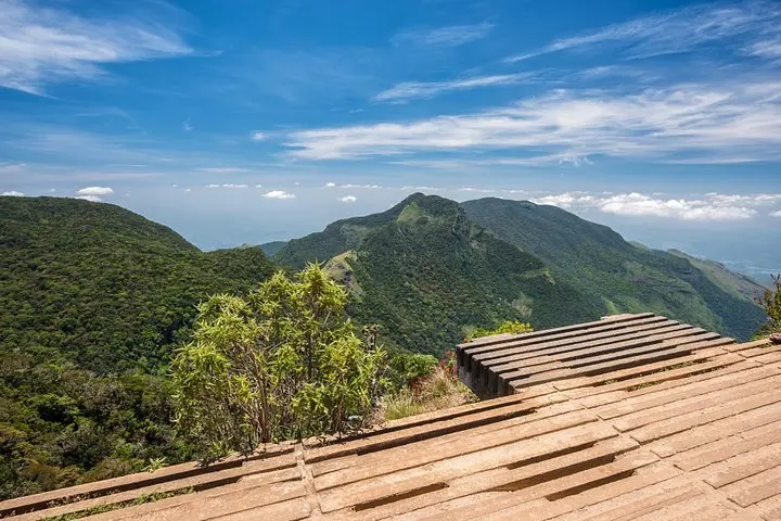
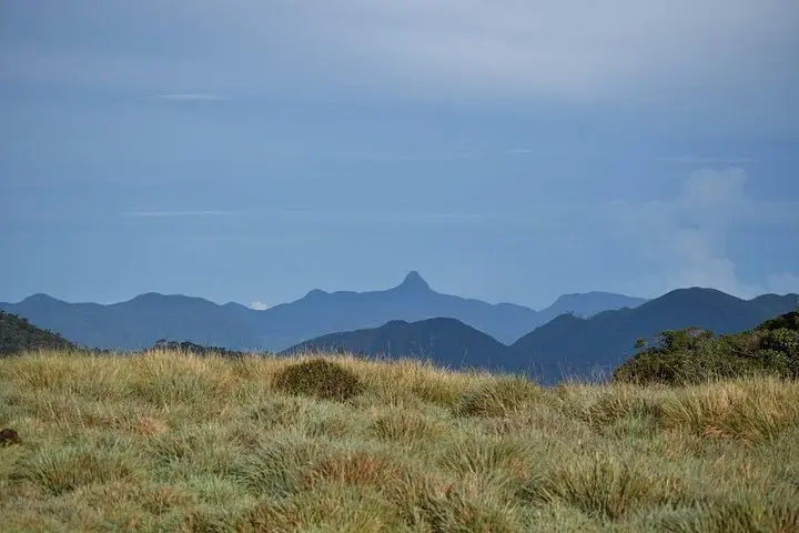
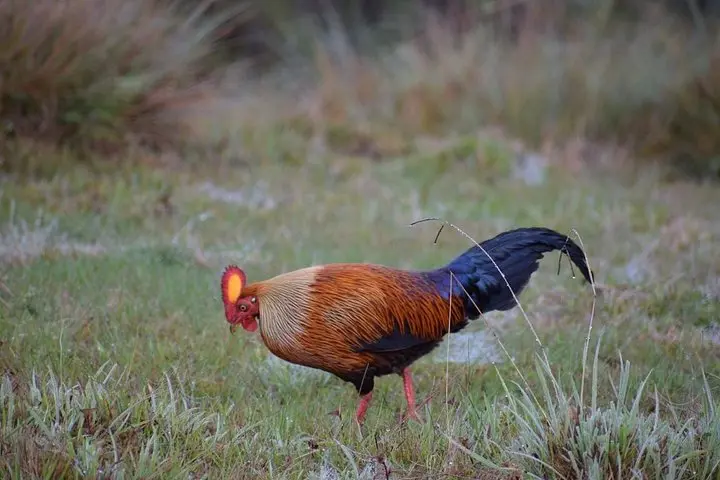
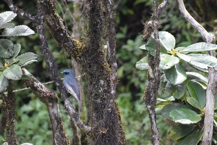
Dawn arrives on the plateau as a cool wind sweeps the grass into low, silver waves and mist slithers through the stunted forest. You round a rocky outcrop and the trail drops toward World's End — a sheer cliff that stares straight down roughly 1,200 meters — while curious sambar pick their way through the grass below.
Dawn arrives on the plateau as a cool wind sweeps the grass into low, silver waves and mist slithers through the stunted forest. You round a rocky outcrop and the trail drops toward World's End — a sheer cliff that stares straight down roughly 1,200 meters — while curious sambar pick their way through the grass below.
Horton Plains sits on Sri Lanka’s Central Highlands, a high-elevation moorland cut into rolling plateaus by ancient uplift and persistent erosion. The British recognized the area's unique climate during the colonial tea boom, but protection came later: Horton Plains was designated a national park to preserve its rare montane grasslands and endemic species. Local communities still read the land by weather and water; streams here feed the island’s major rivers.
On the trail you’ll pass filigree waterfalls, boggy boardwalks and rocky heath, with a surprising variety of birds and endemic plants that thrive at 2,000+ meters. The route is exposed at times — wind will push at you and clouds can arrive quickly — so timing matters.
Plan for an early start to catch clear views and wildlife activity. Wear waterproof layers and sturdy boots for muddy sections and boardwalks. Bring at least 1–2 liters of water, a light pack, and binoculars for birding. Stay on marked paths to protect fragile peat soils, and expect a steady 5-hour outing that’s more about altitude and steady footing than technical climbing.