THE ADVENTURE COLLECTIVE® · Independent discovery and booking for outdoor travel

A manageable day-hike from Podgorica that climbs to 1,834 m for a border-side viewpoint over Cijevna canyon and the Albanian Prokletije. Expect 10 km of varied terrain, occasional wild horses and a post-hike chance to eat at an ethno restaurant.
A manageable day-hike from Podgorica that climbs to 1,834 m for a border-side viewpoint over Cijevna canyon and the Albanian Prokletije. Expect 10 km of varied terrain, occasional wild horses and a post-hike chance to eat at an ethno restaurant.
You step out of the air-conditioned transfer into thin mountain air at Kučka Korita, laces already damp from the morning chill. A steady path threads through pasture and low beech, then pitches higher toward Hum Orahovski’s summit at 1,834 m. The wind here seems to push you forward; ahead, the ridge narrows toward Grlo Sokolovo where the border with Albania cuts a hard line through the landscape.
Verified experiences and guided adventures in the surrounding area.
Operated by Monte Mare Travel · Podgorica, Podgorica Municipality
You step out of the air-conditioned transfer into thin mountain air at Kučka Korita, laces already damp from the morning chill. A steady path threads through pasture and low beech, then pitches higher toward Hum Orahovski’s summit at 1,834 m. The wind here seems to push you forward; ahead, the ridge narrows toward Grlo Sokolovo where the border with Albania cuts a hard line through the landscape.
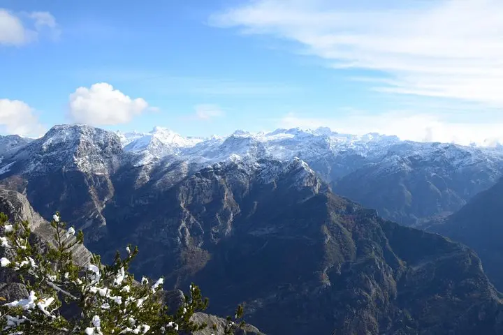
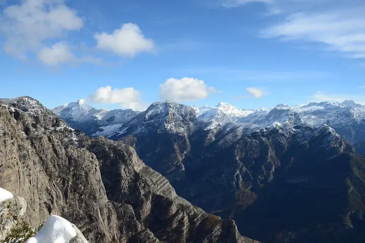
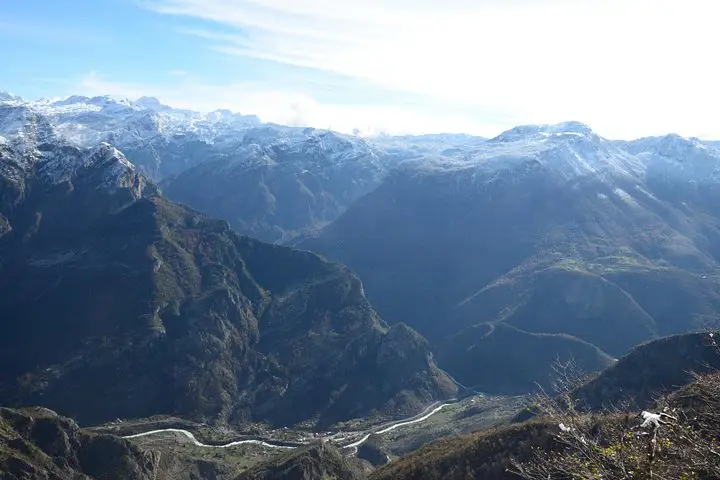
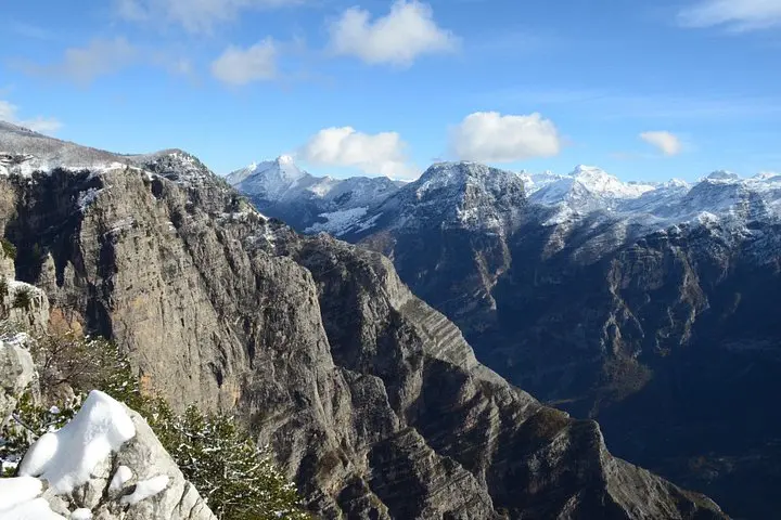
This stretch of Kuči country carries the imprint of highland shepherding — stone pens, switchback tracks and small ethno-restaurants that keep local recipes alive. Geologically, the slope drains into the Cijevna (Cem) canyon; carbonate rock and glacially-sculpted bowls shape sudden drops and sharp viewpoints. In clear weather the Albanian village of Tamare and the jagged teeth of the Prokletije become a raw, close panorama.
The outing is straightforward: roughly 10 km round trip, with an ascent to 1,834 m and several hundred meters of elevation gain depending on your start. Trails vary from packed dirt to rocky switchbacks; the route is graded easy and suited to most fitness levels, but expect exposed sections and variable footing.
Practically: allow about six hours including transfers, carry 2–3 liters of water, layered clothing, and sturdy footwear; trekking poles help on steeper descents. Wild horses are occasionally seen grazing on the slopes; photographers should bring a tele lens.
Optional: many operators offer an after-hike lunch at a nearby ethno restaurant—ideal for sampling local cheeses and mountain lamb while watching clouds roll into the canyon.
The route is about 10 km round trip with an ascent to 1,834 m; operators grade it easy and it’s suitable for most ages and fitness levels, though there are rocky sections and several hundred meters of climb.
Most bookings include transfer time—expect a total tour duration of about six hours plus transfer depending on your accommodation; confirm pickup details when you book.
Wild horses are known in the area and birdlife like raptors are common; sightings aren’t guaranteed but encounters are possible, especially in quieter seasons.
Yes—many operators can arrange an optional lunch at a nearby ethno restaurant featuring local dishes such as mountain cheeses and lamb.
Monte Mare Travel operates guided outdoor trips and adventures with an emphasis on safety, stewardship, and memorable experiences.
You step out of the air-conditioned transfer into thin mountain air at Kučka Korita, laces already damp from the morning chill. A steady path threads through pasture and low beech, then pitches higher toward Hum Orahovski’s summit at 1,834 m. The wind here seems to push you forward; ahead, the ridge narrows toward Grlo Sokolovo where the border with Albania cuts a hard line through the landscape.
You step out of the air-conditioned transfer into thin mountain air at Kučka Korita, laces already damp from the morning chill. A steady path threads through pasture and low beech, then pitches higher toward Hum Orahovski’s summit at 1,834 m. The wind here seems to push you forward; ahead, the ridge narrows toward Grlo Sokolovo where the border with Albania cuts a hard line through the landscape.
This stretch of Kuči country carries the imprint of highland shepherding — stone pens, switchback tracks and small ethno-restaurants that keep local recipes alive. Geologically, the slope drains into the Cijevna (Cem) canyon; carbonate rock and glacially-sculpted bowls shape sudden drops and sharp viewpoints. In clear weather the Albanian village of Tamare and the jagged teeth of the Prokletije become a raw, close panorama.
The outing is straightforward: roughly 10 km round trip, with an ascent to 1,834 m and several hundred meters of elevation gain depending on your start. Trails vary from packed dirt to rocky switchbacks; the route is graded easy and suited to most fitness levels, but expect exposed sections and variable footing.
Practically: allow about six hours including transfers, carry 2–3 liters of water, layered clothing, and sturdy footwear; trekking poles help on steeper descents. Wild horses are occasionally seen grazing on the slopes; photographers should bring a tele lens.
Optional: many operators offer an after-hike lunch at a nearby ethno restaurant—ideal for sampling local cheeses and mountain lamb while watching clouds roll into the canyon.