THE ADVENTURE COLLECTIVE® · Independent discovery and booking for outdoor travel

A high-altitude, single-day trek from Cusco to a stunning turquoise lagoon beneath Nevado Humantay. This practical guide covers the route, altitude considerations, and what to pack for the 4,200 m ascent.
A high-altitude, single-day trek from Cusco to a stunning turquoise lagoon beneath Nevado Humantay. This practical guide covers the route, altitude considerations, and what to pack for the 4,200 m ascent.
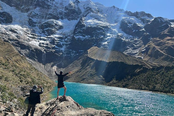
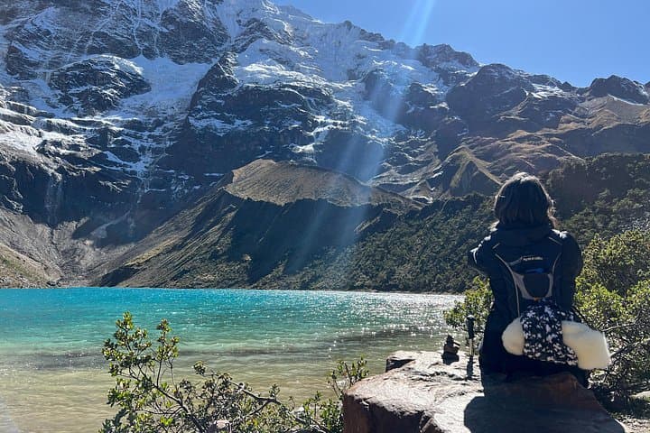
A pre-dawn van eases out of Cusco and the Andes press close—rock faces, distant glaciers and the slow light along the Apurímac valley. By Soraypampa you step out into thin, cold air; the trail climbs quickly through puna grass and rock, and the lake appears as a shock of blue above the switchbacks, a suspended pool fed by the glacier tongues of Nevado Humantay.
Verified experiences and guided adventures in the surrounding area.
Operated by Peru Andes Top · Soraypampa, Cusco Region
A pre-dawn van eases out of Cusco and the Andes press close—rock faces, distant glaciers and the slow light along the Apurímac valley. By Soraypampa you step out into thin, cold air; the trail climbs quickly through puna grass and rock, and the lake appears as a shock of blue above the switchbacks, a suspended pool fed by the glacier tongues of Nevado Humantay.
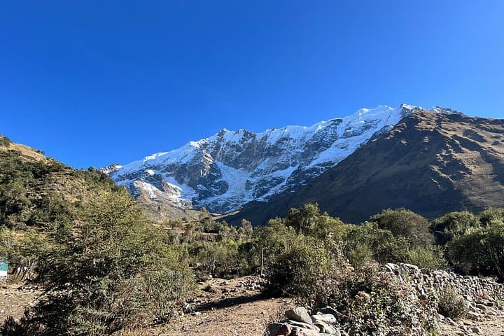
Humantay is a glacial amphitheater carved by ice and melt. The Nevado Humantay itself shows compact seracs, ice caves and fractured ice faces where freeze-thaw cycles sculpt the mountaintop. Local Quechua communities in the region historically regarded high peaks as protective apus; today guides and porters still maintain cultural rituals at high passes and travelers commonly pass small offerings or ask permission before entering sacred spaces.
Expect a steep, rocky track from Soraypampa (≈3,900 m) to the lake at roughly 4,200 m—about 2–3 km one way with 300–400 m of gain, depending on routing. The trail is exposed to sun, wind and sudden weather; in the dry season the path is firm, in the wet season it can be muddy and slippery. Plan for slow, deliberate pacing to reduce altitude effects, carry water and layers, and allow extra time for photos and acclimatization. Guides often provide trekking poles and oxygen as needed. The payoff is a compact, turquoise lagoon ringed by craggy ice and a panorama of snowy peaks—short, sharp, and unmistakably Andean.
The uphill distance is roughly 2–3 km one way with 300–400 m of elevation gain; plan 1–2 hours each way depending on fitness and acclimatization.
Possibly—at 4,200 m some people experience headaches or nausea; acclimatize in Cusco, hydrate, and descend if symptoms worsen.
Physically capable children and fit older adults can do the hike, but it’s slow and steep; consult a guide and consider oxygen support if needed.
The dry season (May–September) offers the most stable weather and clearer views; the wet months (Nov–Mar) can be muddy and cloudy.
Peru Andes Top operates guided outdoor trips and adventures with an emphasis on safety, stewardship, and memorable experiences.
A pre-dawn van eases out of Cusco and the Andes press close—rock faces, distant glaciers and the slow light along the Apurímac valley. By Soraypampa you step out into thin, cold air; the trail climbs quickly through puna grass and rock, and the lake appears as a shock of blue above the switchbacks, a suspended pool fed by the glacier tongues of Nevado Humantay.
A pre-dawn van eases out of Cusco and the Andes press close—rock faces, distant glaciers and the slow light along the Apurímac valley. By Soraypampa you step out into thin, cold air; the trail climbs quickly through puna grass and rock, and the lake appears as a shock of blue above the switchbacks, a suspended pool fed by the glacier tongues of Nevado Humantay.
Humantay is a glacial amphitheater carved by ice and melt. The Nevado Humantay itself shows compact seracs, ice caves and fractured ice faces where freeze-thaw cycles sculpt the mountaintop. Local Quechua communities in the region historically regarded high peaks as protective apus; today guides and porters still maintain cultural rituals at high passes and travelers commonly pass small offerings or ask permission before entering sacred spaces.
Expect a steep, rocky track from Soraypampa (≈3,900 m) to the lake at roughly 4,200 m—about 2–3 km one way with 300–400 m of gain, depending on routing. The trail is exposed to sun, wind and sudden weather; in the dry season the path is firm, in the wet season it can be muddy and slippery. Plan for slow, deliberate pacing to reduce altitude effects, carry water and layers, and allow extra time for photos and acclimatization. Guides often provide trekking poles and oxygen as needed. The payoff is a compact, turquoise lagoon ringed by craggy ice and a panorama of snowy peaks—short, sharp, and unmistakably Andean.