THE ADVENTURE COLLECTIVE® · Independent discovery and booking for outdoor travel

Escape Marrakech for a day in the High Atlas: a cool, scenic trek from Imlil through orchards, pine woods and waterfalls with a local Berber guide and a traditional lunch. This accessible day trip combines culture, mountain views and moderate walking.
Escape Marrakech for a day in the High Atlas: a cool, scenic trek from Imlil through orchards, pine woods and waterfalls with a local Berber guide and a traditional lunch. This accessible day trip combines culture, mountain views and moderate walking.
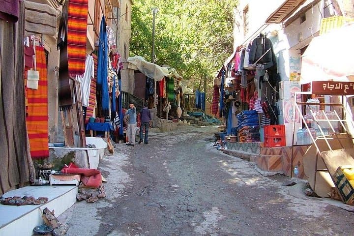
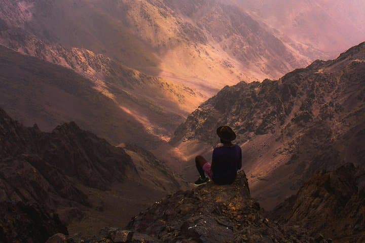
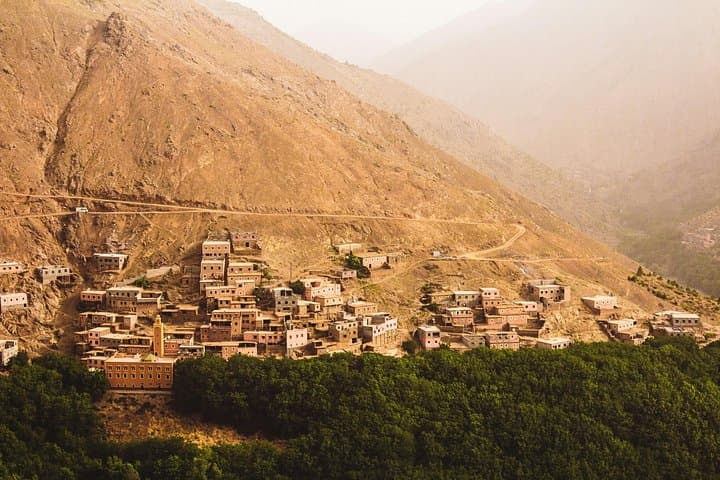
You step out of the minibus and the Atlas exhales—a cool, scented breath of pine and wet stone that contrasts sharply with Marrakech’s dust and heat. Mount Toubkal rises in the distance like an immovable horizon, its ridgelines cutting a clear silhouette over terraced fields and orchards. The path leads past walnut and apple trees, through the soft chatter of a mountain stream, and into villages where children herd goats and elders still trade in Amazigh (Berber) dialects.
Verified experiences and guided adventures in the surrounding area.
Operated by Maaffar travel agency Morocco · Imlil, Marrakech-Safi
You step out of the minibus and the Atlas exhales—a cool, scented breath of pine and wet stone that contrasts sharply with Marrakech’s dust and heat. Mount Toubkal rises in the distance like an immovable horizon, its ridgelines cutting a clear silhouette over terraced fields and orchards. The path leads past walnut and apple trees, through the soft chatter of a mountain stream, and into villages where children herd goats and elders still trade in Amazigh (Berber) dialects.
The High Atlas is young in geological terms, folded up during the same tectonic collisions that raised European ranges; granite outcrops and scree slopes give way to cultivated benches that reflect centuries of mountain agriculture. Imlil itself sits at about 1,740 m and has long been the gateway for climbers heading to Toubkal, but it also supports gentler treks through pine and juniper, small waterfalls, and the village of Tamatert at ~1,810 m.
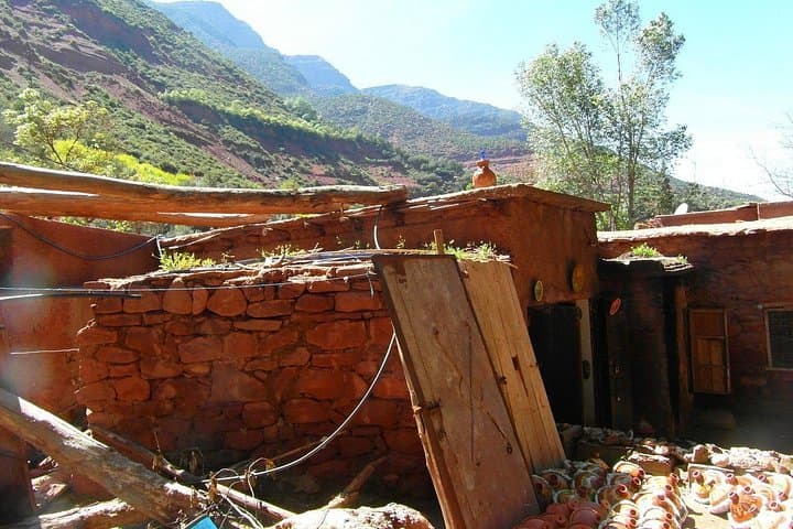
Expect 3–5 hours of walking on mixed dirt tracks, village lanes, and forest paths with moderate elevation changes. A local Berber guide interprets the landscape—pointing out irrigation channels, seasonal orchards, and the traditional flat-roof homes built from local stone. Lunch is typically a communal tagine or stew served in a village restaurant.
Practical notes: start early to avoid afternoon weather shifts, bring layered clothing for sharp temperature swings, and carry at least 1–2 liters of water. The route is family-friendly at a steady pace but not suitable for strollers or wheelchairs. Respect private terraces, leave no trace, and tip your guide—supporting local mountain economies keeps these trails open and well cared for.
The transfer is roughly 1.5 hours each way depending on traffic and road conditions.
Yes—at a relaxed pace the route is family-friendly, but those with mobility issues, pregnant travelers, or serious back problems should avoid it.
Tipping is customary; a modest amount for the guide and driver is appreciated and supports the local community.
Imlil sits around 1,740 m; most travelers do fine, but if you plan to continue to higher elevations (like Toubkal), allow time to acclimatize.
Maaffar travel agency Morocco operates guided outdoor trips and adventures with an emphasis on safety, stewardship, and memorable experiences.
You step out of the minibus and the Atlas exhales—a cool, scented breath of pine and wet stone that contrasts sharply with Marrakech’s dust and heat. Mount Toubkal rises in the distance like an immovable horizon, its ridgelines cutting a clear silhouette over terraced fields and orchards. The path leads past walnut and apple trees, through the soft chatter of a mountain stream, and into villages where children herd goats and elders still trade in Amazigh (Berber) dialects.
You step out of the minibus and the Atlas exhales—a cool, scented breath of pine and wet stone that contrasts sharply with Marrakech’s dust and heat. Mount Toubkal rises in the distance like an immovable horizon, its ridgelines cutting a clear silhouette over terraced fields and orchards. The path leads past walnut and apple trees, through the soft chatter of a mountain stream, and into villages where children herd goats and elders still trade in Amazigh (Berber) dialects.
The High Atlas is young in geological terms, folded up during the same tectonic collisions that raised European ranges; granite outcrops and scree slopes give way to cultivated benches that reflect centuries of mountain agriculture. Imlil itself sits at about 1,740 m and has long been the gateway for climbers heading to Toubkal, but it also supports gentler treks through pine and juniper, small waterfalls, and the village of Tamatert at ~1,810 m.
Expect 3–5 hours of walking on mixed dirt tracks, village lanes, and forest paths with moderate elevation changes. A local Berber guide interprets the landscape—pointing out irrigation channels, seasonal orchards, and the traditional flat-roof homes built from local stone. Lunch is typically a communal tagine or stew served in a village restaurant.
Practical notes: start early to avoid afternoon weather shifts, bring layered clothing for sharp temperature swings, and carry at least 1–2 liters of water. The route is family-friendly at a steady pace but not suitable for strollers or wheelchairs. Respect private terraces, leave no trace, and tip your guide—supporting local mountain economies keeps these trails open and well cared for.