THE ADVENTURE COLLECTIVE® · Independent discovery and booking for outdoor travel

Escape Marrakech for a day and climb into the High Atlas: a 6–7 hour guided hike from Imlil that mixes river valleys, Berber tea stops and foothill views of Mount Toubkal. Practical route details, cultural context and what to pack for the trail.
Escape Marrakech for a day and climb into the High Atlas: a 6–7 hour guided hike from Imlil that mixes river valleys, Berber tea stops and foothill views of Mount Toubkal. Practical route details, cultural context and what to pack for the trail.
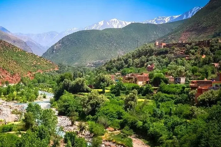
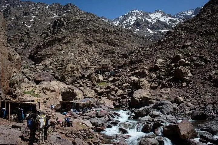
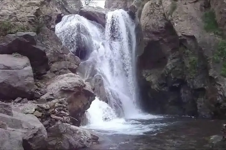
A morning taxi peels away from Marrakech’s ochre edges and the road climbs until terraces and flat-roofed homes give way to the steep gullies of the High Atlas. By the time you step out in Imlil (≈1,770 m), air feels thinner and the river—urgent and bright—seems to be leading you uphill. Paths here are worked into the mountain: stone steps, mule tracks and river flats that push you forward toward Sidi Chamharouch and the lower flanks of Mount Toubkal.
Verified experiences and guided adventures in the surrounding area.
Operated by Imlil Treks Toubkal · Imlil, Marrakech-Safi
A morning taxi peels away from Marrakech’s ochre edges and the road climbs until terraces and flat-roofed homes give way to the steep gullies of the High Atlas. By the time you step out in Imlil (≈1,770 m), air feels thinner and the river—urgent and bright—seems to be leading you uphill. Paths here are worked into the mountain: stone steps, mule tracks and river flats that push you forward toward Sidi Chamharouch and the lower flanks of Mount Toubkal.
The route threads through centuries of Amazigh (Berber) life: terraced fields, stacked stone houses and spring-fed irrigation that shaped both settlement and soil. Geologically, the High Atlas is young and tectonic—sharp ridgelines of schist and limestone carved by winter snows and sudden torrents. Expect stands of oak and juniper, and seasonal wildflowers in spring; birdlife rides thermals above the ravines.
Culturally, the walk is as much social as scenic: tea with local families, shepherd tracks and small shrines that mark traditional resting places. Guides translate both language and landscape—pointing out medicinal herbs and water sources—while local meals typically center on river trout or tagine.
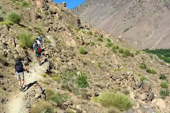
Practically: the standard day covers roughly 10–14 km round-trip with about 900–1,000 m of elevation change if you ascend toward Sidi Chamharouch (2,719 m). The trail is uneven and can be muddy after rains; start early to avoid heat and allow time for a relaxed tea break and return to Marrakech in the evening. Bring layered clothing, sturdy footwear, at least 1.5–2 liters of water, sun protection, and small bills for village purchases and tips. The experience balances accessible hiking with genuine cultural contact—short enough for a day but rich enough to feel remote.
Expect 6–7 hours and roughly 10–14 km round-trip with up to ~900–1,000 m elevation gain if you reach Sidi Chamharouch—moderate fitness recommended.
Children aged 3+ are allowed, but assess trail comfort and stamina; many families pause frequently and use local guide knowledge to shorten sections.
Facilities are basic in villages; carry tissues and hand sanitizer—some stops offer simple bathrooms, but expect natural breaks on the trail.
A guide is recommended for logistics, local insight and cultural introductions; maps are available, but local paths and weather can complicate self-navigation.
Imlil Treks Toubkal operates guided outdoor trips and adventures with an emphasis on safety, stewardship, and memorable experiences.
A morning taxi peels away from Marrakech’s ochre edges and the road climbs until terraces and flat-roofed homes give way to the steep gullies of the High Atlas. By the time you step out in Imlil (≈1,770 m), air feels thinner and the river—urgent and bright—seems to be leading you uphill. Paths here are worked into the mountain: stone steps, mule tracks and river flats that push you forward toward Sidi Chamharouch and the lower flanks of Mount Toubkal.
A morning taxi peels away from Marrakech’s ochre edges and the road climbs until terraces and flat-roofed homes give way to the steep gullies of the High Atlas. By the time you step out in Imlil (≈1,770 m), air feels thinner and the river—urgent and bright—seems to be leading you uphill. Paths here are worked into the mountain: stone steps, mule tracks and river flats that push you forward toward Sidi Chamharouch and the lower flanks of Mount Toubkal.
The route threads through centuries of Amazigh (Berber) life: terraced fields, stacked stone houses and spring-fed irrigation that shaped both settlement and soil. Geologically, the High Atlas is young and tectonic—sharp ridgelines of schist and limestone carved by winter snows and sudden torrents. Expect stands of oak and juniper, and seasonal wildflowers in spring; birdlife rides thermals above the ravines.
Culturally, the walk is as much social as scenic: tea with local families, shepherd tracks and small shrines that mark traditional resting places. Guides translate both language and landscape—pointing out medicinal herbs and water sources—while local meals typically center on river trout or tagine.
Practically: the standard day covers roughly 10–14 km round-trip with about 900–1,000 m of elevation change if you ascend toward Sidi Chamharouch (2,719 m). The trail is uneven and can be muddy after rains; start early to avoid heat and allow time for a relaxed tea break and return to Marrakech in the evening. Bring layered clothing, sturdy footwear, at least 1.5–2 liters of water, sun protection, and small bills for village purchases and tips. The experience balances accessible hiking with genuine cultural contact—short enough for a day but rich enough to feel remote.