THE ADVENTURE COLLECTIVE® · Independent discovery and booking for outdoor travel

A 7-day traverse from Sonamarg to Naranag across high passes and blue alpine lakes. Plan for 11–16 km daily, camped nights, and rapidly changing monsoon weather—best for trekkers ready for altitude and wet trails.
A 7-day traverse from Sonamarg to Naranag across high passes and blue alpine lakes. Plan for 11–16 km daily, camped nights, and rapidly changing monsoon weather—best for trekkers ready for altitude and wet trails.
A low cloud slips over the ridge and the first lake flashes like a coin pushed into green grass. You begin at Sonamarg, climbing past maples and silver birch, the Sind River murmuring below. Rain can tilt the light; when it clears the high meadows open and a string of alpine lakes—Vishansar, Kishansar, Gadsar, Tarsar, Satsar, Gangabal—reflect the sky like small, stubborn mirrors.
Verified experiences and guided adventures in the surrounding area.
Operated by Himalaya Shelter · Sonamarg, Jammu & Kashmir
A low cloud slips over the ridge and the first lake flashes like a coin pushed into green grass. You begin at Sonamarg, climbing past maples and silver birch, the Sind River murmuring below. Rain can tilt the light; when it clears the high meadows open and a string of alpine lakes—Vishansar, Kishansar, Gadsar, Tarsar, Satsar, Gangabal—reflect the sky like small, stubborn mirrors.
This route follows ancient shepherd tracks used by Gujjar and Bakarwal communities who seasonally move livestock through the alpine pastures. Geologically the corridor is glacial—moraines, cirques and tarns carved during the last ice ages create the basin lakes you’ll camp beside. Cultural notes surface at Naranag, where early medieval temple ruins mark the long human presence in this valley.
Expect sustained high-altitude hiking: daily stages of 11–16 km, passes around 4,100–4,210 m, and 6 nights of tent camping. Trails switch from packed dirt and grassy meadows to loose scree on pass approaches; sudden monsoon showers are common in July–August. Guides provided are BMC-certified and camps use A-frame tents, sleeping mats and hot meals.
Practical guidance: prioritize acclimatization, layer for rapidly changing weather, and carry waterproof outerwear and reliable boots. Hydrate and use water treatment for stream fills. Plan travel through Srinagar and Sonamarg, time the trek for early July if you want residual snow or late July–early August for full floral bloom. Leave no trace—these fragile alpine meadows recover slowly.
Early July shows lingering snow against blooming meadows; late July to early August is peak floral bloom. The route is usually possible until mid-September before early snow returns.
Prior multi-day trekking experience and basic acclimatization are strongly recommended; the trek reaches passes above 4,000 m but involves no technical climbing.
Typical inclusions are transport from Srinagar, tented accommodation (A-frame), sleeping mats and bags, meals (breakfast, lunch, dinner), and a BMC-certified guide with first aid.
Most groups start from Srinagar and drive ~3–4 hours to Sonamarg by road following the Sind River; public transport and private transfers are available.
Himalaya Shelter operates guided outdoor trips and adventures with an emphasis on safety, stewardship, and memorable experiences.
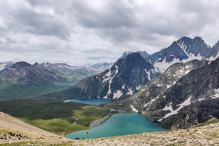
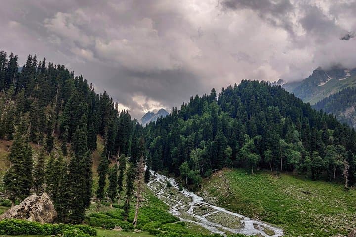

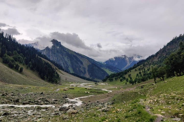
A low cloud slips over the ridge and the first lake flashes like a coin pushed into green grass. You begin at Sonamarg, climbing past maples and silver birch, the Sind River murmuring below. Rain can tilt the light; when it clears the high meadows open and a string of alpine lakes—Vishansar, Kishansar, Gadsar, Tarsar, Satsar, Gangabal—reflect the sky like small, stubborn mirrors.
A low cloud slips over the ridge and the first lake flashes like a coin pushed into green grass. You begin at Sonamarg, climbing past maples and silver birch, the Sind River murmuring below. Rain can tilt the light; when it clears the high meadows open and a string of alpine lakes—Vishansar, Kishansar, Gadsar, Tarsar, Satsar, Gangabal—reflect the sky like small, stubborn mirrors.
This route follows ancient shepherd tracks used by Gujjar and Bakarwal communities who seasonally move livestock through the alpine pastures. Geologically the corridor is glacial—moraines, cirques and tarns carved during the last ice ages create the basin lakes you’ll camp beside. Cultural notes surface at Naranag, where early medieval temple ruins mark the long human presence in this valley.
Expect sustained high-altitude hiking: daily stages of 11–16 km, passes around 4,100–4,210 m, and 6 nights of tent camping. Trails switch from packed dirt and grassy meadows to loose scree on pass approaches; sudden monsoon showers are common in July–August. Guides provided are BMC-certified and camps use A-frame tents, sleeping mats and hot meals.
Practical guidance: prioritize acclimatization, layer for rapidly changing weather, and carry waterproof outerwear and reliable boots. Hydrate and use water treatment for stream fills. Plan travel through Srinagar and Sonamarg, time the trek for early July if you want residual snow or late July–early August for full floral bloom. Leave no trace—these fragile alpine meadows recover slowly.