THE ADVENTURE COLLECTIVE® · Independent discovery and booking for outdoor travel

Paddle five miles across Resurrection Bay, land at the original Fort McGilvray dock, and climb 650 feet for sweeping Gulf of Alaska views—an eight‑hour guided mashup of sea and summit near Seward.
Paddle five miles across Resurrection Bay, land at the original Fort McGilvray dock, and climb 650 feet for sweeping Gulf of Alaska views—an eight‑hour guided mashup of sea and summit near Seward.
A gray morning hush lifts off Resurrection Bay as you push away from Miller’s Landing—spray spatters the bow, gulls argue over a drift log, and the mountains peel open a path to Caines Head. The paddle is steady: five miles of open water with frequent animal sightings, then a surf-to-turf transition onto the original Fort McGilvray dock. From there a two-mile, 650-foot climb in uneven coastal tundra and spruce puts the Gulf of Alaska at your feet.
Verified experiences and guided adventures in the surrounding area.
Operated by Millers Landing Inc. · Seward, Alaska
A gray morning hush lifts off Resurrection Bay as you push away from Miller’s Landing—spray spatters the bow, gulls argue over a drift log, and the mountains peel open a path to Caines Head. The paddle is steady: five miles of open water with frequent animal sightings, then a surf-to-turf transition onto the original Fort McGilvray dock. From there a two-mile, 650-foot climb in uneven coastal tundra and spruce puts the Gulf of Alaska at your feet.
Fort McGilvray is a blunt, practical relic of World War II coastal defense, with concrete gun emplacements cut into volcanic bedrock and trails that once linked lookout posts. Geologically, the coastline bears the scars of the 1964 earthquake—tilted driftwood forests and uplifted beaches—while the area’s cultural history ties to both early Alaskan homesteaders and military strategy during the Pacific war.
Expect a mixed-day of sea navigation and steep hiking: surf landings, a narrow trail that can be muddy and root-strewn, and exposed viewpoints that feed wind and weather. Local guides know currents, wildlife hotspots, and the best vantage for the gun emplacements and a snack at the gunning emplacement.
Practical guidance: bring a layered waterproof system, sturdy hiking boots for rocky ascents, and a full day of food and water—this trip runs roughly eight hours with guided paddling skills taught on site. Keep an eye for whales and sea otters on the approach, and plan timing around tidal windows and wind forecasts; the bay can shift quickly. This day trip rewards stamina and curiosity with wide ocean views and a tangible piece of Alaskan history.
No—guides give instruction and all necessary kayak gear is provided, but participants should be comfortable sitting in and entering/exiting a sea kayak.
The hike is about 2 miles each way with ~650 feet of elevation gain; the tread is uneven and can be muddy—expect a steady, moderate ascent.
Common sightings include sea otters, bald eagles, harbor seals, occasional whales, and mountain goats on coastal cliffs.
Yes—participants must fit within the kayak cockpit limits (roughly 33" x 17.25") and there’s typically a weight cutoff around 250 lb for safe fit and balance.
Millers Landing Inc. operates guided outdoor trips and adventures with an emphasis on safety, stewardship, and memorable experiences.
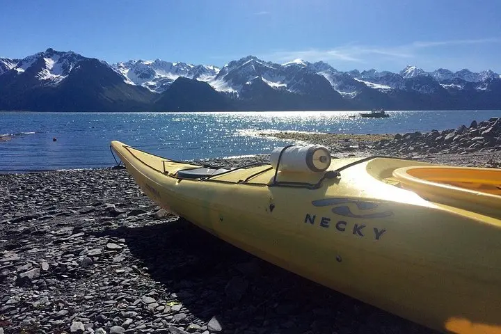
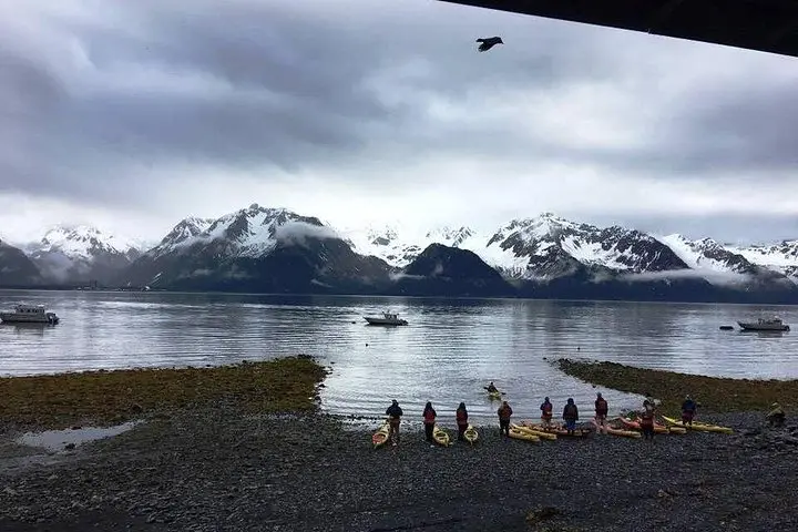
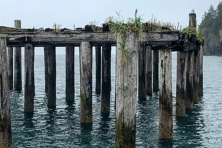
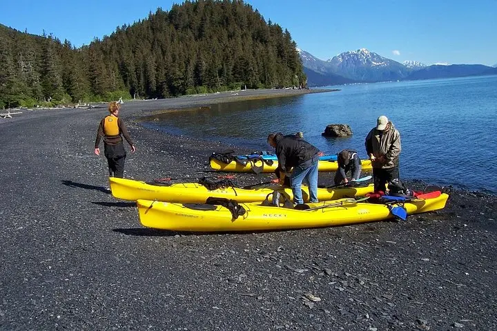
A gray morning hush lifts off Resurrection Bay as you push away from Miller’s Landing—spray spatters the bow, gulls argue over a drift log, and the mountains peel open a path to Caines Head. The paddle is steady: five miles of open water with frequent animal sightings, then a surf-to-turf transition onto the original Fort McGilvray dock. From there a two-mile, 650-foot climb in uneven coastal tundra and spruce puts the Gulf of Alaska at your feet.
A gray morning hush lifts off Resurrection Bay as you push away from Miller’s Landing—spray spatters the bow, gulls argue over a drift log, and the mountains peel open a path to Caines Head. The paddle is steady: five miles of open water with frequent animal sightings, then a surf-to-turf transition onto the original Fort McGilvray dock. From there a two-mile, 650-foot climb in uneven coastal tundra and spruce puts the Gulf of Alaska at your feet.
Fort McGilvray is a blunt, practical relic of World War II coastal defense, with concrete gun emplacements cut into volcanic bedrock and trails that once linked lookout posts. Geologically, the coastline bears the scars of the 1964 earthquake—tilted driftwood forests and uplifted beaches—while the area’s cultural history ties to both early Alaskan homesteaders and military strategy during the Pacific war.
Expect a mixed-day of sea navigation and steep hiking: surf landings, a narrow trail that can be muddy and root-strewn, and exposed viewpoints that feed wind and weather. Local guides know currents, wildlife hotspots, and the best vantage for the gun emplacements and a snack at the gunning emplacement.
Practical guidance: bring a layered waterproof system, sturdy hiking boots for rocky ascents, and a full day of food and water—this trip runs roughly eight hours with guided paddling skills taught on site. Keep an eye for whales and sea otters on the approach, and plan timing around tidal windows and wind forecasts; the bay can shift quickly. This day trip rewards stamina and curiosity with wide ocean views and a tangible piece of Alaskan history.