THE ADVENTURE COLLECTIVE® · Independent discovery and booking for outdoor travel

A six-day Machame ascent moves from rainforest to glacial rim across roughly 62 km, culminating at Uhuru Peak. Expect varied terrain, guided support, and a challenging but non-technical summit night—this route rewards steady pacing and thoughtful preparation.
A six-day Machame ascent moves from rainforest to glacial rim across roughly 62 km, culminating at Uhuru Peak. Expect varied terrain, guided support, and a challenging but non-technical summit night—this route rewards steady pacing and thoughtful preparation.
You step off the jeep at Machame Gate and the rainforest takes you in—vines tug at the hood of your jacket, light filters through a green ceiling, and a chorus of birds seems to pace your first steps. The Machame Route spends its first day here, where the trail is a living thing, narrowing, widening, and daring you to match its rhythm. Over six days it will change its face: rainforest to heath, moorland to alpine desert, then a last, thin world of scree and wind that leads to Uhuru Peak.
Verified experiences and guided adventures in the surrounding area.
Operated by Kilimanjaro Brothers · Moshi, Kilimanjaro Region
You step off the jeep at Machame Gate and the rainforest takes you in—vines tug at the hood of your jacket, light filters through a green ceiling, and a chorus of birds seems to pace your first steps. The Machame Route spends its first day here, where the trail is a living thing, narrowing, widening, and daring you to match its rhythm. Over six days it will change its face: rainforest to heath, moorland to alpine desert, then a last, thin world of scree and wind that leads to Uhuru Peak.
Geology and human stories thread the route. Kilimanjaro is a dormant stratovolcano built by successive lava flows; its broad flanks record eruptions and glacial retreat. The mountain has been a navigational and cultural landmark for Chagga people for centuries and a magnet for global climbers since the early 20th century. On Machame you move through ecological bands—each with its own weather, plants, and pace—and the trail reads like a vertical cross-section of East Africa.
On days two and three the low alpine heather gives way to the rust-colored plains of Shira, where ancient volcanic domes rise like the skeleton of earlier eruptions. Barranco and Karanga demand attention: narrow ridgelines, boulder fields, and a climb known as the Barranco Wall that is as psychological as it is physical. Summit night from Barafu is a cold, lunar march under a scatter of stars. The final push to Uhuru Peak tests breathing and conviction; when the sun meets glaciers along the crater rim, the view flattens maps and recalibrates expectations.
Practically, this itinerary covers about 62 km (37 miles) gate to gate, with sleeping elevations ranging from roughly 1,640m at the gates up to summit heights near 5,895m and back down to 1,640m on descent. Guides provide full board, camping, rescue equipment (oxygen, Gamow bag), and often porters to carry heavy loads—still, personal fitness and sensible packing matter.
Plan for variable conditions: deep forest humidity early on, cold alpine nights, and high winds at altitude. Hydrate before and during the trek, pace your ascent to reduce altitude sickness risk, and lean on your guides for acclimatization cues. Footwear with good ankle support and layering for shifting temperatures are essential. Bring a small daypack, headlamp for summit hours, and patience—the mountain sets its own timetable.
The Machame Route rewards persistence with shifting panoramas, close encounters with unique afro-alpine flora, and the slow satisfaction of altitude earned step by step. It’s not a technical climb, but it is an expedition: manage risk, move deliberately, and the mountain will reveal its hard-won horizons.
No technical climbing skills are required—this is a trekking route—but prior multi-day hiking experience and good fitness improve success chances.
Approximately 62 km (37 miles) gate-to-gate, with elevation ranging from about 1,640m at the gates to 5,895m at Uhuru Peak.
Guides carry pulse oximeters, VHF radios, emergency oxygen, and a Gamow bag; professional evacuation procedures are in place if needed.
Ascend slowly, hydrate, eat well, and inform guides of symptoms; they monitor groups and may adjust plans or descend if necessary.
Yes—tipping is customary and supports local crews; bring cash in small denominations to distribute at trip’s end.
Dry seasons (January–March and June–October) offer more stable conditions and clearer summit windows, though the mountain can change quickly.
Kilimanjaro Brothers operates guided outdoor trips and adventures with an emphasis on safety, stewardship, and memorable experiences.

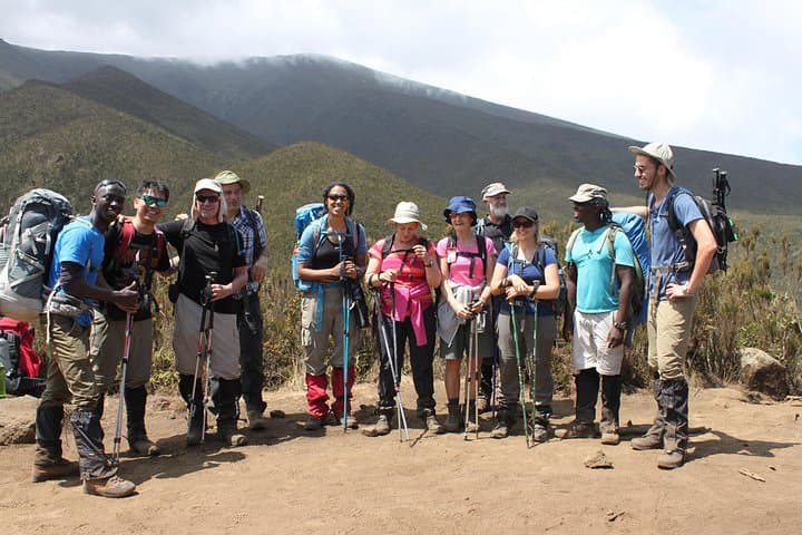
You step off the jeep at Machame Gate and the rainforest takes you in—vines tug at the hood of your jacket, light filters through a green ceiling, and a chorus of birds seems to pace your first steps. The Machame Route spends its first day here, where the trail is a living thing, narrowing, widening, and daring you to match its rhythm. Over six days it will change its face: rainforest to heath, moorland to alpine desert, then a last, thin world of scree and wind that leads to Uhuru Peak.
You step off the jeep at Machame Gate and the rainforest takes you in—vines tug at the hood of your jacket, light filters through a green ceiling, and a chorus of birds seems to pace your first steps. The Machame Route spends its first day here, where the trail is a living thing, narrowing, widening, and daring you to match its rhythm. Over six days it will change its face: rainforest to heath, moorland to alpine desert, then a last, thin world of scree and wind that leads to Uhuru Peak.
Geology and human stories thread the route. Kilimanjaro is a dormant stratovolcano built by successive lava flows; its broad flanks record eruptions and glacial retreat. The mountain has been a navigational and cultural landmark for Chagga people for centuries and a magnet for global climbers since the early 20th century. On Machame you move through ecological bands—each with its own weather, plants, and pace—and the trail reads like a vertical cross-section of East Africa.
On days two and three the low alpine heather gives way to the rust-colored plains of Shira, where ancient volcanic domes rise like the skeleton of earlier eruptions. Barranco and Karanga demand attention: narrow ridgelines, boulder fields, and a climb known as the Barranco Wall that is as psychological as it is physical. Summit night from Barafu is a cold, lunar march under a scatter of stars. The final push to Uhuru Peak tests breathing and conviction; when the sun meets glaciers along the crater rim, the view flattens maps and recalibrates expectations.
Practically, this itinerary covers about 62 km (37 miles) gate to gate, with sleeping elevations ranging from roughly 1,640m at the gates up to summit heights near 5,895m and back down to 1,640m on descent. Guides provide full board, camping, rescue equipment (oxygen, Gamow bag), and often porters to carry heavy loads—still, personal fitness and sensible packing matter.
Plan for variable conditions: deep forest humidity early on, cold alpine nights, and high winds at altitude. Hydrate before and during the trek, pace your ascent to reduce altitude sickness risk, and lean on your guides for acclimatization cues. Footwear with good ankle support and layering for shifting temperatures are essential. Bring a small daypack, headlamp for summit hours, and patience—the mountain sets its own timetable.
The Machame Route rewards persistence with shifting panoramas, close encounters with unique afro-alpine flora, and the slow satisfaction of altitude earned step by step. It’s not a technical climb, but it is an expedition: manage risk, move deliberately, and the mountain will reveal its hard-won horizons.