THE ADVENTURE COLLECTIVE® · Independent discovery and booking for outdoor travel

Climbing Kilimanjaro via the Rongai Route is a seven-day study in changing ecosystems: rainforest, moorland, alpine desert and, finally, the icy crater rim. This practical guide walks you through the terrain, logistics, and on-mountain rhythm you’ll need to reach Uhuru Peak without rushing.
Climbing Kilimanjaro via the Rongai Route is a seven-day study in changing ecosystems: rainforest, moorland, alpine desert and, finally, the icy crater rim. This practical guide walks you through the terrain, logistics, and on-mountain rhythm you’ll need to reach Uhuru Peak without rushing.
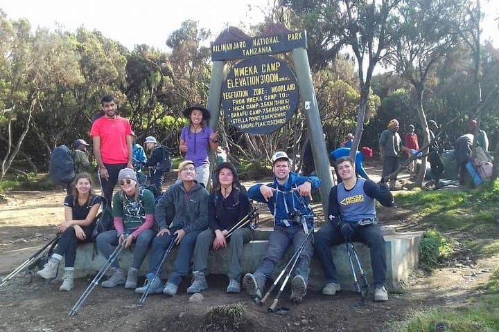
On a damp morning just outside Moshi, the trail eases out of the rainforest and you can feel the mountain change its mood. The Rongai Route begins at Nalemoru Gate (1,990 m), a scrubby threshold where porters bustle and the forest opens to moorland. Each step northward reveals a different Kilimanjaro—first a green, humid mountain full of birdsong, then a hard, wind-swept dome of volcanic rock and ice.
Verified experiences and guided adventures in the surrounding area.
Operated by Habari Adventure · Moshi, Kilimanjaro
On a damp morning just outside Moshi, the trail eases out of the rainforest and you can feel the mountain change its mood. The Rongai Route begins at Nalemoru Gate (1,990 m), a scrubby threshold where porters bustle and the forest opens to moorland. Each step northward reveals a different Kilimanjaro—first a green, humid mountain full of birdsong, then a hard, wind-swept dome of volcanic rock and ice.
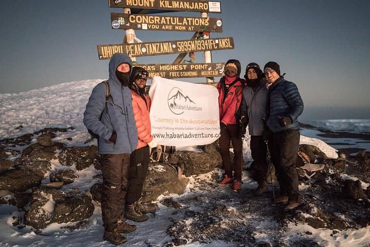
The Rongai approach is one of the quieter lines up Kilimanjaro, the Kenyan side giving it a more gradual, northerly profile. Geologically, Kilimanjaro is a three-peaked stratovolcano: Shira (eroded), Mawenzi (jagged spires), and Kibo (the dormant summit cone). The route traverses rainforest, moorland, heather and alpine desert before the lunar saddle between Mawenzi and Kibo, where the final push to Gilman’s Point and Uhuru Peak (5,895 m) begins.
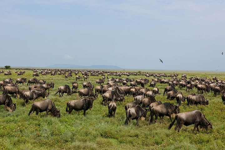
Culturally, the climb is as much about the Chagga lands around Moshi as it is about the summit. Local guides—often from Kilimanjaro communities—combine natural history with practical care; on this itinerary Habari Adventure emphasizes guides trained in first aid, local botany and high-altitude safety. Wildlife sightings are possible in the lower zones: colobus monkeys in the canopy, antelope or even elephant tracks on quieter days.
The itinerary spreads ascent over seven days to aid acclimatization: Nalemoru Gate to Simba Camp, up through Second Cave and Kikelelwa, on to Mawenzi Tarn and Kibo Hut, then a midnight summit bid and descent to Horombo. Expect roughly 3,900 m of elevation gain from gate to summit and total hiking distance in the 60–70 km range over varied terrain—roots and slick mud in the rainforest, tussock and scree higher up.
Practically: pack for rapid weather swings—wet, warm lower down; frigid, windy above 4,000 m. Sleep systems vary; campsites and basic hut nights are included in most guides’ packages. The hardest day is the summit push: start around midnight, walk slowly and steadily; many teams use the “pole pole” (Swahili for slowly) rhythm to manage altitude.
If you go: plan for dry-season months (June–October and January–March) for the best summit chances, arrive in Moshi for a last gear check and rest, and respect park rules—stick to trails and follow guides to minimize impact. Reach the summit at sunrise to watch Mawenzi catch light while the remnants of Kibo’s glaciers glint nearby—a cold, bright reward for careful planning and patient, slow steps.
No. The Rongai Route requires strong hiking fitness but no rope work; the summit is non-technical, though crampons can be helpful near icy patches.
Success depends on fitness, acclimatization and weather; with a seven-day itinerary and experienced guides, summit rates improve considerably but are not guaranteed.
Dry-season windows (June–October and January–March) offer the most stable weather and higher summit probabilities.
Most operators include park fees and campsite costs; confirm with your provider—this specific itinerary lists meals and campsites but verify permit coverage at booking.
Guides use pacing, staged ascent, symptom monitoring, and descent if needed; they carry basic first aid and have evacuation plans for serious cases.
Most groups depart Moshi—this operator offers airport and hotel pickup; Nalemoru Gate is reached by a few hours’ drive from Moshi depending on traffic.
Habari Adventure operates guided outdoor trips and adventures with an emphasis on safety, stewardship, and memorable experiences.

On a damp morning just outside Moshi, the trail eases out of the rainforest and you can feel the mountain change its mood. The Rongai Route begins at Nalemoru Gate (1,990 m), a scrubby threshold where porters bustle and the forest opens to moorland. Each step northward reveals a different Kilimanjaro—first a green, humid mountain full of birdsong, then a hard, wind-swept dome of volcanic rock and ice.
On a damp morning just outside Moshi, the trail eases out of the rainforest and you can feel the mountain change its mood. The Rongai Route begins at Nalemoru Gate (1,990 m), a scrubby threshold where porters bustle and the forest opens to moorland. Each step northward reveals a different Kilimanjaro—first a green, humid mountain full of birdsong, then a hard, wind-swept dome of volcanic rock and ice.
The Rongai approach is one of the quieter lines up Kilimanjaro, the Kenyan side giving it a more gradual, northerly profile. Geologically, Kilimanjaro is a three-peaked stratovolcano: Shira (eroded), Mawenzi (jagged spires), and Kibo (the dormant summit cone). The route traverses rainforest, moorland, heather and alpine desert before the lunar saddle between Mawenzi and Kibo, where the final push to Gilman’s Point and Uhuru Peak (5,895 m) begins.
Culturally, the climb is as much about the Chagga lands around Moshi as it is about the summit. Local guides—often from Kilimanjaro communities—combine natural history with practical care; on this itinerary Habari Adventure emphasizes guides trained in first aid, local botany and high-altitude safety. Wildlife sightings are possible in the lower zones: colobus monkeys in the canopy, antelope or even elephant tracks on quieter days.
The itinerary spreads ascent over seven days to aid acclimatization: Nalemoru Gate to Simba Camp, up through Second Cave and Kikelelwa, on to Mawenzi Tarn and Kibo Hut, then a midnight summit bid and descent to Horombo. Expect roughly 3,900 m of elevation gain from gate to summit and total hiking distance in the 60–70 km range over varied terrain—roots and slick mud in the rainforest, tussock and scree higher up.
Practically: pack for rapid weather swings—wet, warm lower down; frigid, windy above 4,000 m. Sleep systems vary; campsites and basic hut nights are included in most guides’ packages. The hardest day is the summit push: start around midnight, walk slowly and steadily; many teams use the “pole pole” (Swahili for slowly) rhythm to manage altitude.
If you go: plan for dry-season months (June–October and January–March) for the best summit chances, arrive in Moshi for a last gear check and rest, and respect park rules—stick to trails and follow guides to minimize impact. Reach the summit at sunrise to watch Mawenzi catch light while the remnants of Kibo’s glaciers glint nearby—a cold, bright reward for careful planning and patient, slow steps.