THE ADVENTURE COLLECTIVE® · Independent discovery and booking for outdoor travel

Scale La Malinche for panoramic views of Mexico’s great volcanoes, then wind down with a guided stroll through Tlaxcala’s colonial center. This full-day trip blends a challenging mountain hike with local history and markets.
Scale La Malinche for panoramic views of Mexico’s great volcanoes, then wind down with a guided stroll through Tlaxcala’s colonial center. This full-day trip blends a challenging mountain hike with local history and markets.
Dawn breaks over central Mexico and the ridge of La Malinche cuts a clean line against the sky. You set off from the trailhead with a small pack, the path climbing through pine shadow into high grass where the wind seems to be deciding whether to push you forward or slow you down. At higher elevations the terrain opens — volcanic scree, grassy slopes and weather-burnished rocks — and the summit rewards you with a sweep of Popocatépetl, Iztaccíhuatl and the distant Pico de Orizaba.
Verified experiences and guided adventures in the surrounding area.
Operated by Vibe Adventures · Tlaxcala, Tlaxcala
Dawn breaks over central Mexico and the ridge of La Malinche cuts a clean line against the sky. You set off from the trailhead with a small pack, the path climbing through pine shadow into high grass where the wind seems to be deciding whether to push you forward or slow you down. At higher elevations the terrain opens — volcanic scree, grassy slopes and weather-burnished rocks — and the summit rewards you with a sweep of Popocatépetl, Iztaccíhuatl and the distant Pico de Orizaba.
Geology here is honest: La Malinche is an extinct stratovolcano whose soils feed pine and oak forests on its lower flanks and open páramo-like grasslands near the top. The region has a layered human history too — Tlaxcalan towns were important before and after the Spanish conquest, and the town plazas and the Baroque Basilica of Our Lady of Ocotlán reflect that blended past.
Practically, expect a steep 6 km climb to the peak from the common trailhead with roughly 1,000–1,300 m of elevation gain, shifting from forest to exposed ridgeline. Weather changes fast at altitude: mornings are cold, afternoons can be windy with sudden clouds. Guides typically include roundtrip transport from Mexico City, bilingual interpretation, snacks and an orientation walk in downtown Tlaxcala where markets and colonial architecture anchor the return.
Bring layered clothing for sun and wind, hydrate well to mitigate altitude effects, and plan for a full-day commitment — the tour commonly runs most of the day. Respect trail closures, follow your guide, and leave no trace: the high-altitude flora and fragile soils are slower to recover than they seem.
The common uphill route is roughly 6 km to the summit with about 1,000–1,300 m of elevation gain; round-trip time depends on pace and stops.
No technical skills are required — the route is non-technical — but high fitness and comfort on steep, uneven terrain are necessary.
La Malinche is inside a national park and guided tours are standard; organized tours include park access and roundtrip transport.
Take it slowly, hydrate, avoid alcohol before the hike, and inform guides of any symptoms; descending is the most effective treatment if severe signs appear.
Vibe Adventures operates guided outdoor trips and adventures with an emphasis on safety, stewardship, and memorable experiences.
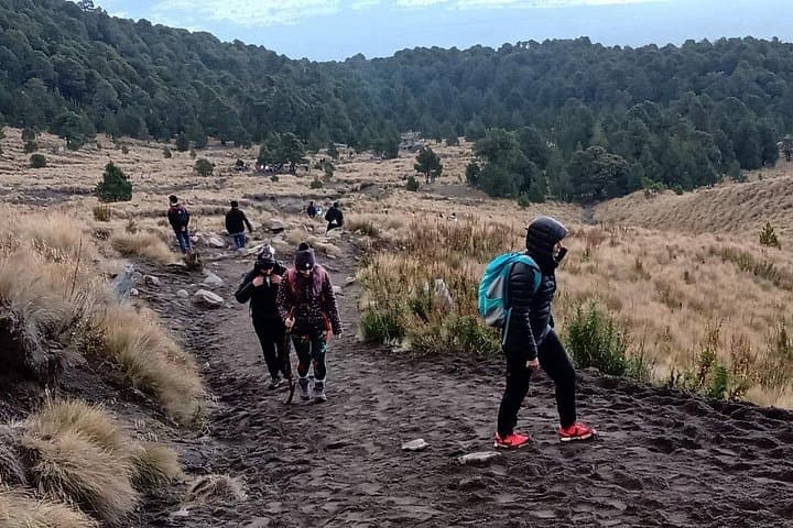
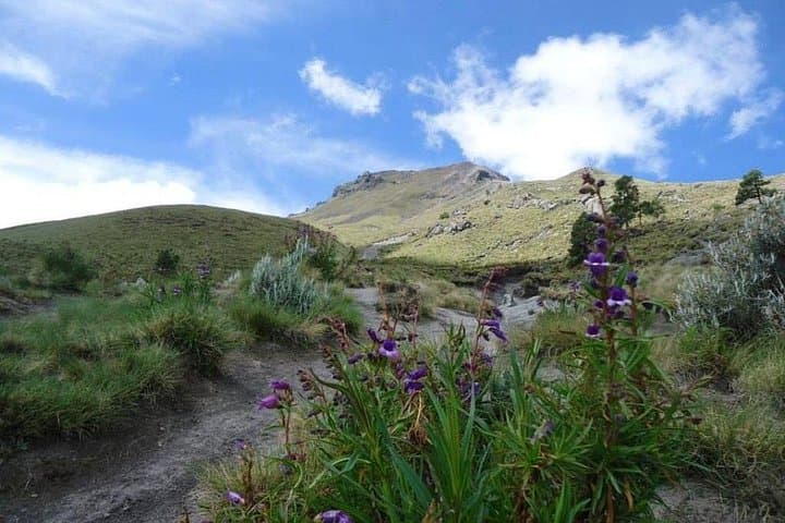
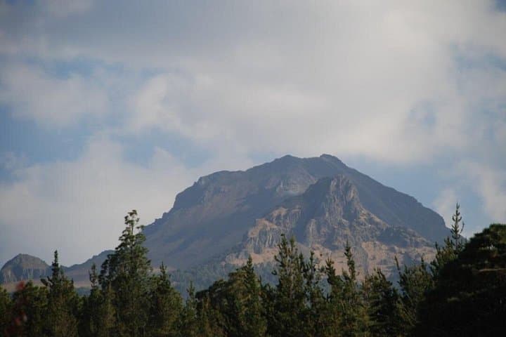
Dawn breaks over central Mexico and the ridge of La Malinche cuts a clean line against the sky. You set off from the trailhead with a small pack, the path climbing through pine shadow into high grass where the wind seems to be deciding whether to push you forward or slow you down. At higher elevations the terrain opens — volcanic scree, grassy slopes and weather-burnished rocks — and the summit rewards you with a sweep of Popocatépetl, Iztaccíhuatl and the distant Pico de Orizaba.
Dawn breaks over central Mexico and the ridge of La Malinche cuts a clean line against the sky. You set off from the trailhead with a small pack, the path climbing through pine shadow into high grass where the wind seems to be deciding whether to push you forward or slow you down. At higher elevations the terrain opens — volcanic scree, grassy slopes and weather-burnished rocks — and the summit rewards you with a sweep of Popocatépetl, Iztaccíhuatl and the distant Pico de Orizaba.
Geology here is honest: La Malinche is an extinct stratovolcano whose soils feed pine and oak forests on its lower flanks and open páramo-like grasslands near the top. The region has a layered human history too — Tlaxcalan towns were important before and after the Spanish conquest, and the town plazas and the Baroque Basilica of Our Lady of Ocotlán reflect that blended past.
Practically, expect a steep 6 km climb to the peak from the common trailhead with roughly 1,000–1,300 m of elevation gain, shifting from forest to exposed ridgeline. Weather changes fast at altitude: mornings are cold, afternoons can be windy with sudden clouds. Guides typically include roundtrip transport from Mexico City, bilingual interpretation, snacks and an orientation walk in downtown Tlaxcala where markets and colonial architecture anchor the return.
Bring layered clothing for sun and wind, hydrate well to mitigate altitude effects, and plan for a full-day commitment — the tour commonly runs most of the day. Respect trail closures, follow your guide, and leave no trace: the high-altitude flora and fragile soils are slower to recover than they seem.