THE ADVENTURE COLLECTIVE® · Independent discovery and booking for outdoor travel

An 8-day trek from Syabrubesi to Kyangjin Gompa with a summit day on Tserko Ri. This route combines high Himalayan views, Tamang culture, and tea-house logistics—ideal for trekkers ready for sustained altitude and long days on varied trails.
An 8-day trek from Syabrubesi to Kyangjin Gompa with a summit day on Tserko Ri. This route combines high Himalayan views, Tamang culture, and tea-house logistics—ideal for trekkers ready for sustained altitude and long days on varied trails.
A thin morning hangs over the trail as you leave the bustle of Kathmandu and ride the winding road toward Syabrubesi. The river below dares you forward, the forest above hums with rhododendron and oak, and each bend in the track reveals sharper teeth of snow on distant ridges. By the second day you walk beside the Langtang Khola, river spray pushing at your boots; by day four the prayer flags of Kyangjin Gompa frame a skyline of glaciers.
Verified experiences and guided adventures in the surrounding area.
Operated by Trekking Organizer Company in Nepal · Kyangjin Gompa, Bagmati Province
A thin morning hangs over the trail as you leave the bustle of Kathmandu and ride the winding road toward Syabrubesi. The river below dares you forward, the forest above hums with rhododendron and oak, and each bend in the track reveals sharper teeth of snow on distant ridges. By the second day you walk beside the Langtang Khola, river spray pushing at your boots; by day four the prayer flags of Kyangjin Gompa frame a skyline of glaciers.
The Langtang region sits inside Langtang National Park, carved by uplift and glaciation into steep valleys and moraine shelves. The area is home to Tamang and Sherpa communities whose Buddhist monasteries and mani walls mark centuries of highland culture. The valley’s recent history includes the devastating 2015 earthquake that destroyed Langtang village and accelerated community-led rebuilding—an important context for sensitive travel here.
Expect steady ascents and long downhill stretches: highest trekking objective Tserko Ri (~5,000 m) adds an acclimatization day and panoramic sunrise; Kyangjin Gompa (≈3,870 m) is the cultural hub. Trails alternate packed dirt, rocky switchbacks and yak pastures; daily walking times range 4–8 hours with cumulative elevation gain of roughly 2,400–3,100 m over the route.
Practical guidance: secure National Park Permit and TIMS before departing, pace your ascent to reduce altitude risk, and plan footwear and layers for rapid weather swings. Tea houses offer basic food and lodgings—bring a warm sleeping layer and water treatment. Start early, keep daily mileage conservative, and allow the valley’s pace to dictate your rhythm.
Yes—trekkers require a Langtang National Park permit and a TIMS card; these are usually arranged by your operator or can be purchased in Kathmandu before departure.
The trek is challenging due to altitude and long days but does not require technical mountaineering skills; prior multi-day hiking experience and good fitness are recommended.
Altitude sickness is a risk above 3,000 m—the itinerary includes an acclimatization day at Kyangjin Gompa and a Tserko Ri day-hike to help; ascend slowly and stay hydrated.
Yes—tea houses provide basic rooms and meals (breakfast, lunch, dinner included on many itineraries), though options are simple and menu variety shrinks higher on the trail.
Trekking Organizer Company in Nepal operates guided outdoor trips and adventures with an emphasis on safety, stewardship, and memorable experiences.
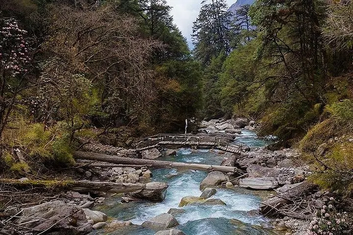
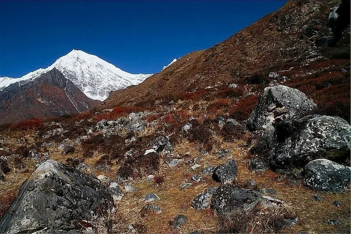
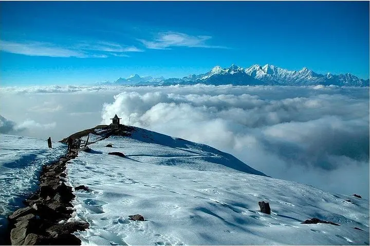
A thin morning hangs over the trail as you leave the bustle of Kathmandu and ride the winding road toward Syabrubesi. The river below dares you forward, the forest above hums with rhododendron and oak, and each bend in the track reveals sharper teeth of snow on distant ridges. By the second day you walk beside the Langtang Khola, river spray pushing at your boots; by day four the prayer flags of Kyangjin Gompa frame a skyline of glaciers.
A thin morning hangs over the trail as you leave the bustle of Kathmandu and ride the winding road toward Syabrubesi. The river below dares you forward, the forest above hums with rhododendron and oak, and each bend in the track reveals sharper teeth of snow on distant ridges. By the second day you walk beside the Langtang Khola, river spray pushing at your boots; by day four the prayer flags of Kyangjin Gompa frame a skyline of glaciers.
The Langtang region sits inside Langtang National Park, carved by uplift and glaciation into steep valleys and moraine shelves. The area is home to Tamang and Sherpa communities whose Buddhist monasteries and mani walls mark centuries of highland culture. The valley’s recent history includes the devastating 2015 earthquake that destroyed Langtang village and accelerated community-led rebuilding—an important context for sensitive travel here.
Expect steady ascents and long downhill stretches: highest trekking objective Tserko Ri (~5,000 m) adds an acclimatization day and panoramic sunrise; Kyangjin Gompa (≈3,870 m) is the cultural hub. Trails alternate packed dirt, rocky switchbacks and yak pastures; daily walking times range 4–8 hours with cumulative elevation gain of roughly 2,400–3,100 m over the route.
Practical guidance: secure National Park Permit and TIMS before departing, pace your ascent to reduce altitude risk, and plan footwear and layers for rapid weather swings. Tea houses offer basic food and lodgings—bring a warm sleeping layer and water treatment. Start early, keep daily mileage conservative, and allow the valley’s pace to dictate your rhythm.