THE ADVENTURE COLLECTIVE® · Independent discovery and booking for outdoor travel

A compact, high-value Himalayan trek that climbs from the forests of Syapru Besi to Kyanjin Gompa. Expect tea-house accommodations, glacial viewpoints, and a demanding altitude profile best attempted in spring or fall.
A compact, high-value Himalayan trek that climbs from the forests of Syapru Besi to Kyanjin Gompa. Expect tea-house accommodations, glacial viewpoints, and a demanding altitude profile best attempted in spring or fall.
You step off the bus at Syapru Besi and the valley opens like a map of stone and green: the Bhote Koshi river hurries downhill, rhododendron trunks lean over narrow trails, and the high walls of Langtang Lirung loom white above the tree line.
Verified experiences and guided adventures in the surrounding area.
Operated by Everest Trekking Routes Pvt. Ltd. · Syapru Besi, Bagmati Province
You step off the bus at Syapru Besi and the valley opens like a map of stone and green: the Bhote Koshi river hurries downhill, rhododendron trunks lean over narrow trails, and the high walls of Langtang Lirung loom white above the tree line.
This ten-day teahouse trek moves steadily from 1,462m to the alpine hamlet of Kyanjin Gompa (3,798m), with an optional climb to Chorkari Ri (≈5,050m). Geologically the valley is a classic glacial trough carved by repeated ice advances; moraines and icefalls still dominate the upper basin. The region sits inside Langtang National Park, home to Tamang and Sherpa communities whose Buddhist monasteries and cheese-making traditions punctuate the route. The valley also bears traces of the 2015 earthquake, and rebuilding efforts shape village life.
Expect 60–75 km of walking on mixed terrain—sinuous river flats, stone switchbacks, and forested slopes—paired with steady elevation gain rather than technical exposure. Tea houses provide basic meals and bunks; bring cash and patience for simple hot showers. Acclimatization days and pacing are critical: altitude dictates the itinerary more than distance. Best seasons are spring and fall for clear views and rhododendron blooms; monsoon brings lushness and mud, winter brings snow above 3,000m.
Practical tips: carry layers and a warm sleep system, use trekking poles, and drink early and often. Permits (Langtang National Park and TIMS) are required and usually handled by operators. The Langtang Valley offers a concentrated Himalayan experience—big peaks, close-knit villages, and the kind of quiet that makes each summit view feel earned.
Yes—Langtang National Park entry and a TIMS card are required; reputable operators usually arrange these before you enter the trail.
Kyanjin Gompa sits at about 3,798m, and the optional Chorkari Ri climb reaches roughly 5,050m—prepare for high-altitude conditions if you attempt the latter.
Tea houses provide basic lodging and hot meals; expect shared bathrooms, simple heating, and fewer amenities as you gain altitude—bring a warm sleep liner.
Spring (March–May) and fall (September–November) offer the clearest views and most stable weather; monsoon is wet and winter brings snow and cold above 3,000m.
Everest Trekking Routes Pvt. Ltd. operates guided outdoor trips and adventures with an emphasis on safety, stewardship, and memorable experiences.
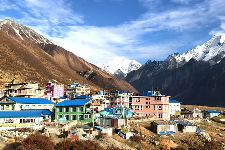
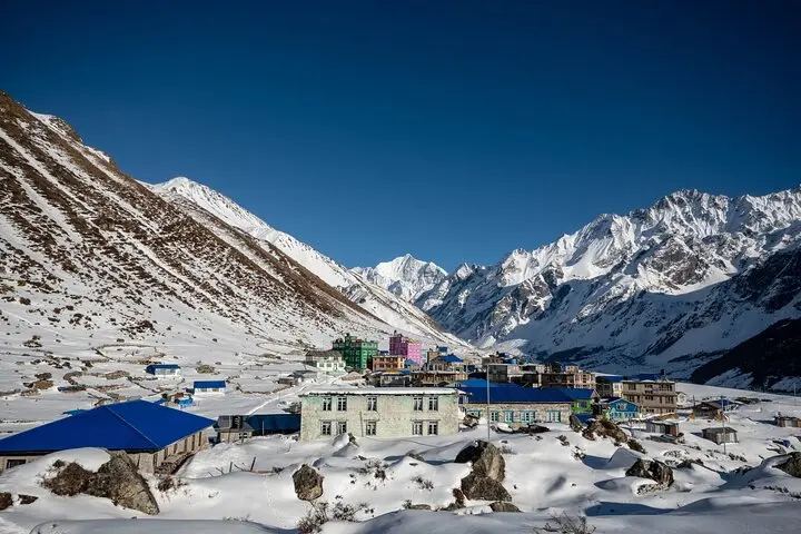
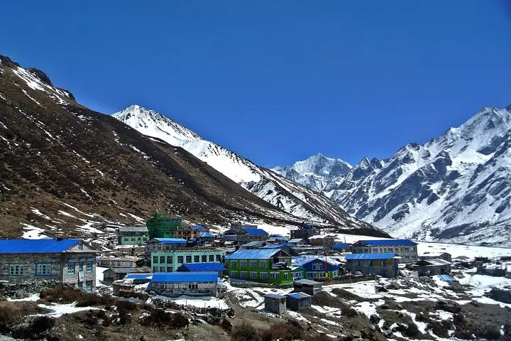
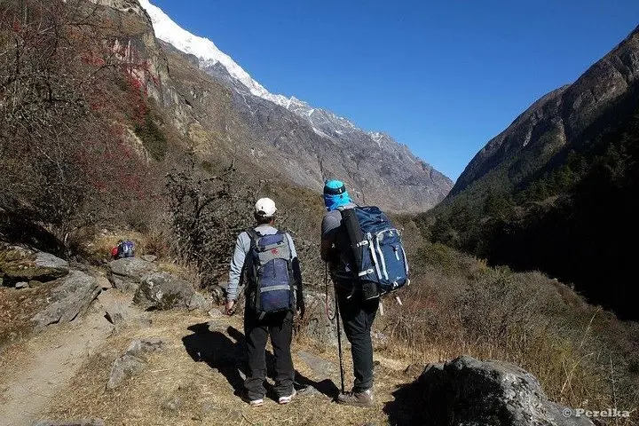
You step off the bus at Syapru Besi and the valley opens like a map of stone and green: the Bhote Koshi river hurries downhill, rhododendron trunks lean over narrow trails, and the high walls of Langtang Lirung loom white above the tree line.
You step off the bus at Syapru Besi and the valley opens like a map of stone and green: the Bhote Koshi river hurries downhill, rhododendron trunks lean over narrow trails, and the high walls of Langtang Lirung loom white above the tree line.
This ten-day teahouse trek moves steadily from 1,462m to the alpine hamlet of Kyanjin Gompa (3,798m), with an optional climb to Chorkari Ri (≈5,050m). Geologically the valley is a classic glacial trough carved by repeated ice advances; moraines and icefalls still dominate the upper basin. The region sits inside Langtang National Park, home to Tamang and Sherpa communities whose Buddhist monasteries and cheese-making traditions punctuate the route. The valley also bears traces of the 2015 earthquake, and rebuilding efforts shape village life.
Expect 60–75 km of walking on mixed terrain—sinuous river flats, stone switchbacks, and forested slopes—paired with steady elevation gain rather than technical exposure. Tea houses provide basic meals and bunks; bring cash and patience for simple hot showers. Acclimatization days and pacing are critical: altitude dictates the itinerary more than distance. Best seasons are spring and fall for clear views and rhododendron blooms; monsoon brings lushness and mud, winter brings snow above 3,000m.
Practical tips: carry layers and a warm sleep system, use trekking poles, and drink early and often. Permits (Langtang National Park and TIMS) are required and usually handled by operators. The Langtang Valley offers a concentrated Himalayan experience—big peaks, close-knit villages, and the kind of quiet that makes each summit view feel earned.