THE ADVENTURE COLLECTIVE® · Independent discovery and booking for outdoor travel

A high-altitude traverse from Paro to Punakha that crosses 5,005m passes, meets Layap communities and ends with the Royal Highlander Festival and Gasa hot springs. Expect long days, remote campsites and dramatic views of Jomolhari.
A high-altitude traverse from Paro to Punakha that crosses 5,005m passes, meets Layap communities and ends with the Royal Highlander Festival and Gasa hot springs. Expect long days, remote campsites and dramatic views of Jomolhari.
You step out of the pine-scented dusk into a thin, clear night and the silhouette of Jomolhari pins the sky — a broad, glaciated shoulder that seems to breathe cold air down the valley. The trail climbs relentlessly here: scree, rhododendron corridors, and open moraine where yak bells mark old trade routes. By dawn the peaks take on sharp faces; by evening, tents cluster at campsites that have hosted generations of nomadic herders.
Verified experiences and guided adventures in the surrounding area.
Operated by Bhutan Travel Club · Paro, Paro District
You step out of the pine-scented dusk into a thin, clear night and the silhouette of Jomolhari pins the sky — a broad, glaciated shoulder that seems to breathe cold air down the valley. The trail climbs relentlessly here: scree, rhododendron corridors, and open moraine where yak bells mark old trade routes. By dawn the peaks take on sharp faces; by evening, tents cluster at campsites that have hosted generations of nomadic herders.
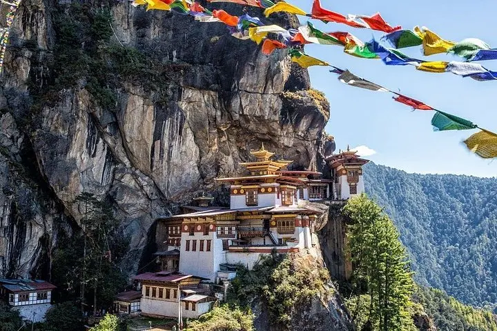
This 17-night traverse links Paro with Gasa and Punakha, threading through Jigme Dorji National Park and former salt routes like the old Tremo La. Geology is on display: uplifted schist, glacial cirques and high passes—Shinche La (5,005m) and Nyile La (4,890m)—offer panoramic views and real elevation gain (daily ascents commonly 400–1,000m). Culturally the route opens into Layap villages: tightly woven wool goods, high-collared garments and a unique highland dialect. The itinerary culminates at the Royal Highlander Festival in Laya and a restorative soak at Gasa hot springs.
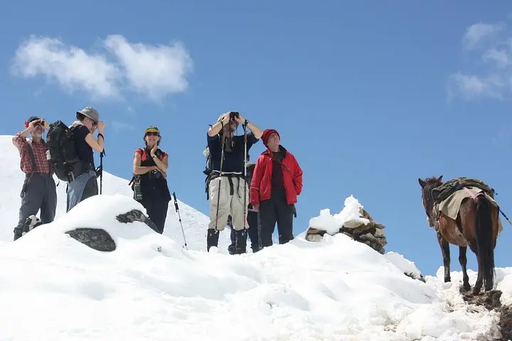
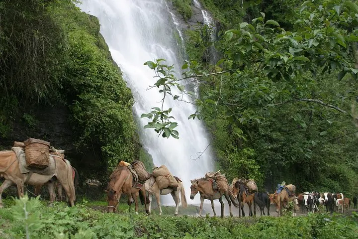
Practical edge: expect long days (4–8 hours on many stages), repeated altitude gain and rocky, sometimes snowy terrain. Guides handle permits and army check-ins; porters and equipment haulage are typically included. Acclimatize with rest days (Jangothang is used for this), carry layered insulation, and plan for sudden weather swings. Best windows are April–June and mid-September–mid-November when trails are most stable. This is serious high-altitude trekking—respect the pace, watch for symptoms of altitude sickness, and savor the rare encounters with blue sheep and takin that make the effort worthwhile.
Yes—permits and local registrations are required and typically handled by your licensed guide; army check-ins occur at some camps.
Passes reach about 5,005m (Shinche La) and altitude sickness is a real risk—use staged acclimatization, hydrate and inform guides of symptoms early.
Camping is standard backcountry style with tents and communal dining; many operators provide sleeping mats, meals and haulage via porters or animals.
April–June and mid‑September–mid‑November offer the most stable, clear weather and align with cultural events like the Royal Highlander Festival.
Bhutan Travel Club operates guided outdoor trips and adventures with an emphasis on safety, stewardship, and memorable experiences.
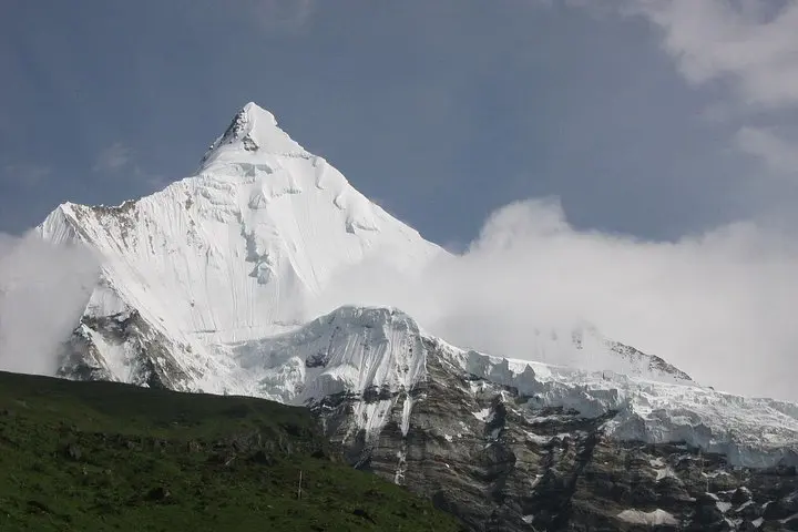
You step out of the pine-scented dusk into a thin, clear night and the silhouette of Jomolhari pins the sky — a broad, glaciated shoulder that seems to breathe cold air down the valley. The trail climbs relentlessly here: scree, rhododendron corridors, and open moraine where yak bells mark old trade routes. By dawn the peaks take on sharp faces; by evening, tents cluster at campsites that have hosted generations of nomadic herders.
You step out of the pine-scented dusk into a thin, clear night and the silhouette of Jomolhari pins the sky — a broad, glaciated shoulder that seems to breathe cold air down the valley. The trail climbs relentlessly here: scree, rhododendron corridors, and open moraine where yak bells mark old trade routes. By dawn the peaks take on sharp faces; by evening, tents cluster at campsites that have hosted generations of nomadic herders.
This 17-night traverse links Paro with Gasa and Punakha, threading through Jigme Dorji National Park and former salt routes like the old Tremo La. Geology is on display: uplifted schist, glacial cirques and high passes—Shinche La (5,005m) and Nyile La (4,890m)—offer panoramic views and real elevation gain (daily ascents commonly 400–1,000m). Culturally the route opens into Layap villages: tightly woven wool goods, high-collared garments and a unique highland dialect. The itinerary culminates at the Royal Highlander Festival in Laya and a restorative soak at Gasa hot springs.
Practical edge: expect long days (4–8 hours on many stages), repeated altitude gain and rocky, sometimes snowy terrain. Guides handle permits and army check-ins; porters and equipment haulage are typically included. Acclimatize with rest days (Jangothang is used for this), carry layered insulation, and plan for sudden weather swings. Best windows are April–June and mid-September–mid-November when trails are most stable. This is serious high-altitude trekking—respect the pace, watch for symptoms of altitude sickness, and savor the rare encounters with blue sheep and takin that make the effort worthwhile.