THE ADVENTURE COLLECTIVE® · Independent discovery and booking for outdoor travel

A full-day guided hike from Zurich along Leistkamm Ridge delivers sweeping views of Lake Walensee and the Churfirsten peaks. Expect 12–14 km with ~1,000 m of climbing across quiet alpine trails and meadows.
A full-day guided hike from Zurich along Leistkamm Ridge delivers sweeping views of Lake Walensee and the Churfirsten peaks. Expect 12–14 km with ~1,000 m of climbing across quiet alpine trails and meadows.
You step off the early train in the low-angled light and watch the valley open: Lake Walensee is a deep strip of blue, cliffs rising like folded pages, and the Leistkamm Ridge cuts a clean line above Arvenbüel. The guide checks boots and maps, and the group climbs into larches and alpine meadows, the path alternating between compact dirt and scree as the valley drops away below.
Verified experiences and guided adventures in the surrounding area.
Operated by Trekking Switzerland · Amden, St. Gallen
You step off the early train in the low-angled light and watch the valley open: Lake Walensee is a deep strip of blue, cliffs rising like folded pages, and the Leistkamm Ridge cuts a clean line above Arvenbüel. The guide checks boots and maps, and the group climbs into larches and alpine meadows, the path alternating between compact dirt and scree as the valley drops away below.
Geologically, the area is shaped by the Glarus thrust and glacial carving; the Churfirsten chain across the lake displays hard limestone ribs that resisted ancient ice. Culturally, these slopes have been grazed for generations — you'll pass small alpine huts and stone terraces that speak to a pastoral past and seasonal transhumance still practiced by local farmers.
Expect 12–14 km with roughly 1,000 m of ascent. Trails vary from forested gradients to exposed ridgewalks; sections can be rocky and require sure footing. Wildlife is subtle: marmots whistle from boulder fields, and chamois may appear on distant cliffs. Photography opportunities are frequent — sunrise or late afternoon light brings out the lake’s depth and the serrated Churfirsten skyline.
Practical notes: the day includes round-trip transport from Zurich, usually by train and bus, so plan for a long day (allow 8–10 hours). Bring layers for wind and sun, at least 2 liters of water, and a lunch with extra snacks. If in doubt about weather, check local forecasts — mountain conditions change quickly. This route rewards steady pacing: walk conservatively uphill, take short, frequent breaks, and leave no trace on fragile alpine flora.
It’s rated moderate: 12–14 km with ~1,000 m ascent; hikers should be comfortable with sustained climbs and uneven terrain.
Yes—round-trip transport via train and bus is typically included in the full-day itinerary.
Active beginners with prior day-hiking experience can join, but they should prepare for continuous climbing and rocky sections.
The operator may alter the route for safety; cancellations typically require 24-hour notice for a full refund per the booking policy.
Trekking Switzerland operates guided outdoor trips and adventures with an emphasis on safety, stewardship, and memorable experiences.
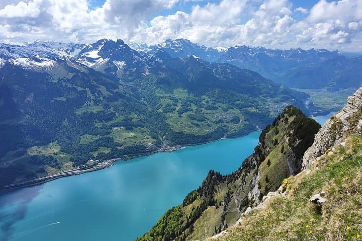
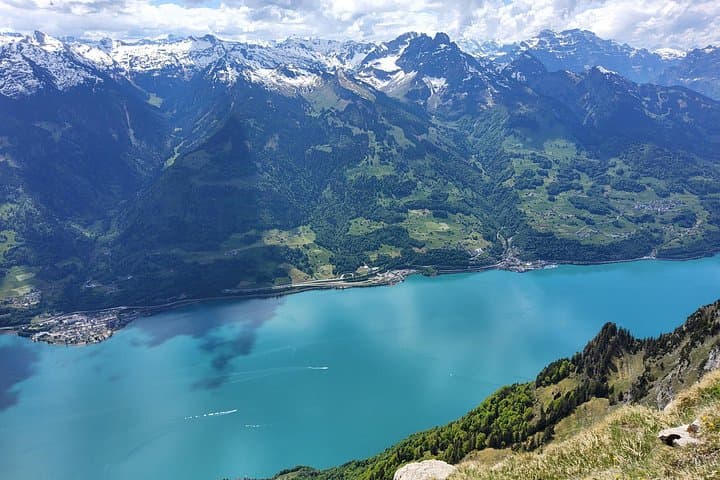
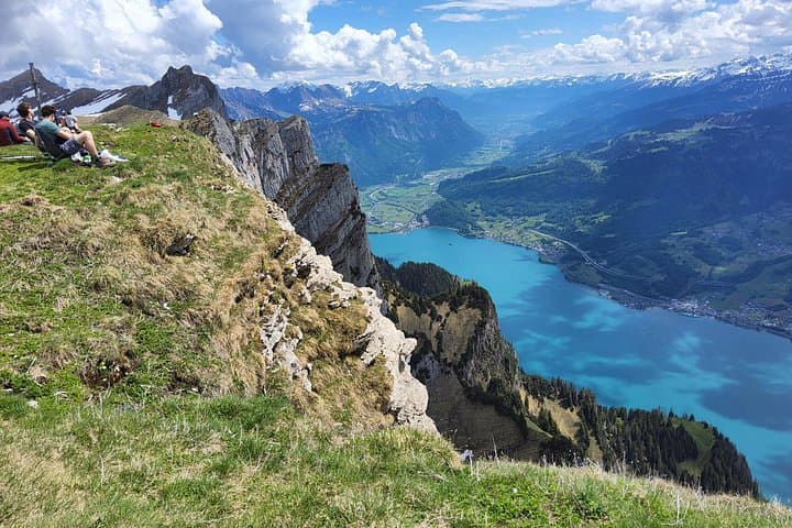
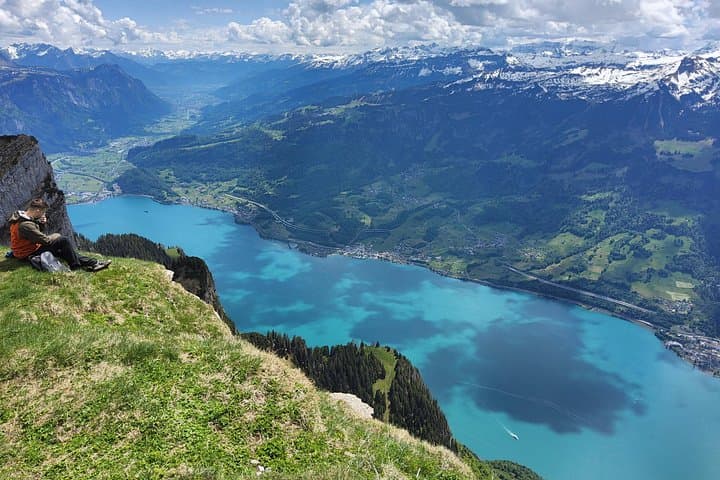
You step off the early train in the low-angled light and watch the valley open: Lake Walensee is a deep strip of blue, cliffs rising like folded pages, and the Leistkamm Ridge cuts a clean line above Arvenbüel. The guide checks boots and maps, and the group climbs into larches and alpine meadows, the path alternating between compact dirt and scree as the valley drops away below.
You step off the early train in the low-angled light and watch the valley open: Lake Walensee is a deep strip of blue, cliffs rising like folded pages, and the Leistkamm Ridge cuts a clean line above Arvenbüel. The guide checks boots and maps, and the group climbs into larches and alpine meadows, the path alternating between compact dirt and scree as the valley drops away below.
Geologically, the area is shaped by the Glarus thrust and glacial carving; the Churfirsten chain across the lake displays hard limestone ribs that resisted ancient ice. Culturally, these slopes have been grazed for generations — you'll pass small alpine huts and stone terraces that speak to a pastoral past and seasonal transhumance still practiced by local farmers.
Expect 12–14 km with roughly 1,000 m of ascent. Trails vary from forested gradients to exposed ridgewalks; sections can be rocky and require sure footing. Wildlife is subtle: marmots whistle from boulder fields, and chamois may appear on distant cliffs. Photography opportunities are frequent — sunrise or late afternoon light brings out the lake’s depth and the serrated Churfirsten skyline.
Practical notes: the day includes round-trip transport from Zurich, usually by train and bus, so plan for a long day (allow 8–10 hours). Bring layers for wind and sun, at least 2 liters of water, and a lunch with extra snacks. If in doubt about weather, check local forecasts — mountain conditions change quickly. This route rewards steady pacing: walk conservatively uphill, take short, frequent breaks, and leave no trace on fragile alpine flora.