THE ADVENTURE COLLECTIVE® · Independent discovery and booking for outdoor travel

An 18-day high-altitude trek across the Larkya La (5,160m) in Nepal’s Manaslu Conservation Area. Expect long days, tea-house nights, Tibetan-influenced villages, and a demanding final pass with expansive Himalayan views.
An 18-day high-altitude trek across the Larkya La (5,160m) in Nepal’s Manaslu Conservation Area. Expect long days, tea-house nights, Tibetan-influenced villages, and a demanding final pass with expansive Himalayan views.
You step off the dusty jeep at Sotikhola and the valley exhales: rivers daring you across wooden bridges, rhododendron slopes crowding the trail, and a skyline that grows sharper with each day. The route climbs from 700m roads to the exposed crest of Larkya La at 5,160m, where wind-carved snowfields push you forward and the high peaks of the Manaslu massif loom like old guardians.
Verified experiences and guided adventures in the surrounding area.
Operated by Happyland Treks · Samagaun, Gandaki Province
You step off the dusty jeep at Sotikhola and the valley exhales: rivers daring you across wooden bridges, rhododendron slopes crowding the trail, and a skyline that grows sharper with each day. The route climbs from 700m roads to the exposed crest of Larkya La at 5,160m, where wind-carved snowfields push you forward and the high peaks of the Manaslu massif loom like old guardians.
The corridor follows centuries-old mule tracks through the Manaslu Conservation Area, a region formally opened to trekkers in the 1990s to balance local livelihoods and protection. Geologically, the trek crosses Himalayan thrusts—river-cut gorges, moraine flats and a high pass that reveals glacial sculpting. Culturally, villages such as Samagaun and Samdo show Tibetan-influenced gompas, mani walls and hospitality in tea houses that fuel day-to-day progress.
Expect mixed terrain: river valleys and forested switchbacks to 3,000m, then rocky, sometimes icy slopes above 4,000m. Key stages: long drives into the Valley, steady 5–9 hour trekking days, an acclimatization pause at Samagaun, and an early, exposed summit day over Larkya La.
Practical guidance: prioritize acclimatization and light, layered clothing; carry water purification and high-calorie snacks; plan for late-season snow on the pass. Footwear with firm ankle support and trekking poles will save energy on descents. Mobile coverage is patchy—download maps and keep spare batteries. The reward is direct: vast Himalayan panoramas, Tibetan-flavored villages and the satisfaction of crossing one of Nepal’s classic high passes.
Yes—Manaslu Restricted Area permits, a Manaslu Conservation Area permit (MCAP) and TIMS card are required and commonly arranged before departure.
The pass day is long and exposed: expect 8–9 hours with steep ascent to 5,160m and cold, windy conditions—start early and follow your guide.
Yes—this itinerary is tea-house based with basic twin rooms and shared facilities; book peak-season spots in advance.
Ascend slowly, drink lots of fluids, avoid alcohol, and communicate symptoms to your guide; descent is the primary treatment for serious symptoms.
Happyland Treks operates guided outdoor trips and adventures with an emphasis on safety, stewardship, and memorable experiences.
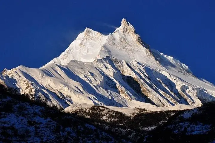
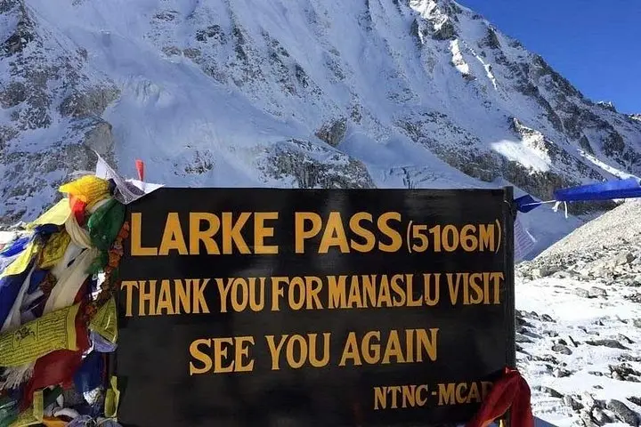
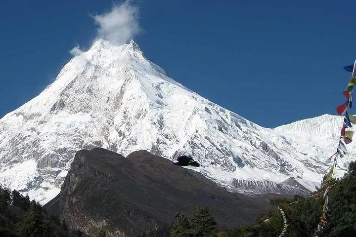
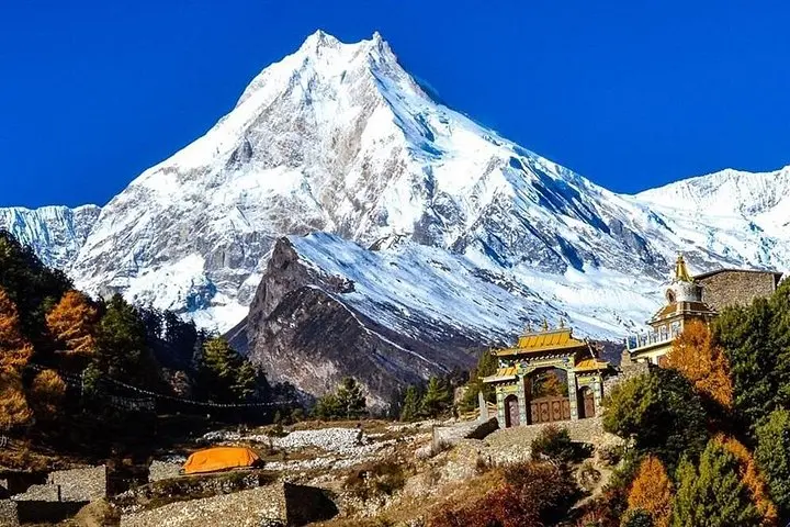
You step off the dusty jeep at Sotikhola and the valley exhales: rivers daring you across wooden bridges, rhododendron slopes crowding the trail, and a skyline that grows sharper with each day. The route climbs from 700m roads to the exposed crest of Larkya La at 5,160m, where wind-carved snowfields push you forward and the high peaks of the Manaslu massif loom like old guardians.
You step off the dusty jeep at Sotikhola and the valley exhales: rivers daring you across wooden bridges, rhododendron slopes crowding the trail, and a skyline that grows sharper with each day. The route climbs from 700m roads to the exposed crest of Larkya La at 5,160m, where wind-carved snowfields push you forward and the high peaks of the Manaslu massif loom like old guardians.
The corridor follows centuries-old mule tracks through the Manaslu Conservation Area, a region formally opened to trekkers in the 1990s to balance local livelihoods and protection. Geologically, the trek crosses Himalayan thrusts—river-cut gorges, moraine flats and a high pass that reveals glacial sculpting. Culturally, villages such as Samagaun and Samdo show Tibetan-influenced gompas, mani walls and hospitality in tea houses that fuel day-to-day progress.
Expect mixed terrain: river valleys and forested switchbacks to 3,000m, then rocky, sometimes icy slopes above 4,000m. Key stages: long drives into the Valley, steady 5–9 hour trekking days, an acclimatization pause at Samagaun, and an early, exposed summit day over Larkya La.
Practical guidance: prioritize acclimatization and light, layered clothing; carry water purification and high-calorie snacks; plan for late-season snow on the pass. Footwear with firm ankle support and trekking poles will save energy on descents. Mobile coverage is patchy—download maps and keep spare batteries. The reward is direct: vast Himalayan panoramas, Tibetan-flavored villages and the satisfaction of crossing one of Nepal’s classic high passes.