THE ADVENTURE COLLECTIVE® · Independent discovery and booking for outdoor travel

Thread a red-walled slot canyon in the heart of Morocco’s Dadès Valley on a 2–3 hour hike past rock formations nicknamed the "monkey fingers." This compact trail pairs dramatic geology with village culture and valley views.
Thread a red-walled slot canyon in the heart of Morocco’s Dadès Valley on a 2–3 hour hike past rock formations nicknamed the "monkey fingers." This compact trail pairs dramatic geology with village culture and valley views.
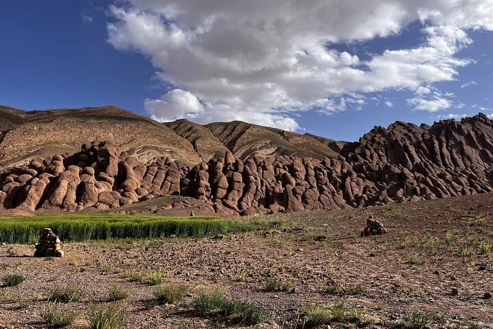
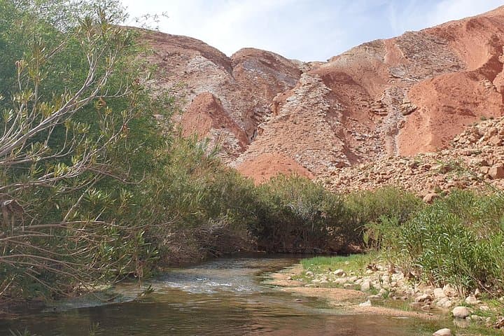
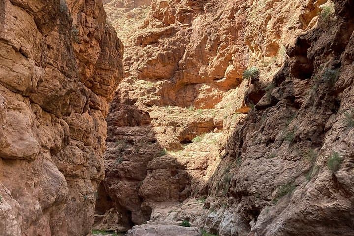
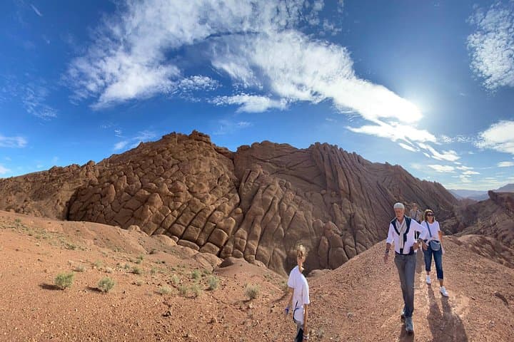
You step from a sun-baked Berber lane into a slot of red stone and the canyon reaches for the sky—armored cliffs leaning close enough to touch. Light slides down the narrow throat, turning the walls from rust to copper as the trail threads between sculpted pillars that locals call the "monkey fingers." The air smells faintly of dust and almond blossom; a small irrigation channel chatters nearby, daring you to follow.
Verified experiences and guided adventures in the surrounding area.
Operated by Excursion Miguirne Chez Ali · Boumalne Dades, Drâa-Tafilalet
You step from a sun-baked Berber lane into a slot of red stone and the canyon reaches for the sky—armored cliffs leaning close enough to touch. Light slides down the narrow throat, turning the walls from rust to copper as the trail threads between sculpted pillars that locals call the "monkey fingers." The air smells faintly of dust and almond blossom; a small irrigation channel chatters nearby, daring you to follow.
The path begins in a village at the foot of the Dadès Mountains where terraced gardens and palm groves still supply villagers with figs, almonds and vegetables. Geologically, the canyon is carved from sedimentary and metamorphosed rock shaped by water and wind over millennia; its vertical walls and tight choke points are classic indicators of fluvial incision in an arid mountain zone. Culturally, this stretch of the Dades Valley has long been home to Berber communities whose irrigation terraces and stone walls you pass on the approach.
Practical details: the route typically takes 2–3 hours, covering roughly 4–6 km with about 150–300 m cumulative elevation gain on uneven, rocky footing and occasional loose scree. Expect narrow sections, brief scrambling and an open return ridge that reveals sweeping valley views. Bring at least 1–1.5 liters of water, sun protection, grippy hiking shoes, and layered clothing for temperature swings. Start mid-morning or late afternoon for softer light and cooler air; follow a local guide if you prefer cultural context or need route certainty. The hike balances striking geology, easy cultural stops, and compact adventure—ideal for photographers and hikers who want a vivid half-day in southern Morocco.
Expect 2–3 hours on a roughly 4–6 km route with about 150–300 m cumulative elevation gain; terrain is uneven with brief scrambling, making it moderately challenging.
No—experienced hikers can navigate independently on marked local trails, but guides add safety, navigation certainty and cultural interpretation.
Not reliably; bring at least 1–1.5 liters per person depending on season and exertion.
Not recommended for travelers with serious back problems or pregnant visitors due to uneven footing and some narrow passages; check weather and avoid after heavy rains.
Excursion Miguirne Chez Ali operates guided outdoor trips and adventures with an emphasis on safety, stewardship, and memorable experiences.
You step from a sun-baked Berber lane into a slot of red stone and the canyon reaches for the sky—armored cliffs leaning close enough to touch. Light slides down the narrow throat, turning the walls from rust to copper as the trail threads between sculpted pillars that locals call the "monkey fingers." The air smells faintly of dust and almond blossom; a small irrigation channel chatters nearby, daring you to follow.
You step from a sun-baked Berber lane into a slot of red stone and the canyon reaches for the sky—armored cliffs leaning close enough to touch. Light slides down the narrow throat, turning the walls from rust to copper as the trail threads between sculpted pillars that locals call the "monkey fingers." The air smells faintly of dust and almond blossom; a small irrigation channel chatters nearby, daring you to follow.
The path begins in a village at the foot of the Dadès Mountains where terraced gardens and palm groves still supply villagers with figs, almonds and vegetables. Geologically, the canyon is carved from sedimentary and metamorphosed rock shaped by water and wind over millennia; its vertical walls and tight choke points are classic indicators of fluvial incision in an arid mountain zone. Culturally, this stretch of the Dades Valley has long been home to Berber communities whose irrigation terraces and stone walls you pass on the approach.
Practical details: the route typically takes 2–3 hours, covering roughly 4–6 km with about 150–300 m cumulative elevation gain on uneven, rocky footing and occasional loose scree. Expect narrow sections, brief scrambling and an open return ridge that reveals sweeping valley views. Bring at least 1–1.5 liters of water, sun protection, grippy hiking shoes, and layered clothing for temperature swings. Start mid-morning or late afternoon for softer light and cooler air; follow a local guide if you prefer cultural context or need route certainty. The hike balances striking geology, easy cultural stops, and compact adventure—ideal for photographers and hikers who want a vivid half-day in southern Morocco.