THE ADVENTURE COLLECTIVE® · Independent discovery and booking for outdoor travel

Walk two hours from Cannery Row to Old Monterey with GPS-triggered audio that brings the city’s sardine-era docks, Colton Hall, and mission-era sites to life. Download the app, enter access code NYG134, and follow a mostly flat 1.5–2 mile route along the waterfront and historic downtown.
Walk two hours from Cannery Row to Old Monterey with GPS-triggered audio that brings the city’s sardine-era docks, Colton Hall, and mission-era sites to life. Download the app, enter access code NYG134, and follow a mostly flat 1.5–2 mile route along the waterfront and historic downtown.
The ocean wind cuts across Cannery Row and the boardwalk smells faintly of salt and frying oil — a modern shoreline where factory whistles once ruled the day. Start at the waterfront and let GPS-triggered narration guide you past bronze memorials to Steinbeck, along the Presidio’s grassed rises, and into Old Monterey’s narrow streets where adobe walls keep the past close.
Verified experiences and guided adventures in the surrounding area.
Operated by Drives & Detours · Monterey, California
The ocean wind cuts across Cannery Row and the boardwalk smells faintly of salt and frying oil — a modern shoreline where factory whistles once ruled the day. Start at the waterfront and let GPS-triggered narration guide you past bronze memorials to Steinbeck, along the Presidio’s grassed rises, and into Old Monterey’s narrow streets where adobe walls keep the past close.
This two-hour, roughly 1.5–2 mile walk follows mostly flat, paved surfaces with occasional boardwalk and cobble. The route threads through key historical sites: the Custom House where the U.S. flag rose over California, Colton Hall where delegates drafted the 1849 constitution, and quieter mission-era corners like San Carlos Borromeo. Geologically the path traces Monterey Bay’s uplifted coastal plain — small cliffs and a protective submarine canyon offshore shape the bay’s rich marine life and historic fishing economy.
Along the way you’ll encounter working wharves, small galleries on Calle Principal, and tidepools near the municipal wharf where currents shape life just offshore. Local culture reads in murals, seafood shacks, and the steady, slightly sardonic presence of Steinbeck’s legacy and the city’s military past.
Practically: download the Drives & Detours app before you go, use access code NYG134, and carry a charged phone—GPS narration triggers automatically but works best with offline download. Wear supportive shoes, bring a windproof layer (coastal fog is common), and allow two hours for a relaxed pace with stops for photos and museum jumps. Public transit and parking are available near Cannery Row; the path is family-friendly and accessible for most walkers.
The guided audio itinerary is about 2 hours and covers roughly 1.5–2 miles of mostly flat, paved route with short stair or curb crossings.
Download the Drives & Detours app (iOS/Android), select the Cannery Row tour and enter access code NYG134; download the tour for offline use if service is spotty.
Much of the route is on paved sidewalks and boardwalks and is accessible, but some historic areas have cobbles or narrow sections—check specific stops for ramps if mobility is a concern.
Service animals are allowed; local leash rules apply for pets and some indoor attractions may not permit animals.
Drives & Detours operates guided outdoor trips and adventures with an emphasis on safety, stewardship, and memorable experiences.
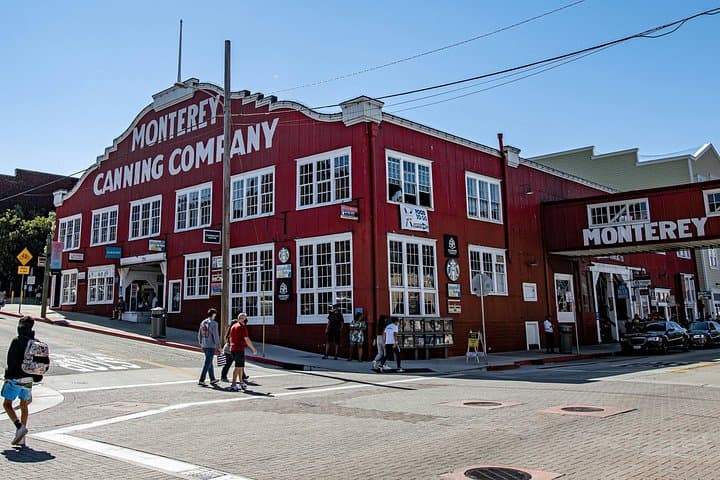
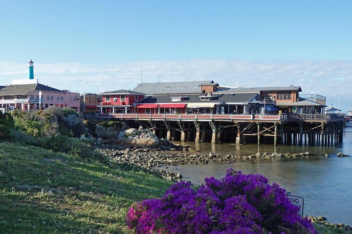

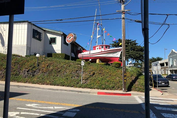
The ocean wind cuts across Cannery Row and the boardwalk smells faintly of salt and frying oil — a modern shoreline where factory whistles once ruled the day. Start at the waterfront and let GPS-triggered narration guide you past bronze memorials to Steinbeck, along the Presidio’s grassed rises, and into Old Monterey’s narrow streets where adobe walls keep the past close.
The ocean wind cuts across Cannery Row and the boardwalk smells faintly of salt and frying oil — a modern shoreline where factory whistles once ruled the day. Start at the waterfront and let GPS-triggered narration guide you past bronze memorials to Steinbeck, along the Presidio’s grassed rises, and into Old Monterey’s narrow streets where adobe walls keep the past close.
This two-hour, roughly 1.5–2 mile walk follows mostly flat, paved surfaces with occasional boardwalk and cobble. The route threads through key historical sites: the Custom House where the U.S. flag rose over California, Colton Hall where delegates drafted the 1849 constitution, and quieter mission-era corners like San Carlos Borromeo. Geologically the path traces Monterey Bay’s uplifted coastal plain — small cliffs and a protective submarine canyon offshore shape the bay’s rich marine life and historic fishing economy.
Along the way you’ll encounter working wharves, small galleries on Calle Principal, and tidepools near the municipal wharf where currents shape life just offshore. Local culture reads in murals, seafood shacks, and the steady, slightly sardonic presence of Steinbeck’s legacy and the city’s military past.
Practically: download the Drives & Detours app before you go, use access code NYG134, and carry a charged phone—GPS narration triggers automatically but works best with offline download. Wear supportive shoes, bring a windproof layer (coastal fog is common), and allow two hours for a relaxed pace with stops for photos and museum jumps. Public transit and parking are available near Cannery Row; the path is family-friendly and accessible for most walkers.