THE ADVENTURE COLLECTIVE® · Independent discovery and booking for outdoor travel

A guided eight-day climb that stages two high camps and a dawn summit push on Turkey’s highest peak. Expect glaciated slopes above 4,850 m, mule-supported camps, and wide views across borders when skies clear.
A guided eight-day climb that stages two high camps and a dawn summit push on Turkey’s highest peak. Expect glaciated slopes above 4,850 m, mule-supported camps, and wide views across borders when skies clear.
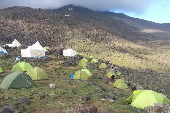
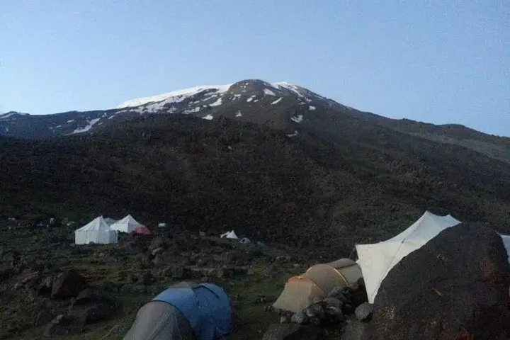
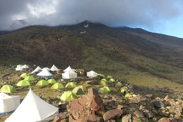
You arrive in Dogubeyazıt at dusk and the mountain is already at work on your nerves — a broad, white cone that eats the horizon. The expedition begins with a slow unspooling: a drive from Van airport to Eli village, pack animals clattering, a ridge route that runs high above shattered gullies where the Ulker glacier sends down teeth of ice. By camp one, at roughly 3,200 m, the air is thin enough that every breath counts and the wind has the blunt personality of a place used to being climbed.
Verified experiences and guided adventures in the surrounding area.
Operated by Overland Travel Trekking · Doğubeyazıt, Ağrı
You arrive in Dogubeyazıt at dusk and the mountain is already at work on your nerves — a broad, white cone that eats the horizon. The expedition begins with a slow unspooling: a drive from Van airport to Eli village, pack animals clattering, a ridge route that runs high above shattered gullies where the Ulker glacier sends down teeth of ice. By camp one, at roughly 3,200 m, the air is thin enough that every breath counts and the wind has the blunt personality of a place used to being climbed.
Ararat is an ice-clad stratovolcano with two summits: Greater Ararat (5,165 m) and the smaller Lesser Ararat to the northwest. Geologically, its slopes are the result of repeated eruptions and long erosional seasons; moraines and permanent ice fields appear above ~4,850–5,000 m. Culturally, Ararat is a landmark stitched into Armenian, Kurdish and Turkish histories — a cratered silhouette tied to Noah’s Ark in local lore and to centuries of nomadic pastureland where shepherds still move with the seasons.
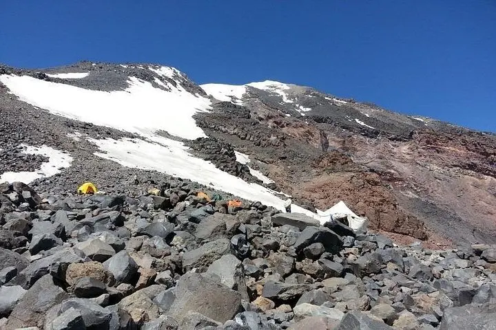
The itinerary spreads the ascent over days to let altitude and stamina even out. Day two climbs—by trail and mule track—about 1,200 m to Base Camp at 3,200 m (roughly 4 hours of walking). An acclimatization loop up to Camp II (4,200 m) follows, then a short skills session in crampon and ice-axe use before bivvying at 4,200 m. Summit night starts in the early pre-dawn: a 3:00–3:30 a.m. departure, a steady ridge that gives way to permanent ice fields near 4,850 m, then the final hump of cairns at 5,165 m. Expect a 9–10 hour summit push with about 937 m of ascent that day and a long descent back to base camp.
Practical edge: the route is non-technical for much of the approach but becomes glaciated near the top — crampons, ice axes and rope skills are required. The operator uses mules to shuttle gear to camp I; guides handle permits and logistics. Clear weather can offer views into Iran and, on exceptional days, toward the Caucasus.
Plan as if for real Alpine conditions: train with long hikes and altitude exposure; prioritize layered insulation, sturdy B2/B3 mountaineering boots and a sleeping system rated for cold nights at 3,200–4,200 m. Hydration and slow pacing beat pride on summit day. Bring valid passport details (mountain zone is near international border) and expect military checkpoints; the operator usually arranges permissions.
For experienced trekkers wanting a high, remote objective with crampon-and-rope sections, Ararat delivers panoramic payoff and hands-on mountaineering. Respect the mountain’s weather windows and altitude rules, and it will hand back some of Turkey’s most expansive views.
Yes — climbs occur in a restricted border zone; reputable operators arrange permits and military clearance as part of your booking.
Summer months (June to early September) offer the most stable weather and accessible snow conditions; outside this window snow and temperatures increase technical difficulty.
The southern ridge is non-technical for much of the approach but becomes glaciated above ~4,850 m; crampons, ice-axe competence and guided ropework are required.
Yes—there are significant altitude gains; the itinerary includes acclimatization and extra summit-day contingency, but monitor symptoms and communicate with guides.
You should be comfortable carrying a 10–15 kg pack on sustained uphill hikes and have experience with multi-day trekking; previous high-altitude exposure is a major advantage.
Yes — meals are included for most days and mules/pack animals carry group equipment to camp I; personal daypacks are still required.
Overland Travel Trekking operates guided outdoor trips and adventures with an emphasis on safety, stewardship, and memorable experiences.
You arrive in Dogubeyazıt at dusk and the mountain is already at work on your nerves — a broad, white cone that eats the horizon. The expedition begins with a slow unspooling: a drive from Van airport to Eli village, pack animals clattering, a ridge route that runs high above shattered gullies where the Ulker glacier sends down teeth of ice. By camp one, at roughly 3,200 m, the air is thin enough that every breath counts and the wind has the blunt personality of a place used to being climbed.
You arrive in Dogubeyazıt at dusk and the mountain is already at work on your nerves — a broad, white cone that eats the horizon. The expedition begins with a slow unspooling: a drive from Van airport to Eli village, pack animals clattering, a ridge route that runs high above shattered gullies where the Ulker glacier sends down teeth of ice. By camp one, at roughly 3,200 m, the air is thin enough that every breath counts and the wind has the blunt personality of a place used to being climbed.
Ararat is an ice-clad stratovolcano with two summits: Greater Ararat (5,165 m) and the smaller Lesser Ararat to the northwest. Geologically, its slopes are the result of repeated eruptions and long erosional seasons; moraines and permanent ice fields appear above ~4,850–5,000 m. Culturally, Ararat is a landmark stitched into Armenian, Kurdish and Turkish histories — a cratered silhouette tied to Noah’s Ark in local lore and to centuries of nomadic pastureland where shepherds still move with the seasons.
The itinerary spreads the ascent over days to let altitude and stamina even out. Day two climbs—by trail and mule track—about 1,200 m to Base Camp at 3,200 m (roughly 4 hours of walking). An acclimatization loop up to Camp II (4,200 m) follows, then a short skills session in crampon and ice-axe use before bivvying at 4,200 m. Summit night starts in the early pre-dawn: a 3:00–3:30 a.m. departure, a steady ridge that gives way to permanent ice fields near 4,850 m, then the final hump of cairns at 5,165 m. Expect a 9–10 hour summit push with about 937 m of ascent that day and a long descent back to base camp.
Practical edge: the route is non-technical for much of the approach but becomes glaciated near the top — crampons, ice axes and rope skills are required. The operator uses mules to shuttle gear to camp I; guides handle permits and logistics. Clear weather can offer views into Iran and, on exceptional days, toward the Caucasus.
Plan as if for real Alpine conditions: train with long hikes and altitude exposure; prioritize layered insulation, sturdy B2/B3 mountaineering boots and a sleeping system rated for cold nights at 3,200–4,200 m. Hydration and slow pacing beat pride on summit day. Bring valid passport details (mountain zone is near international border) and expect military checkpoints; the operator usually arranges permissions.
For experienced trekkers wanting a high, remote objective with crampon-and-rope sections, Ararat delivers panoramic payoff and hands-on mountaineering. Respect the mountain’s weather windows and altitude rules, and it will hand back some of Turkey’s most expansive views.