THE ADVENTURE COLLECTIVE® · Independent discovery and booking for outdoor travel

Short, sharp climbs, marble‑white river boulders and a compact summit make Mount Daraitan a rewarding day hike from Manila. Expect river pools, scrambling on rounded rocks, and sweeping Sierra Madre views — plan for 6–8 hours and variable weather.
Short, sharp climbs, marble‑white river boulders and a compact summit make Mount Daraitan a rewarding day hike from Manila. Expect river pools, scrambling on rounded rocks, and sweeping Sierra Madre views — plan for 6–8 hours and variable weather.
A narrow jeepney road gives way to a ribbon of trail and the first glimpses of the Sierra Madre rising off to the east. Early light falls on rounded white boulders and a river that seems to have been polished by time; the air smells damp and green. From the jump-off you can already pick out the 739‑meter summit — Heart Peak — a compact crown above a corridor of steep ridges and river terraces.
Verified experiences and guided adventures in the surrounding area.
Operated by Yolo Travel Philippines · Tanay, Rizal
A narrow jeepney road gives way to a ribbon of trail and the first glimpses of the Sierra Madre rising off to the east. Early light falls on rounded white boulders and a river that seems to have been polished by time; the air smells damp and green. From the jump-off you can already pick out the 739‑meter summit — Heart Peak — a compact crown above a corridor of steep ridges and river terraces.
Mount Daraitan sits on the western edge of the Sierra Madre range in Rizal province. The area is known locally for Tinipak River’s smooth limestone and quartzite boulders and clear pools; the river has long been a freshwater source for nearby barangays. Geologically, you’ll move from narrow forested switchbacks to river flats and exposed boulder fields carved by seasonal floods.
Expect a mixed trail of dirt steps, rooted forest, and short scrambling sections (trail class 1–3). The main loop to Heart Peak and back with a Tinipak river stop is typically 6–8 km round trip with roughly 400–600 m of elevation gain depending on your chosen route. Hike time runs 6–8 hours including river time and breaks. Weather can flip from hot sun to sudden showers; mornings are best for the sea of clouds and clearer summit views.
Practically: wear grippy shoes, bring 2–3 liters of water, a light rain shell, and waterproof storage for electronics. Start before dawn if you want the cloud inversion; allow time to cool off at Tinipak’s pools on the return. Local guides and community fees are common — respect trail closures and pack out all trash.
The typical loop with Tinipak river time is 6–8 hours, roughly 6–8 km round trip with 400–600 m elevation gain; trail class varies 1–3 with short scrambling — rated moderate.
Local guides are not strictly required but commonly hired; there may be community or park fees at the jump‑off — check current rules with the local barangay before you go.
Yes, there are clear pools suitable for swimming, but avoid soaps, stay within marked areas, and be cautious of slippery limestone boulders and sudden currents after rain.
Most visitors arrange pickup from Makati/Manila or travel by bus/jeep to Tanay and local tricycle to the jump‑off; organized tours often include roundtrip transport.
Yolo Travel Philippines operates guided outdoor trips and adventures with an emphasis on safety, stewardship, and memorable experiences.
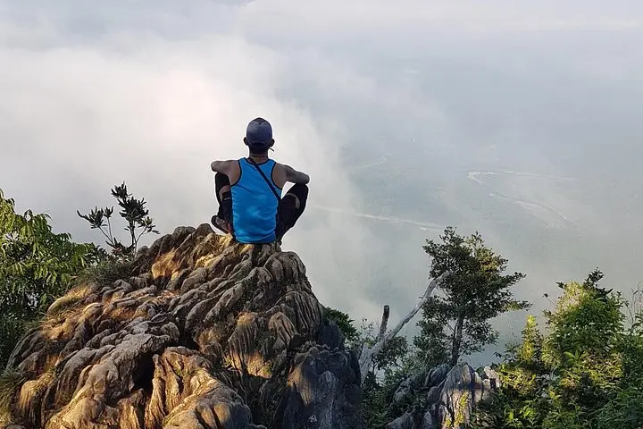
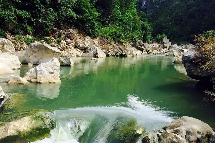
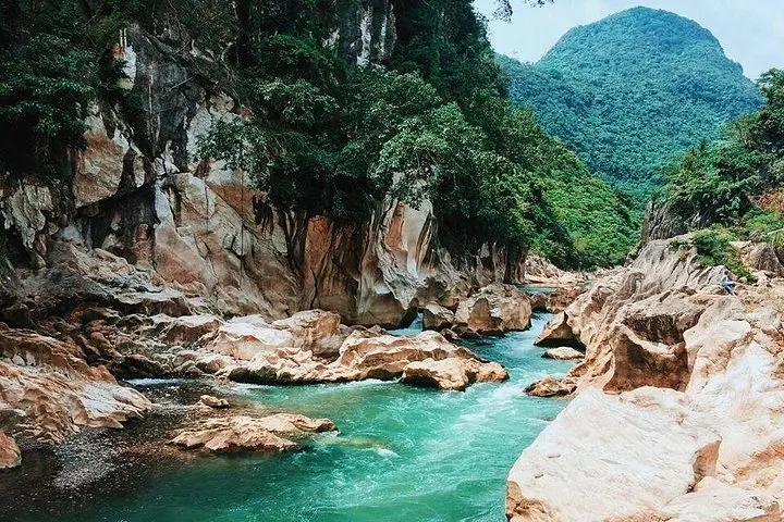
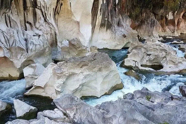
A narrow jeepney road gives way to a ribbon of trail and the first glimpses of the Sierra Madre rising off to the east. Early light falls on rounded white boulders and a river that seems to have been polished by time; the air smells damp and green. From the jump-off you can already pick out the 739‑meter summit — Heart Peak — a compact crown above a corridor of steep ridges and river terraces.
A narrow jeepney road gives way to a ribbon of trail and the first glimpses of the Sierra Madre rising off to the east. Early light falls on rounded white boulders and a river that seems to have been polished by time; the air smells damp and green. From the jump-off you can already pick out the 739‑meter summit — Heart Peak — a compact crown above a corridor of steep ridges and river terraces.
Mount Daraitan sits on the western edge of the Sierra Madre range in Rizal province. The area is known locally for Tinipak River’s smooth limestone and quartzite boulders and clear pools; the river has long been a freshwater source for nearby barangays. Geologically, you’ll move from narrow forested switchbacks to river flats and exposed boulder fields carved by seasonal floods.
Expect a mixed trail of dirt steps, rooted forest, and short scrambling sections (trail class 1–3). The main loop to Heart Peak and back with a Tinipak river stop is typically 6–8 km round trip with roughly 400–600 m of elevation gain depending on your chosen route. Hike time runs 6–8 hours including river time and breaks. Weather can flip from hot sun to sudden showers; mornings are best for the sea of clouds and clearer summit views.
Practically: wear grippy shoes, bring 2–3 liters of water, a light rain shell, and waterproof storage for electronics. Start before dawn if you want the cloud inversion; allow time to cool off at Tinipak’s pools on the return. Local guides and community fees are common — respect trail closures and pack out all trash.