THE ADVENTURE COLLECTIVE® · Independent discovery and booking for outdoor travel

A full-day guided hike up Mount Kenya via the Naro Moru route, reaching the Meteorological Station through rainforest, bamboo and high-alpine heath. Expect 5–6 hours on the trail, changing weather, and a packed lunch with park entry and transfers from Nairobi included.
A full-day guided hike up Mount Kenya via the Naro Moru route, reaching the Meteorological Station through rainforest, bamboo and high-alpine heath. Expect 5–6 hours on the trail, changing weather, and a packed lunch with park entry and transfers from Nairobi included.
Morning light breaks over steep ridgelines as you leave Nairobi behind and drive toward the green flank of Mount Kenya. By the time the van slows at Naro Moru Gate you can hear the mountain in motion: rainforests breathing, streams urging you higher, and the trail narrowing into bamboo and montane forest.
Verified experiences and guided adventures in the surrounding area.
Operated by Sabilom Kenya Tours & Safaris · Naro Moru, Nyeri County
Morning light breaks over steep ridgelines as you leave Nairobi behind and drive toward the green flank of Mount Kenya. By the time the van slows at Naro Moru Gate you can hear the mountain in motion: rainforests breathing, streams urging you higher, and the trail narrowing into bamboo and montane forest.
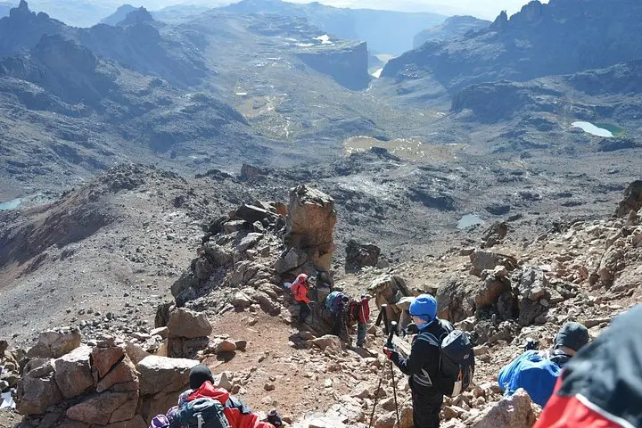
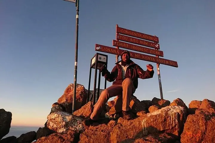
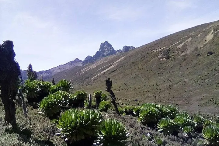
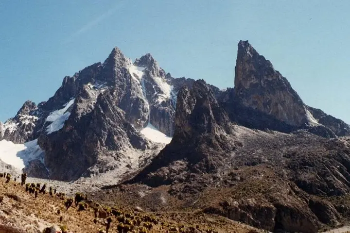
The Naro Moru route follows valley gullies cut by ancient glaciers and rivers. Geologically, Mount Kenya is an eroded stratovolcano with rugged peaks (Batian and Nelion) left as resistant cores; the route to the Meteorological Station climbs through lower rainforest, a bamboo belt, and into heath and tussock where giant lobelias punctuate the landscape. The mountain has long cultural importance to the local Kikuyu people, known as Kirinyaga, and the park is a UNESCO World Heritage Site for its ecological values.
Expect a steady uphill of roughly 8–10 km round trip with about 800–1,000 m of elevation gain on mixed dirt paths, roots and occasional scree. Wildlife can include colobus monkeys and bushbucks; keep a respectful distance. Weather changes quickly—clouds can move in and the wind can bite above the bamboo.
Practical guidance: start early, carry 2–3 liters of water, wear sturdy hiking boots and layered clothing, and bring sun protection and a waterproof shell. The hike to the Meteorological Station is typically 5–6 hours on the trail with breaks; guides provided on most full-day departures will handle permits and logistics and include a packed lunch. Watch for altitude effects and pace yourself on the steady climb—take breaks, hydrate, and enjoy the shifting forest as you climb back toward the gate.
The trail time is usually 5–6 hours round trip on the mountain (part of a full-day 12-hour tour including transfers). It’s a steady climb with 800–1,000 m of gain and is classed as moderate—pace yourself and take breaks.
Guides are provided by the tour operator; park entrance and permits are typically included in full-day packages and handled at collection points.
Common sightings include colobus monkeys, various bird species and occasionally larger mammals like elephants or buffalo in lower park zones—always observe from a distance.
Altitude can affect some people on the upper sections; stay hydrated, ascend slowly, report symptoms to your guide and be prepared to descend if symptoms worsen.
Sabilom Kenya Tours & Safaris operates guided outdoor trips and adventures with an emphasis on safety, stewardship, and memorable experiences.
Morning light breaks over steep ridgelines as you leave Nairobi behind and drive toward the green flank of Mount Kenya. By the time the van slows at Naro Moru Gate you can hear the mountain in motion: rainforests breathing, streams urging you higher, and the trail narrowing into bamboo and montane forest.
Morning light breaks over steep ridgelines as you leave Nairobi behind and drive toward the green flank of Mount Kenya. By the time the van slows at Naro Moru Gate you can hear the mountain in motion: rainforests breathing, streams urging you higher, and the trail narrowing into bamboo and montane forest.
The Naro Moru route follows valley gullies cut by ancient glaciers and rivers. Geologically, Mount Kenya is an eroded stratovolcano with rugged peaks (Batian and Nelion) left as resistant cores; the route to the Meteorological Station climbs through lower rainforest, a bamboo belt, and into heath and tussock where giant lobelias punctuate the landscape. The mountain has long cultural importance to the local Kikuyu people, known as Kirinyaga, and the park is a UNESCO World Heritage Site for its ecological values.
Expect a steady uphill of roughly 8–10 km round trip with about 800–1,000 m of elevation gain on mixed dirt paths, roots and occasional scree. Wildlife can include colobus monkeys and bushbucks; keep a respectful distance. Weather changes quickly—clouds can move in and the wind can bite above the bamboo.
Practical guidance: start early, carry 2–3 liters of water, wear sturdy hiking boots and layered clothing, and bring sun protection and a waterproof shell. The hike to the Meteorological Station is typically 5–6 hours on the trail with breaks; guides provided on most full-day departures will handle permits and logistics and include a packed lunch. Watch for altitude effects and pace yourself on the steady climb—take breaks, hydrate, and enjoy the shifting forest as you climb back toward the gate.