THE ADVENTURE COLLECTIVE® · Independent discovery and booking for outdoor travel
A two-day, guided trek from Marrakech to the summit of Jbel Toubkal, North Africa’s highest peak. Expect a long summit day, steep rocky trails and panoramic views across the High Atlas.
A two-day, guided trek from Marrakech to the summit of Jbel Toubkal, North Africa’s highest peak. Expect a long summit day, steep rocky trails and panoramic views across the High Atlas.
The air thins as the road from Marrakech drops away and the jagged spine of the High Atlas rises into view.
Verified experiences and guided adventures in the surrounding area.
Operated by mountains desert tours · Imlil, Marrakesh-Safi
The air thins as the road from Marrakech drops away and the jagged spine of the High Atlas rises into view.
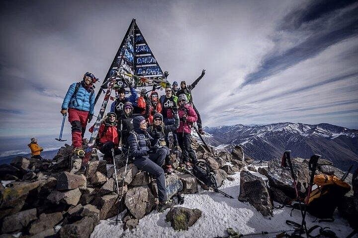
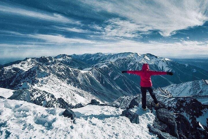
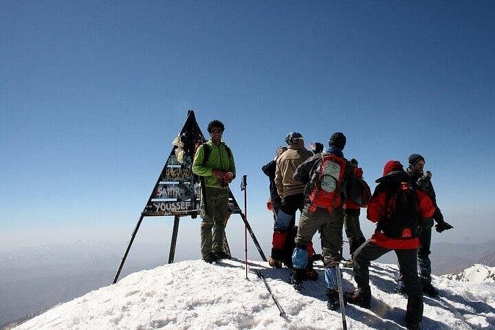
By the time you reach Imlil the valley tightens, stone paths threading through terraced fields and small Berber farms; the trail climbs past the shrine of Sidi Chamarouch and a series of cascades before the refuge at 3,207 m. On summit morning you set out pre-dawn, headlamp cutting a moving band along scree, crossing streams and boulder fields until the plateau opens and the summit finally claims you — a 360° sweep that on clear days reaches the Anti-Atlas and even the Sahara.
Geologically the High Atlas is young and folded, uplifted by the convergence of Africa and Eurasia; the landscape alternates hard volcanic rock, scree slopes and cultivated valley benches shaped by centuries of Berber agriculture. Culturally, villages like Aremd and Imlil are entry points to mountain life — guesthouses, mule handlers and guides maintain long-standing mountain traditions.
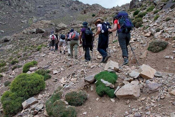
Practically, the trek is a compact alpine push: 5–6 hours approach day, then a 10–12 hour summit day including ascent and return. Expect steep, rocky trails, loose scree near the top and large daily elevation change (Imlil ~1,740 m to summit 4,167 m). Hydrate and pace early to mitigate altitude effects; pack warm layers for the refuge and wind-exposed summit. Mules commonly carry luggage, but your daypack should hold water, snacks, a waterproof layer and headlamp. Weather can swing quickly — plan for cold mornings and strong sun by midday.
You should be comfortable hiking 5–12 hours on consecutive days with significant elevation gain; regular cardio training and long hikes beforehand are recommended.
Yes — the summit is over 4,100 m. Take time to hydrate, ascend slowly when possible and notify guides of symptoms; descent is the primary treatment.
Typically transport from Marrakech, guide, one night accommodation at the refuge, most meals, and mule support for luggage are included — confirm details with the operator.
Late spring through early autumn offers milder conditions; winter has snow and requires mountaineering equipment and winter experience.
mountains desert tours operates guided outdoor trips and adventures with an emphasis on safety, stewardship, and memorable experiences.
The air thins as the road from Marrakech drops away and the jagged spine of the High Atlas rises into view.
The air thins as the road from Marrakech drops away and the jagged spine of the High Atlas rises into view.
By the time you reach Imlil the valley tightens, stone paths threading through terraced fields and small Berber farms; the trail climbs past the shrine of Sidi Chamarouch and a series of cascades before the refuge at 3,207 m. On summit morning you set out pre-dawn, headlamp cutting a moving band along scree, crossing streams and boulder fields until the plateau opens and the summit finally claims you — a 360° sweep that on clear days reaches the Anti-Atlas and even the Sahara.
Geologically the High Atlas is young and folded, uplifted by the convergence of Africa and Eurasia; the landscape alternates hard volcanic rock, scree slopes and cultivated valley benches shaped by centuries of Berber agriculture. Culturally, villages like Aremd and Imlil are entry points to mountain life — guesthouses, mule handlers and guides maintain long-standing mountain traditions.
Practically, the trek is a compact alpine push: 5–6 hours approach day, then a 10–12 hour summit day including ascent and return. Expect steep, rocky trails, loose scree near the top and large daily elevation change (Imlil ~1,740 m to summit 4,167 m). Hydrate and pace early to mitigate altitude effects; pack warm layers for the refuge and wind-exposed summit. Mules commonly carry luggage, but your daypack should hold water, snacks, a waterproof layer and headlamp. Weather can swing quickly — plan for cold mornings and strong sun by midday.
