THE ADVENTURE COLLECTIVE® · Independent discovery and booking for outdoor travel

A full-day 14 km trek to Mount Pinatubo’s crater lake that begins with a bumpy 4x4 ride and finishes with panoramic views over a volcanic bowl. Expect river crossings, volcanic sand, and a demanding but rewarding day trip from Manila.
A full-day 14 km trek to Mount Pinatubo’s crater lake that begins with a bumpy 4x4 ride and finishes with panoramic views over a volcanic bowl. Expect river crossings, volcanic sand, and a demanding but rewarding day trip from Manila.
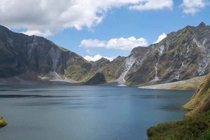
You step out of a rumbling 4x4 onto an open plain of gray sand; the wind carries a mineral tang and the crater sits ahead like a gouged, blue bowl daring you closer.
Verified experiences and guided adventures in the surrounding area.
Operated by Abraham Tours Philippines · Capas, Tarlac
You step out of a rumbling 4x4 onto an open plain of gray sand; the wind carries a mineral tang and the crater sits ahead like a gouged, blue bowl daring you closer.
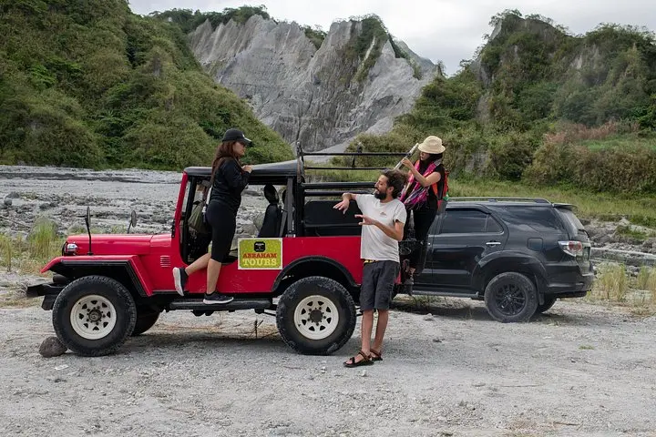
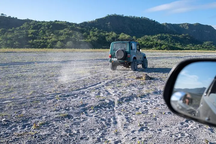
The day begins with a bumpy 4x4 transfer from the jump-off—roads cut across lahar plains left by Pinatubo’s 1991 megascale eruption—then a challenging 14 km trek that traverses ash flats, braided stream crossings and low scrub. The trail gains a few hundred metres of elevation (roughly 400–600 m cumulative) in rolling sections rather than a single steep pitch, so the cadence is long and rhythmic: sweat, river splash, rest, then more open desert toward the crater lake.
Geologically, Pinatubo is a young caldera—the 1991 eruption reshaped the summit and created the now-famous sulpuric crater lake whose brilliant blue contrasts with the gray of the surrounding deposits. Culturally, local Aeta communities and towns around Clark and Capas felt the eruption’s economic and social aftershocks; recent recovery has mixed new access roads with protected regrowth.
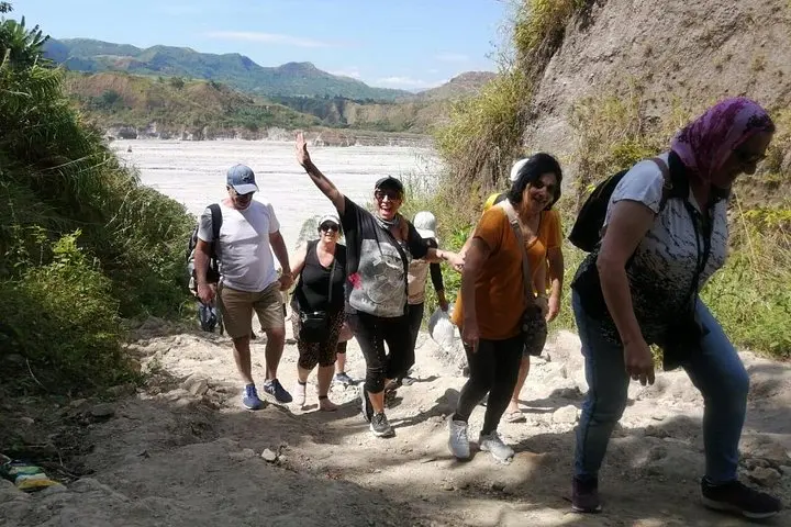
On the trail expect variable footing—volcanic sand, loose rock and shallow river crossings—plus strong sun and sudden wind across exposed ridgelines. Practicalities: start early to avoid midday heat, bring 2–3 liters of water, tuck a lightweight rain layer for sudden tropical showers, and wear sturdy, high-traction footwear. Guides usually handle permits and transport; plan for a long (10–12 hour) day including transfers.
The route is raw, elemental and surprisingly beautiful—an active landscape that rewards steady feet and respectful curiosity.
The tour covers about 14 km total with roughly 400–600 m cumulative elevation gain; it’s rated moderate—long miles on variable terrain rather than technical climbing.
Crossings are usually shallow but can be slippery; guides time crossings after rain and will advise on safe lines—use trekking poles if you have balance concerns.
You should have a moderate level of fitness; complete beginners may find the distance and sand challenging, but guided pacing and rest stops help most participants complete the route.
Most tours include round-trip transportation from Manila, 4x4 ride to the trailhead, entrance fees and a local guide—confirm specifics before booking.
Abraham Tours Philippines operates guided outdoor trips and adventures with an emphasis on safety, stewardship, and memorable experiences.
You step out of a rumbling 4x4 onto an open plain of gray sand; the wind carries a mineral tang and the crater sits ahead like a gouged, blue bowl daring you closer.
You step out of a rumbling 4x4 onto an open plain of gray sand; the wind carries a mineral tang and the crater sits ahead like a gouged, blue bowl daring you closer.
The day begins with a bumpy 4x4 transfer from the jump-off—roads cut across lahar plains left by Pinatubo’s 1991 megascale eruption—then a challenging 14 km trek that traverses ash flats, braided stream crossings and low scrub. The trail gains a few hundred metres of elevation (roughly 400–600 m cumulative) in rolling sections rather than a single steep pitch, so the cadence is long and rhythmic: sweat, river splash, rest, then more open desert toward the crater lake.
Geologically, Pinatubo is a young caldera—the 1991 eruption reshaped the summit and created the now-famous sulpuric crater lake whose brilliant blue contrasts with the gray of the surrounding deposits. Culturally, local Aeta communities and towns around Clark and Capas felt the eruption’s economic and social aftershocks; recent recovery has mixed new access roads with protected regrowth.
On the trail expect variable footing—volcanic sand, loose rock and shallow river crossings—plus strong sun and sudden wind across exposed ridgelines. Practicalities: start early to avoid midday heat, bring 2–3 liters of water, tuck a lightweight rain layer for sudden tropical showers, and wear sturdy, high-traction footwear. Guides usually handle permits and transport; plan for a long (10–12 hour) day including transfers.
The route is raw, elemental and surprisingly beautiful—an active landscape that rewards steady feet and respectful curiosity.